Old Maps of Sperryville, Virginia
Explore 22 old maps of Sperryville, spanning from 1893 to today. These high-resolution historic maps reveal how streets, neighborhoods, landmarks, and natural features evolved over time — perfect for genealogy, metal detecting, research, and local history exploration.
What you can do with these maps:
- See how Sperryville changed over time: Compare historical maps to modern-day views to trace roads, homesites, rail lines & more.
- View detailed metadata: Each map includes creators, publishers, year, scale, and archive source.
- Overlay maps with satellite & LiDAR: Visualize the past alongside modern tools to explore terrain & human change.
- Trusted historical sources: Maps sourced from the USGS, Library of Congress, and other archives.
- Access maps your way: View online, download high-res files, or order prints for personal or research use.
Start exploring old maps of Sperryville to uncover forgotten places, hidden landmarks, and the deep history beneath your feet.
Sperryville, VA maps
(22)- 1893 Map of Luray, 1898 Print
 1893 Luray1898 Print · USGSThe Shenandoah Valley in the 1890s was a land of steep mountain ridges and vital new railways. Genealogists and historians can trace old homesteads and depots along the Shenandoah Valley Railroad or find remote hamlets like Seven Fountains and Browntown.
 - 1905 Map of Luray, 1910 Print
 1905 Luray1910 Print · USGSThe Blue Ridge and Shenandoah Valley are frozen in time just after the turn of the century, showing the critical rail networks and mountain gaps of the period. Genealogists can trace family names and settlements like Luray, Front Royal, and Strasburg along the Shenandoah Valley Railroad.4 unique versions available
 - 1929 Map of Stony Man
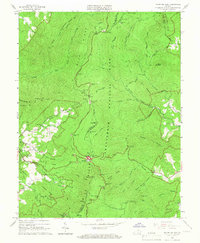
 1929 Stony Man1929 Print · USGSBlue Ridge mountain life and the early development of Shenandoah National Park are captured here just as the park boundary was being established. Genealogists and hikers can trace old mountain routes to the President Hoover Community Sch, locate St Luke Episcopal Mission, or find early trail markers at Sexton Shelter.2 unique versions available
 - 1933 Map of Stony Man
 1933 Stony Man1933 Print · USGSThe Blue Ridge highlands and Page Valley are captured here during the early years of the national park era. Genealogists and historians can trace family locations through mountain hollows and riverside crossings like Stricklers Ferry, St George Mission, and Baileys Store.3 unique versions available
 - 1949 Map of Charlottesville
 1949 Charlottesville1949 Print · USGSThe Shenandoah Valley and Blue Ridge appear in the late 1940s as a thriving corridor of rail and river commerce. Researchers can trace the mid-century footprints of Harrisonburg, Staunton, and Culpeper alongside the historic routes of the Southern Railway.2 unique versions available
 - 1956 Map of Charlottesville, 1966 Print
 1956 Charlottesville1966 Print · USGSThe Shenandoah Valley and Blue Ridge are captured in detail during the mid-1960s as the modern interstate system began to emerge. Genealogists and historians can trace rail-connected hubs like Waynesboro or follow the river paths of the Rapidan River and Rivanna River.4 unique versions available
 - 1961 Map of Sperryville, 1962 Print
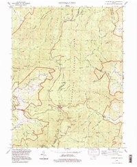
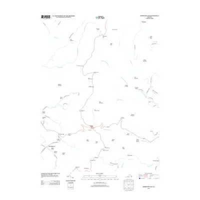
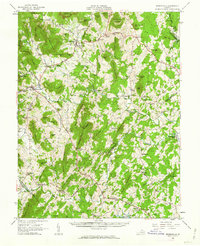 1961 Sperryville1962 Print · USGSVirginia's Piedmont and the Blue Ridge foothills come alive in this early 1960s survey of Rappahannock and Culpeper counties. Genealogists and historians can trace numerous milling communities like Monumental Mills and Peola Mills alongside local landmarks such as Hope Hill Chapel.2 unique versions available
 - 1965 Map of Thornton Gap, 1966 Print
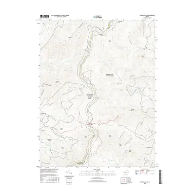
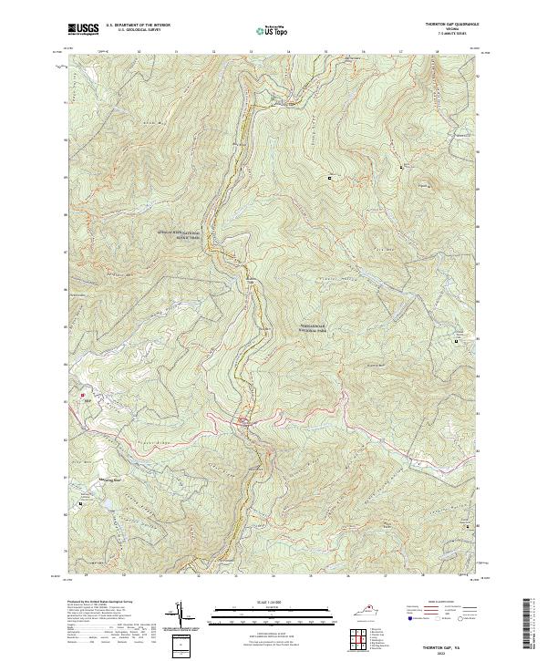
 1965 Thornton Gap1966 Print · USGSShenandoah National Park and the Blue Ridge heights are captured here in the mid-sixties as recreation and mountain life intersected. Researchers can trace the winding Skyline Drive, locate the Morning Star Church, and find old shelters like Byrds Nest No 3.5 unique versions available
 - 1971 Map of Washington, 1986 Print
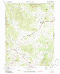 1971 Washington1986 Print · USGSThe foothills of Rappahannock County come alive in this early 1970s survey as the mountains of the Blue Ridge meet valley settlements. Researchers can trace rural life through landmarks like Fletcher Mill, Reynolds Ch, and the crossroads at Rediviva.
 - 1986 Map of Front Royal
 1986 Front Royal1986 Print · USGSThe northern Shenandoah Valley and the Blue Ridge crest are captured here in the mid-eighties as modern highways began to bypass historic valley towns. Researchers can trace ancestral connections near Peola Mills, navigate the gaps like Manassas Gap, or study the river bends around Luray.3 unique versions available
 - 1994 Map of Washington, 1997 Print
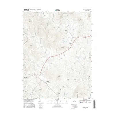
 1994 Washington1997 Print · USGSRappahannock County remains a patchwork of historic Piedmont villages and mountain gaps in the 1990s. Genealogists and historians can trace the foundations of Washington, Sperryville, and Fletcher Mill alongside local landmarks like Old School Ch.
 - 1994 Map of Thornton Gap, 1997 Print
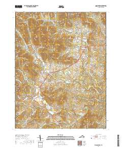
 1994 Thornton Gap1997 Print · USGSThe high crest of the Blue Ridge is captured here in the 1990s as it divides Page and Rappahannock Counties. Hikers and historians can trace the Appalachian Trail past Pass Mountain Shelter or locate the park facilities at Panorama.
 - 2011 Map of Thornton Gap, 2011 Print
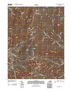 2011 Thornton Gap2011 Print · USGSCovers Sperryville, including Morning Star, Page County, and other nearby areas
 - 2011 Map of Washington, 2011 Print
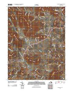 2011 Washington2011 Print · USGSCovers Sperryville, including Washington, Smedley, and other nearby areas
 - 2013 Map of Washington, 2013 Print
 2013 Washington2013 Print · USGSCovers Sperryville, including Washington, Smedley, and other nearby areas
 - 2013 Map of Thornton Gap, 2013 Print
 2013 Thornton Gap2013 Print · USGSCovers Sperryville, including Morning Star, Page County, and other nearby areas
 - 2016 Map of Thornton Gap, 2016 Print
 2016 Thornton Gap2016 Print · USGSCovers Sperryville, including Morning Star, Page County, and other nearby areas
 - 2016 Map of Washington, 2016 Print
 2016 Washington2016 Print · USGSCovers Sperryville, including Washington, Smedley, and other nearby areas
 - 2019 Map of Washington, 2019 Print
 2019 Washington2019 Print · USGSCovers Sperryville, including Washington, Smedley, and other nearby areas
 - 2019 Map of Thornton Gap, 2019 Print
 2019 Thornton Gap2019 Print · USGSCovers Sperryville, including Morning Star, Page County, and other nearby areas
 - 2022 Map of Thornton Gap, 2022 Print
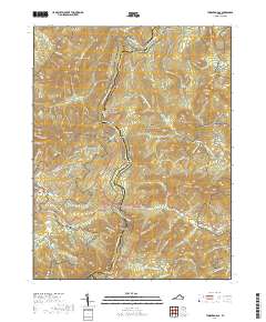
 2022 Thornton Gap2022 Print · USGSThe high ridges of the Virginia Blue Ridge are mapped here in the early twenty-first century, spanning the border of Page and Rappahannock counties. Genealogists and hikers can trace remote family sites like Dwyer Cem and the Jenkins Leake Cem alongside the famous Appalachian National Scenic Trl.
 - 2022 Map of Washington, 2022 Print
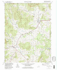
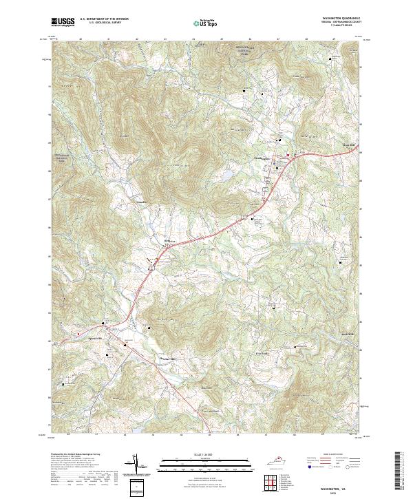 2022 Washington2022 Print · USGSRappahannock County's historic corridor between Washington and Sperryville is shown here as it appears today. Researchers can locate numerous ancestral sites like Fletcher Mill and family landmarks such as the Hawkins Burke Cem or Stewart Family Cem.
End of results
Showing maps 1-22 of 22
Top cities near Sperryville
- Culpeper historical maps
- Luray historical maps
- Brightwood historical maps
- Chester Gap historical maps
- Flint Hill historical maps
- Washington historical maps
Frequently asked questions
- What are the different types of historical maps available for Sperryville?
- What is the oldest map of Sperryville?
- Where can I purchase historical maps of Sperryville for my home or office?
- Where can I download high-res historical maps of Sperryville?
- Are there historical topographic maps available for Sperryville?
- Is there historical aerial imagery available for Sperryville?
- Where are historical maps of Sperryville sourced from?