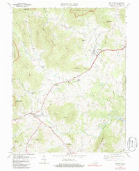
1971 Map of Washington
USGS Topo · Published 1986About this map
Shenandoah National Park defines the western edge of this 1970s landscape, where the Blue Ridge meets the foothills of Rappahannock County. The village of Washington sits at the northern end of the map, while Sperryville anchors the southwest, serving as the gateway to the mountains via the North Fork Thornton River. The map reveals an intricate network of small agricultural settlements and crossroads like Rediviva, Smedley, and Five Forks, which grew around the river valleys.
Find a feature on this map
53 named features on this map. Tap any name to fly to it.
Don’t see what you’re looking for? This feature index may not catch every label — zoom into the map to look around manually.
Map Details
Editions of this 1971 Washington Map
This is the sole edition of this map. No revisions or reprints were ever made.
Other maps of this area

1893 · Luray
USGS Topo · 1:125,000

1905 · Luray
USGS Topo · 1:125,000

1929 · Stony Man
USGS Topo · 1:48,000

1933 · Stony Man
USGS Topo · 1:62,500

1939 · Front Royal
USGS Topo · 1:48,000

1944 · Front Royal
USGS Topo · 1:62,500

1947 · Strasburg
USGS Topo · 1:62,500

1949 · Charlottesville
USGS Topo · 1:250,000

1950 · Strasburg
USGS Topo · 1:62,500

1956 · Charlottesville
USGS Topo · 1:250,000