2020s Maps of Sperryville, Virginia
Explore 2 historic maps of Sperryville from the 2020s. These maps offer a rare glimpse into what life looked like during the 2020s — showing old roads, neighborhoods, homes, and landmarks that have changed or disappeared over time.
Whether you're researching your family's past, planning a metal detecting trip, or studying how Sperryville's landscape evolved across the 2020s, these high-resolution maps are a powerful tool for exploring the history of this region.
- Focus on a specific era: All maps on this page are from the 2020s, giving you a focused view of this time period.
- See what’s changed: Compare century-old streets, trails, and buildings to today's modern landscape using overlays and satellite layers.
- Research with precision: Use these maps for genealogy, historical research, land use analysis, or educational projects.
- View, download, or print: Maps are fully viewable online in high resolution, and can be downloaded or printed for your own records.
Start exploring Sperryville's history through authentic maps from the 2020s. This is your window into the past.
Sperryville, VA maps
(2)- 2022 Map of Thornton Gap, 2022 Print
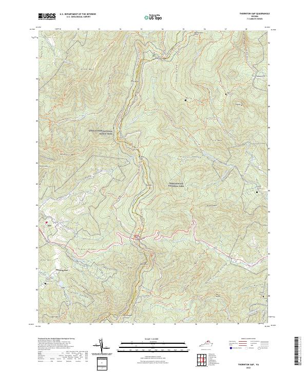 2022 Thornton Gap2022 Print · USGSThe high ridges of the Virginia Blue Ridge are mapped here in the early twenty-first century, spanning the border of Page and Rappahannock counties. Genealogists and hikers can trace remote family sites like Dwyer Cem and the Jenkins Leake Cem alongside the famous Appalachian National Scenic Trl.
 - 2022 Map of Washington, 2022 Print
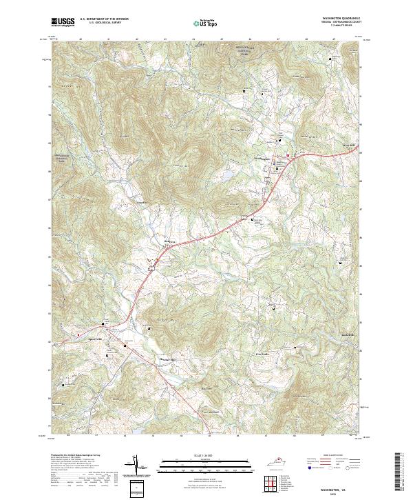 2022 Washington2022 Print · USGSRappahannock County's historic corridor between Washington and Sperryville is shown here as it appears today. Researchers can locate numerous ancestral sites like Fletcher Mill and family landmarks such as the Hawkins Burke Cem or Stewart Family Cem.
End of results
Showing maps 1-2 of 2
Top cities near Sperryville
- Culpeper historical maps
- Luray historical maps
- Brightwood historical maps
- Chester Gap historical maps
- Flint Hill historical maps
- Washington historical maps
Frequently asked questions
- What are the different types of historical maps available for Sperryville?
- What is the oldest map of Sperryville?
- Where can I purchase historical maps of Sperryville for my home or office?
- Where can I download high-res historical maps of Sperryville?
- Are there historical topographic maps available for Sperryville?
- Is there historical aerial imagery available for Sperryville?
- Where are historical maps of Sperryville sourced from?