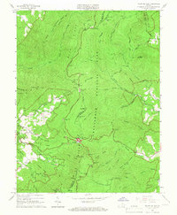
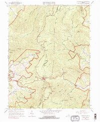
1965 Map of Thornton Gap
USGS Topo · Published 1966About this map
Shenandoah National Park dominates this mid-1960s survey, following the high ridgelines where the Page and Rappahannock county lines meet. The landscape is defined by the winding course of Skyline Drive and the Appalachian Trail, providing a detailed look at the recreational infrastructure of the era, including shelters like Byrds Nest No 4 and the Pass Mountain Shelter.
Find a feature on this map
61 named features on this map. Tap any name to fly to it.
Don’t see what you’re looking for? This feature index may not catch every label — zoom into the map to look around manually.
Map Details
Editions of this 1965 Thornton Gap Map
5 editions found
Other maps of this area

1893 · Luray
USGS Topo · 1:125,000

1905 · Luray
USGS Topo · 1:125,000

1929 · Stony Man
USGS Topo · 1:48,000

1933 · Stony Man
USGS Topo · 1:62,500

1939 · Front Royal
USGS Topo · 1:48,000

1944 · Front Royal
USGS Topo · 1:62,500

1947 · Strasburg
USGS Topo · 1:62,500

1949 · Charlottesville
USGS Topo · 1:250,000

1950 · Strasburg
USGS Topo · 1:62,500

1956 · Charlottesville
USGS Topo · 1:250,000