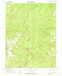
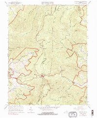
1965 Map of Thornton Gap
USGS Topo · Published 1976About this map
Skyline Drive snakes along the crest of the Blue Ridge Mountain, serving as the central artery for this section of Shenandoah National Park. The landscape is defined by the high-elevation traverse between Elkwallow Gap and Thornton Gap, where travelers transitioned from the winding ridge road to the crossing at U.S. 211. While much of the terrain is dedicated to the park's recreational infrastructure, including the Elkwallow Shelter and Piedmont Picnic Area, the presence of the Morning Star Ch and scattered Cem labels near the park boundaries point to the earlier rural communities that occupied these hollows before the park's establishment. The drainage patterns of the Thornton River and Hazel River carve deep into the eastern slopes, creating distinctive features like Little Devils Stairs and White Rocks. This survey highlights the mid-century development of the park's facilities, from the Park Headquarters to numerous overlooks like Jeremys Run Overlook.
Find a feature on this map
68 named features on this map. Tap any name to fly to it.
Don’t see what you’re looking for? This feature index may not catch every label — zoom into the map to look around manually.
Map Details
Editions of this 1965 Thornton Gap Map
5 editions found
Other maps of this area

1893 · Luray
USGS Topo · 1:125,000

1905 · Luray
USGS Topo · 1:125,000

1929 · Stony Man
USGS Topo · 1:48,000

1933 · Stony Man
USGS Topo · 1:62,500

1939 · Front Royal
USGS Topo · 1:48,000

1944 · Front Royal
USGS Topo · 1:62,500

1947 · Strasburg
USGS Topo · 1:62,500

1949 · Charlottesville
USGS Topo · 1:250,000

1950 · Strasburg
USGS Topo · 1:62,500

1956 · Charlottesville
USGS Topo · 1:250,000