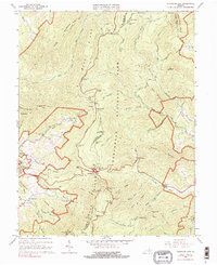
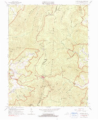
1965 Map of Thornton Gap
USGS Topo · Published 1991About this map
Shenandoah National Park straddles the crest of the Blue Ridge, serving as the central focus of this mid-1960s survey. The winding path of Skyline Drive acts as a primary corridor for visitors, connecting key overlooks like Beahms Gap Overlook and Thornton Hollow Overlook. Hikers can trace the Appalachian Trail as it traverses the ridge, passing the Pass Mountain Shelter and Elkwallow Shelter.
Find a feature on this map
73 named features on this map. Tap any name to fly to it.
Don’t see what you’re looking for? This feature index may not catch every label — zoom into the map to look around manually.
Map Details
Editions of this 1965 Thornton Gap Map
5 editions found
Other maps of this area

1893 · Luray
USGS Topo · 1:125,000

1905 · Luray
USGS Topo · 1:125,000

1929 · Stony Man
USGS Topo · 1:48,000

1933 · Stony Man
USGS Topo · 1:62,500

1939 · Front Royal
USGS Topo · 1:48,000

1944 · Front Royal
USGS Topo · 1:62,500

1947 · Strasburg
USGS Topo · 1:62,500

1949 · Charlottesville
USGS Topo · 1:250,000

1950 · Strasburg
USGS Topo · 1:62,500

1956 · Charlottesville
USGS Topo · 1:250,000