1960s Maps of Roanoke County, Virginia
Explore 16 historic maps of Roanoke County from the 1960s. These maps offer a rare glimpse into what life looked like during the 1960s — showing old roads, neighborhoods, homes, and landmarks that have changed or disappeared over time.
Whether you're researching your family's past, planning a metal detecting trip, or studying how Roanoke County's landscape evolved across the 1960s, these high-resolution maps are a powerful tool for exploring the history of this region.
- Focus on a specific era: All maps on this page are from the 1960s, giving you a focused view of this time period.
- See what’s changed: Compare century-old streets, trails, and buildings to today's modern landscape using overlays and satellite layers.
- Research with precision: Use these maps for genealogy, historical research, land use analysis, or educational projects.
- View, download, or print: Maps are fully viewable online in high resolution, and can be downloaded or printed for your own records.
Start exploring Roanoke County's history through authentic maps from the 1960s. This is your window into the past.
Roanoke County, VA maps
(16)- 1961 Map of Bluefield
 1961 Bluefield1961 Print · USGSThe coalfields and mountain ridges of southern West Virginia and southwest Virginia are captured in the early sixties. Genealogists can trace family ties through rail-linked towns like Princeton and Richlands or along the shores of Bluestone Reservoir.
 - 1962 Map of Roanoke
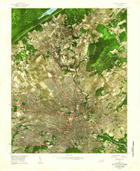 1962 Roanoke1962 Print · USGSMid-century Roanoke and its surrounding valley are captured in this unique experimental aerial mosaic. Genealogists and local historians can trace the early footprints of Vinton, Hollins, and Kingstown, or locate landmarks like Hollins College and the Municipal Airport.
 - 1963 Map of Roanoke
 1963 Roanoke1963 Print · USGSCentral Virginia and the Blue Ridge front appear here in the early sixties, caught between their deep railroad roots and new postwar developments. Genealogists and historians can trace the rail lines of the Norfolk and Western through towns like Bedford and Altavista, or locate family landmarks near Smith Mountain Lake.
 - 1963 Map of Hardy
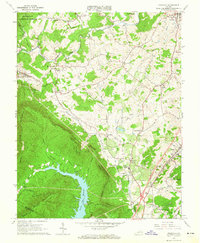
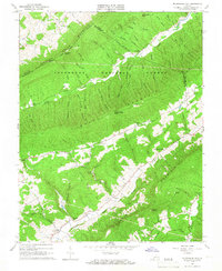
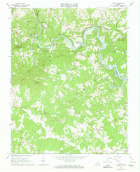 1963 Hardy1963 Print · USGSThe Roanoke River valley and the emerging Smith Mountain Lake dominate this early 1960s survey of the Franklin and Bedford county borders. Local historians can trace family land near Hardy, Red Valley, and numerous landmarks like Gravel Hill Ch and Oyler Chapel Cem.3 unique versions available
 - 1963 Map of Stewartsville, 1964 Print
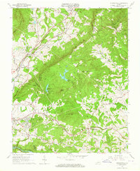 1963 Stewartsville1964 Print · USGSBedford and Botetourt counties meet along the crest of the mountains in the early sixties, as the scenic parkway overlooks a developing valley. Family historians can trace numerous rural churchyards and schools like Mays Memorial Cem and Colonial Sch.4 unique versions available
 - 1963 Map of Roanoke, 1965 Print
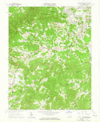
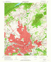 1963 Roanoke1965 Print · USGSRoanoke and its surrounding valley are caught in a moment of rapid suburban and industrial expansion in the early sixties. Researchers can find dozens of family landmarks and local institutions, from Evergreen Cemetery to the campus of Hollins College.6 unique versions available
 - 1963 Map of Glenvar, 1965 Print
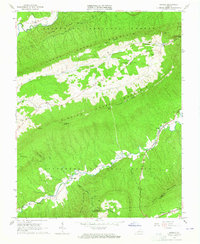
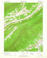 1963 Glenvar1965 Print · USGSRoanoke County in the mid-1960s shows a landscape of steep ridges and river-valley transport. Genealogists and hikers can trace the original Appalachian Trail path and locate family sites like Beard Cem, Shiloh Ch, and the settlement of Bradshaw.4 unique versions available
 - 1963 Map of Looney, 1965 Print
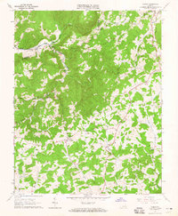
 1963 Looney1965 Print · USGSCraig County in the early sixties reveals a landscape of isolated mountain hollows and ridge-top footpaths. Genealogists and local historians can trace family ties at Looney Cem or Salem Ch and locate historic rural infrastructure like Webbs Mill.3 unique versions available
 - 1963 Map of Check, 1965 Print
 1963 Check1965 Print · USGSFloyd County at the dawn of the 1960s shows a landscape of upland farms and tight-knit valley communities. Genealogists and local historians can trace family land via field lines and find landmarks like Willis Store, Hemlock School, and Kefauver Cemetery.3 unique versions available
 - 1963 Map of Elliston, 1965 Print
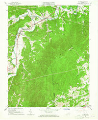 1963 Elliston1965 Print · USGSIn the early 1960s, the forks of the Roanoke River anchored the community life of Montgomery County. Genealogists can trace family names at Duckwiller Cem and Craighead Cem or locate the Elliston-Lafayette Sch and Wabun Bible Chapel.2 unique versions available
 - 1963 Map of Garden City, 1965 Print
 1963 Garden City1965 Print · USGSRoanoke and its southern environs were rapidly expanding into the Blue Ridge foothills in the early 1960s. Genealogists can trace family landmarks like Gearhart Cem and Plunkett Cem, or locate mid-century sites like the Roanoke Drag Strip and Roanoke Technical Institute.3 unique versions available
 - 1963 Map of Bent Mountain, 1965 Print
 1963 Bent Mountain1965 Print · USGSThe Roanoke and Franklin County borderlands meet along the Blue Ridge in the early sixties as suburban growth begins to reach toward the mountains. Genealogists can trace family roots at Lawrence Memorial Ch, Poages Mill, and the Kittinger Cem.5 unique versions available
 - 1963 Map of Daleville, 1965 Print
 1963 Daleville1965 Print · USGSBotetourt County in the early sixties shows a rural landscape of mountain ridges and valley settlements before major suburban expansion. Genealogists and historians can trace old homesteads and family sites near Fincastle, Glebe Mills, and Greenfield Cem.4 unique versions available
 - 1963 Map of Catawba, 1965 Print
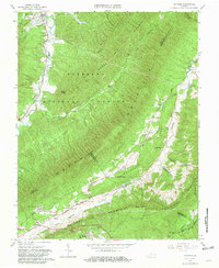 1963 Catawba1965 Print · USGSThe Roanoke and Craig County borderlands are captured here in the early sixties, showing the rural communities of New Castle and Catawba. Genealogists and hikers can locate Catawba Valley Ch, the Catawba Sanatorium, and the path of the Appalachian Trail.4 unique versions available
 - 1963 Map of Salem, 1965 Print
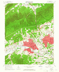 1963 Salem1965 Print · USGSSalem and the western edge of Roanoke are captured here in the early sixties, showing a period of significant suburban and industrial growth. Researchers can locate long-standing institutions like Roanoke College, the grounds of Lakeside Amusement Park, and the Veterans Administration Hospital.4 unique versions available
 - 1965 Map of Mc Donalds Mill, 1966 Print
 1965 Mc Donalds Mill1966 Print · USGSMontgomery County’s mountain ridges and rural hollows are captured here in the mid-1960s, showing a landscape defined by traditional agriculture and forestry. Researchers can trace family history through sites like Mc Donalds Mill, the Appalachian Trail, and several small burial grounds like White Anderson Cem.2 unique versions available
End of results
Showing maps 1-16 of 16
Top cities of Roanoke County
Frequently asked questions
- What are the different types of historical maps available for Roanoke County?
- What is the oldest map of Roanoke County?
- Where can I purchase historical maps of Roanoke County for my home or office?
- Where can I download high-res historical maps of Roanoke County?
- Are there historical topographic maps available for Roanoke County?
- Is there historical aerial imagery available for Roanoke County?
- Where are historical maps of Roanoke County sourced from?