Old Maps of Roanoke County, Virginia for Academic Research
Study the evolution of Roanoke County with 61 high-resolution historic maps. Whether you're teaching, researching, or modeling changes in land use, these maps provide essential visual documentation of urban, environmental, and geographic change.
- Analyze long-term change: Track patterns in development, transportation, and natural features.
- Ideal for environmental or urban studies: Support academic projects with primary historical map data.
- Use in the classroom or lab: Educators and researchers rely on these maps to bring historical context to life.
These maps are a powerful tool for teaching, research, and visualizing how Roanoke County has changed over the decades.
Roanoke County, VA maps
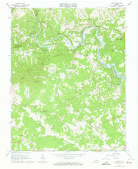
(61)- 1890 Map of Roanoke
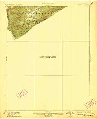
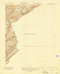
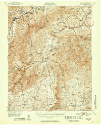
 1890 Roanoke1890 Print · USGSThe Roanoke Valley in the late nineteenth century was a growing rail and mining hub shaped by the Blue Ridge. Researchers can trace the early industrial footprint of the Rorer Mines or locate old community anchors like Dillons Mill and Hales Bridge.
 - 1890 Map of Christiansburg
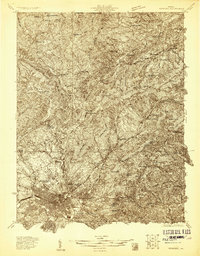
 1890 Christiansburg1890 Print · USGSSouthwestern Virginia in the late nineteenth century centers on the emerging rail and resort economy. Trace the Norfolk and Western Railroad through Christiansburg and find historic resorts like Alleghany Springs.10 unique versions available
 - 1891 Map of Roanoke
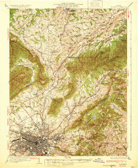
 1891 Roanoke1891 Print · USGSVirginia's Blue Ridge and Roanoke Valley come alive in the late nineteenth century, showing a landscape defined by new rail lines and old river crossings. Genealogists and local researchers can trace family landmarks and forgotten transport nodes like Rorer Mines, Hollins Inst., and Blackwater Ford.8 unique versions available
 - 1923 Map of Waiteville
 1923 Waiteville1923 Print · USGSThe mountain border between West Virginia and Virginia comes to life in the early 1920s, centered on the settlement of Waiteville. Local historians can trace the Norfolk and Western Ry line as it snakes along Potts Cr beneath Peters Mountain.2 unique versions available
 - 1929 Map of Roanoke
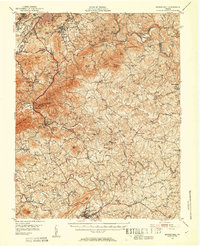
 1929 Roanoke1929 Print · USGSThe Roanoke Valley is shown just before the Great Depression, documenting the area's transition from rural townships to a developing urban center. Genealogists can locate family landmarks such as Forest Chapel Sch, Coyner Springs, and the early neighborhoods of Riverdale.3 unique versions available
 - 1929 Map of Salem
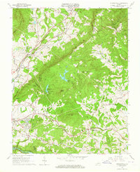
 1929 Salem1929 Print · USGSThe Roanoke River valley and surrounding mountain ridges are captured here in the late 1920s as the railroad and highway networks expanded. Genealogists and researchers can trace local landmarks like Catawba Sanatorium, Webb Mill, and old schoolhouses including Rubles Sch.2 unique versions available
 - 1931 Map of Waiteville
 1931 Waiteville1931 Print · USGSThe Virginia and West Virginia borderlands in the early 1930s reveal a landscape of high ridges and isolated valley settlements. Genealogists can trace family footprints around Newport, Clover Hollow Ch, and the waters of Striking Creek.
 - 1932 Map of Salem
 1932 Salem1932 Print · USGSThe Roanoke Valley and the high ridges of the Blue Ridge meet in this early 1930s survey of the Salem area. Genealogists can locate family landmarks like Webbs Mill, the Catawba Sanatorium, and numerous rural churches including New Hope Church.3 unique versions available
 - 1933 Map of Roanoke
 1933 Roanoke1933 Print · USGSThe Roanoke Valley in the early thirties shows a thriving rail-and-river hub surrounded by a landscape of small crossroads schools and churches. Genealogists can trace family names through landmarks like Hollins College, Gravel Hill Sch, and Trinity church.3 unique versions available
 - 1944 Map of Waiteville
 1944 Waiteville1944 Print · USGSThe borderlands of Giles and Craig counties are captured here in the early twentieth century, showing a transition from rail-dependent industry to rural isolation. Genealogists and historians can trace family locations near Mt Olivet Ch, the settlement at Waiteville, and the now-silent tracks of the Norfolk and Western Ry.
 - 1947 Map of Roanoke, 1948 Print
 1947 Roanoke1948 Print · USGSCentral Virginia in the late 1940s reveals a region defined by its great mountain ridges and the powerful river-and-rail economy connecting Roanoke to Lynchburg. Researchers can trace the path of the Virginian RR and locate historic county seats like Charlotte Court House.2 unique versions available
 - 1950 Map of Elliston, 1952 Print
 1950 Elliston1952 Print · USGSThe Roanoke River headwaters and Blue Ridge highlands are captured here in the early postwar era. Genealogists and historians can trace community roots through numerous country landmarks like Check High Sch, Dillons Mill, and Bend Union Ch.4 unique versions available
 - 1951 Map of Boones Mill, 1953 Print
 1951 Boones Mill1953 Print · USGSFranklin and Roanoke Counties are captured in the early fifties, showing the Blue Ridge foothills before modern development. Genealogists can locate family landmarks such as Oylers Cem, Piedmont Mill, and several rural churches like St Pauls Ch and Brook Hill Ch.3 unique versions available
 - 1951 Map of Waiteville, 1953 Print
 1951 Waiteville1953 Print · USGSThe Virginia and West Virginia borderlands are captured here in the early fifties, showing a landscape of high ridges and narrow valley settlements. Researchers can find old community hubs like Blue Healing Springs, Simmonsville, and Slussers Chapel among the mountain hollows.3 unique versions available
 - 1955 Map of Bluefield
 1955 Bluefield1955 Print · USGSThe Central Appalachian borderlands come alive in the mid-fifties, showing the coal and rail networks connecting Bluefield to Beckley. Researchers can trace the industrial landscape of the New River Ordnance Plant and the terrain of Burkes Garden.
 - 1957 Map of Bluefield, 1967 Print
 1957 Bluefield1967 Print · USGSThe heart of Central Appalachia in the mid-fifties is defined by the winding rail lines and river valleys of the coalfields. Researchers can trace the industrial footprints of towns like Welch and Princeton or locate landmarks such as the Bluestone Reservoir and Claytor Lake.2 unique versions available
 - 1959 Map of Roanoke
 1959 Roanoke1959 Print · USGSCentral Virginia and the Blue Ridge appear in great detail during the late fifties, showcasing the transition from mountain industry to Piedmont farmland. Trace the path of the Norfolk and Western railroad or find old river towns like Appomattox and Amelia Court House.
 - 1961 Map of Bluefield
 1961 Bluefield1961 Print · USGSThe coalfields and mountain ridges of southern West Virginia and southwest Virginia are captured in the early sixties. Genealogists can trace family ties through rail-linked towns like Princeton and Richlands or along the shores of Bluestone Reservoir.
 - 1962 Map of Roanoke
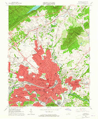
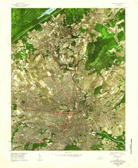 1962 Roanoke1962 Print · USGSMid-century Roanoke and its surrounding valley are captured in this unique experimental aerial mosaic. Genealogists and local historians can trace the early footprints of Vinton, Hollins, and Kingstown, or locate landmarks like Hollins College and the Municipal Airport.
 - 1963 Map of Roanoke
 1963 Roanoke1963 Print · USGSCentral Virginia and the Blue Ridge front appear here in the early sixties, caught between their deep railroad roots and new postwar developments. Genealogists and historians can trace the rail lines of the Norfolk and Western through towns like Bedford and Altavista, or locate family landmarks near Smith Mountain Lake.
 - 1963 Map of Hardy
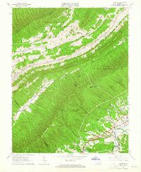
 1963 Hardy1963 Print · USGSThe Roanoke River valley and the emerging Smith Mountain Lake dominate this early 1960s survey of the Franklin and Bedford county borders. Local historians can trace family land near Hardy, Red Valley, and numerous landmarks like Gravel Hill Ch and Oyler Chapel Cem.3 unique versions available
 - 1963 Map of Stewartsville, 1964 Print
 1963 Stewartsville1964 Print · USGSBedford and Botetourt counties meet along the crest of the mountains in the early sixties, as the scenic parkway overlooks a developing valley. Family historians can trace numerous rural churchyards and schools like Mays Memorial Cem and Colonial Sch.4 unique versions available
 - 1963 Map of Roanoke, 1965 Print
 1963 Roanoke1965 Print · USGSRoanoke and its surrounding valley are caught in a moment of rapid suburban and industrial expansion in the early sixties. Researchers can find dozens of family landmarks and local institutions, from Evergreen Cemetery to the campus of Hollins College.6 unique versions available
 - 1963 Map of Glenvar, 1965 Print
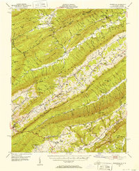
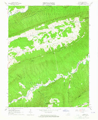
 1963 Glenvar1965 Print · USGSRoanoke County in the mid-1960s shows a landscape of steep ridges and river-valley transport. Genealogists and hikers can trace the original Appalachian Trail path and locate family sites like Beard Cem, Shiloh Ch, and the settlement of Bradshaw.4 unique versions available
 - 1963 Map of Looney, 1965 Print
 1963 Looney1965 Print · USGSCraig County in the early sixties reveals a landscape of isolated mountain hollows and ridge-top footpaths. Genealogists and local historians can trace family ties at Looney Cem or Salem Ch and locate historic rural infrastructure like Webbs Mill.3 unique versions available
Showing maps 1-25 of 61
Top cities of Roanoke County
Frequently asked questions
- What are the different types of historical maps available for Roanoke County?
- What is the oldest map of Roanoke County?
- Where can I purchase historical maps of Roanoke County for my home or office?
- Where can I download high-res historical maps of Roanoke County?
- Are there historical topographic maps available for Roanoke County?
- Is there historical aerial imagery available for Roanoke County?
- Where are historical maps of Roanoke County sourced from?