Old Maps of Goshen, Virginia for Metal Detecting
Plan your next treasure hunt with 26 historic maps of Goshen. Find old homesites, ghost towns, trails, and gathering spots that may be lost to time — perfect for identifying promising metal detecting locations.
- Locate forgotten sites: Uncover places like long-lost settlements, abandoned rail lines, or gathering spots.
- Plan better hunts: Use map overlays combined with LiDAR or satellite views to narrow in on historically rich areas.
- Made for detectorists: Thousands of hobbyists use these maps to discover relics, coins, and hidden history.
Use these historic maps to boost your research and find new opportunities beneath the surface of Goshen.
Goshen, VA maps
(26)- 1894 Map of Natural Bridge, 1898 Print
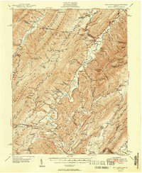
 1894 Natural Bridge1898 Print · USGSThe Virginia ridges thrived with iron furnaces and mineral springs during the 1890s. Genealogists and historians can trace the early industrial footprint of Long Dale Furnace and Victoria Mines, or locate local landmarks like Lick Run Ferry and Rapps Mill.7 unique versions available
 - 1894 Map of Lexington, 1900 Print
 1894 Lexington1900 Print · USGSAmherst and the surrounding Blue Ridge foothills are captured in the late nineteenth century during a period of rural expansion and early rail development. Genealogists can locate family homesteads near Clifford P.O. or trace landmarks like Cornerstone Ch. and Massies Mill.7 unique versions available
 - 1901 Map of Monterey, 1905 Print
 1901 Monterey1905 Print · USGSThe high Allegheny ridges of Highland and Bath Counties are shown at the turn of the century when isolated valley settlements were linked by winding mountain gaps. Genealogists can trace early homesteads and commerce centers like Cleeks Mills, Mountaingrove, and New Hampden.8 unique versions available
 - 1932 Map of Lexington
 1932 Lexington1932 Print · USGSRockbridge County in the early 1930s shows a landscape of academic centers and rural mill towns. Genealogists and historians can trace family locations near Rockbridge Alum Springs, Brownsburg Mill, or the segregated White Hall (Colored View) School.
 - 1937 Map of Lexington
 1937 Lexington1937 Print · USGSRockbridge County during the mid-1930s shows a landscape defined by mountain gaps and the river-and-rail economy of the Shenandoah Valley. Researchers can trace old family names and rural infrastructure through Rockbridge Baths, McClung Mill, and New Monmouth Ch.3 unique versions available
 - 1946 Map of Millboro, 1957 Print
 1946 Millboro1957 Print · USGSThe Alleghany and Rockbridge county lines are mapped here in the mid-1940s, highlighting a rugged corridor of industry and nature. Researchers can trace the Chesapeake and Ohio RR through the Lick Run Tunnel or locate Long Dale Furnace and Rockbridge Alum Springs.2 unique versions available
 - 1946 Map of Williamsville, 1964 Print
 1946 Williamsville1964 Print · USGSThe mountain valleys of Bath and Highland counties are captured here in the mid-1940s, showing a landscape of forest ridges and river settlements. Genealogists and hikers can locate old landmarks like Lockridge Memorial Ch, the Flood Sch, and the Duncan Knob Lookout Tower.
 - 1947 Map of Roanoke, 1948 Print
 1947 Roanoke1948 Print · USGSCentral Virginia in the late 1940s reveals a region defined by its great mountain ridges and the powerful river-and-rail economy connecting Roanoke to Lynchburg. Researchers can trace the path of the Virginian RR and locate historic county seats like Charlotte Court House.2 unique versions available
 - 1949 Map of Charlottesville
 1949 Charlottesville1949 Print · USGSThe Shenandoah Valley and Blue Ridge appear in the late 1940s as a thriving corridor of rail and river commerce. Researchers can trace the mid-century footprints of Harrisonburg, Staunton, and Culpeper alongside the historic routes of the Southern Railway.2 unique versions available
 - 1949 Map of Williamsville
 1949 Williamsville1949 Print · USGSThe ridges and valleys of Bath and Highland Counties come alive in this mid-century survey, documenting a time of remote mountain settlements and forest lookouts. Trace the locations of Starr Chapel, Flood Sch, and the high-elevation Duncan Knob Lookout Tower.2 unique versions available
 - 1949 Map of Millboro
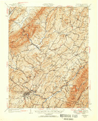
 1949 Millboro1949 Print · USGSThe Virginia highlands between Bath and Rockbridge counties were still deeply defined by their iron-industry and railroad roots in the late 1940s. Genealogists and researchers can trace old family settlements at Nimrod Hall, visit historic sites like Long Dale Furnace, and locate rural landmarks such as Sharon Sch.2 unique versions available
 - 1950 Map of Lexington
 1950 Lexington1950 Print · USGSRockbridge County and the Shenandoah Valley are shown in detail during the mid-twentieth century, centered on the bustling college town of Lexington. Researchers can trace the heritage of the Maury River valley through historic sites like Rockbridge Baths, Goshen Pass, and McClung Mill.2 unique versions available
 - 1951 Map of Lexington
 1951 Lexington1951 Print · USGSMid-century Rockbridge County is documented here at the intersection of the Blue Ridge and the Alleghenies. Researchers can trace the river-and-rail economy through McClung Mill, the Norfolk and Western line, and long-standing landmarks like Rockbridge Baths.2 unique versions available
 - 1956 Map of Charlottesville, 1966 Print
 1956 Charlottesville1966 Print · USGSThe Shenandoah Valley and Blue Ridge are captured in detail during the mid-1960s as the modern interstate system began to emerge. Genealogists and historians can trace rail-connected hubs like Waynesboro or follow the river paths of the Rapidan River and Rivanna River.4 unique versions available
 - 1959 Map of Roanoke
 1959 Roanoke1959 Print · USGSCentral Virginia and the Blue Ridge appear in great detail during the late fifties, showcasing the transition from mountain industry to Piedmont farmland. Trace the path of the Norfolk and Western railroad or find old river towns like Appomattox and Amelia Court House.
 - 1963 Map of Roanoke
 1963 Roanoke1963 Print · USGSCentral Virginia and the Blue Ridge front appear here in the early sixties, caught between their deep railroad roots and new postwar developments. Genealogists and historians can trace the rail lines of the Norfolk and Western through towns like Bedford and Altavista, or locate family landmarks near Smith Mountain Lake.
 - 1967 Map of Goshen, 1979 Print
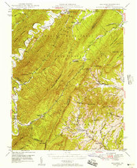
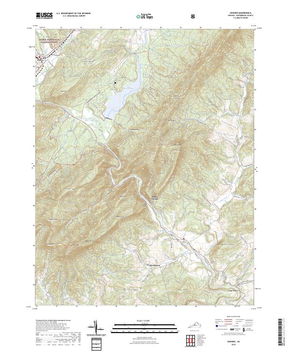
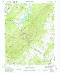 1967 Goshen1979 Print · USGSRockbridge County's mountain passes and river valleys are captured here in the late sixties, just as recreational camps expanded around Lake Merriweather. Researchers can locate historic rural centers like Rockbridge Baths, Cedar Grove, and Bethesda Ch.3 unique versions available
 - 1969 Map of Green Valley, 1970 Print
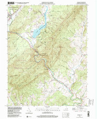
 1969 Green Valley1970 Print · USGSBath County's mountain gaps and river valleys are shown here in the late sixties as the region maintained its rural character. Genealogists can locate family landmarks like McCowan Spring, Cloverdale Ch, and the small settlement of Armstrong.5 unique versions available
 - 1969 Map of Millboro, 1971 Print
 1969 Millboro1971 Print · USGSVirginia's mountain gaps and railroad corridors are captured here in the late sixties, showing the rugged divide between Bath and Rockbridge counties. Researchers can trace historic sites like Rockbridge Alum Springs, the Millboro Tunnel, and the remote community of California.3 unique versions available
 - 1971 Map of Roanoke, 1977 Print
 1971 Roanoke1977 Print · USGSThe Virginia Piedmont and Blue Ridge mountains meet in this early 1970s landscape of river valleys and rail hubs. Researchers can trace historic transportation routes and landmarks like the Appomattox Court House Nat Hist Pk, the Peaks of Otter, and Amelia Court House.2 unique versions available
 - 1986 Map of Buena Vista
 1986 Buena Vista1986 Print · USGSThe mid-eighties landscape around Rockbridge County comes alive in this survey of the Blue Ridge and Allegheny foothills. Researchers can trace the legacy of institutions like Washington and Lee University or follow the historic Chesapeake and Ohio Railway through Clifton Forge.2 unique versions available
 - 1986 Map of Staunton
 1986 Staunton1986 Print · USGSThe Shenandoah Valley and Allegheny Highlands meet in the mid-1980s, revealing a landscape of historic mountain towns and thermal resorts. Genealogists and historians can trace institutional landmarks like Mary Baldwin College or follow the legacy of the Chesapeake and Ohio Railroad through Craigsville and Swoope.2 unique versions available
 - 1999 Map of Goshen, 2000 Print
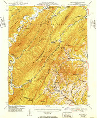
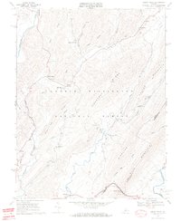
 1999 Goshen2000 Print · USGSThe Maury River gorge and Lake Merriweather dominate this late-twentieth-century study of the Rockbridge County highlands. Researchers can locate remote mountain camps and old valley landmarks like Rockbridge Baths, Bethesda Ch, and Little River Cem.
 - 2022 Map of Green Valley, 2022 Print
 2022 Green Valley2022 Print · USGSBath and Rockbridge Counties remain deeply forested and sparsely settled in this modern topographic survey. Researchers can trace rural lineages through numerous local sites including Bethel Chapel Cem, the settlement at Hotchkiss, and landmarks like McCowan Spring.
 - 2022 Map of Goshen, 2022 Print
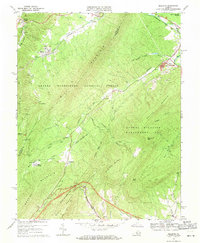
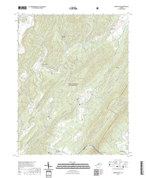
 2022 Goshen2022 Print · USGSRockbridge County mountain communities and the iconic Goshen Pass are documented in this contemporary survey of the Maury River valley. Genealogists and hikers can trace historic routes to Wilson Springs or locate the Little River Cem near Lake Merriweather.
Showing maps 1-25 of 26
Top cities near Goshen
Frequently asked questions
- What are the different types of historical maps available for Goshen?
- What is the oldest map of Goshen?
- Where can I purchase historical maps of Goshen for my home or office?
- Where can I download high-res historical maps of Goshen?
- Are there historical topographic maps available for Goshen?
- Is there historical aerial imagery available for Goshen?
- Where are historical maps of Goshen sourced from?