1900s (20th Century) Maps of Rockingham County, Virginia
Explore 87 historic maps of Rockingham County from the 1900s (20th Century). These maps offer a rare glimpse into what life looked like during the 1900s — showing old roads, neighborhoods, homes, and landmarks that have changed or disappeared over time.
Whether you're researching your family's past, planning a metal detecting trip, or studying how Rockingham County's landscape evolved across the 1900s, these high-resolution maps are a powerful tool for exploring the history of this region.
- Focus on a specific era: All maps on this page are from the 1900s, giving you a focused view of this time period.
- See what’s changed: Compare century-old streets, trails, and buildings to today's modern landscape using overlays and satellite layers.
- Research with precision: Use these maps for genealogy, historical research, land use analysis, or educational projects.
- View, download, or print: Maps are fully viewable online in high resolution, and can be downloaded or printed for your own records.
Start exploring Rockingham County's history through authentic maps from the 1900s. This is your window into the past.
Rockingham County, VA maps
(87)- 1920 Map of Petersburg
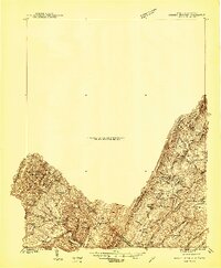
 1920 Petersburg1920 Print · USGSThe West Virginia and Virginia borderlands were a network of tight-knit mountain communities just after the Great War. Genealogists can locate family-named sites like Schmuckers School and Sites Chapel or trace the early Smoke Hole Settlement.3 unique versions available
 - 1921 Map of Orkney Springs
 1921 Orkney Springs1921 Print · USGSHardy County life in the early 1920s was centered in the valley between the high ridges of Shenandoah and South Fork mountains. Genealogists can trace family footprints through a dense network of rural schools and churches, including Jenkins Chapel, Mathias, and the Lumber RR.2 unique versions available
 - 1921 Map of Petersburg
 1921 Petersburg1921 Print · USGSEastern West Virginia at the start of the twenties shows a landscape of mountain hollows tied together by the Baltimore and Ohio at Petersburg. Genealogists can trace family names through landmarks like Hedrick Church, Crites School, and Ketterman.
 - 1922 Map of Fort Seybert
 1922 Fort Seybert1922 Print · USGSPendleton County's South Fork Valley is captured in the early 1920s, showing a landscape of remote mountain homesteads and small valley hamlets. Genealogists can locate family landmarks like Locust Grove School, New Bethel Church, and the high peaks of Shenandoah Mountain.2 unique versions available
 - 1922 Map of Petersburg
 1922 Petersburg1922 Print · USGSThe West Virginia highlands in the early 1920s are centered here on the river valley at Petersburg. Researchers can locate dozens of rural schools and mountain churches, including Royal Glen Mill, Hedrick Church, and Mountaindale School.2 unique versions available
 - 1923 Map of Orkney Springs
 1923 Orkney Springs1923 Print · USGSHardy County, West Virginia, is shown in the early twenties as a landscape of rural schoolhouses and mountain churches tucked between high ridges. Genealogists can locate specific family-named landmarks like Halterman School, Jenkins Chapel, and the Lumber RR line.2 unique versions available
 - 1924 Map of Fort Seybert
 1924 Fort Seybert1924 Print · USGSIn the early 1920s, the Pendleton County highlands were defined by remote mountain gaps and close-knit valley settlements. Genealogists can locate family-named landmarks and rural hubs like Fort Seybert, Brandywine, and the Cedar Grove School.3 unique versions available
 - 1930 Map of Madison
 1930 Madison1930 Print · USGSThe Blue Ridge foothills of Madison and Greene counties are captured here just as Shenandoah National Park was being established. Researchers can trace the early mountain communities around Graves Mill, Criglersville, and the remote Upper Pocosin Mission.3 unique versions available
 - 1931 Map of University
 1931 University1931 Print · USGSAlbemarle County is shown here during the late Prohibition era, when the university and the railroad defined the local economy. Genealogists can trace family names through landmarks like the Miller School, Whitehall, and Mt Plains Ch.2 unique versions available
 - 1933 Map of Madison
 1933 Madison1933 Print · USGSThe Virginia Piedmont meets the Blue Ridge in the early thirties, just as the national park is taking shape. Genealogists can trace family names across Eppards Mill, The Presidents Camp, and remote schools like the Upper Pocosin Mission.3 unique versions available
 - 1934 Map of Waynesboro
 1934 Waynesboro1934 Print · USGSAugusta County settlements and Blue Ridge rail lines are captured here in the mid-1930s as the regional economy modernized. Local historians can trace old schools and churches from Fort Defiance to Lipscomb, including Old Stone Ch and the Blue Ridge Tunnel.2 unique versions available
 - 1935 Map of University, 1962 Print
 1935 University1962 Print · USGSAlbemarle County is captured here in the mid-thirties as the new national park and Skyline Drive begin to reshape the Blue Ridge peaks. Genealogists can trace family names across dozens of rural institutions, from the Miller School to Meriwether Lewis Sch and Hillsboro.
 - 1937 Map of Elkton
 1937 Elkton1937 Print · USGSThe Shenandoah Valley and Blue Ridge highlands are captured here in the 1930s as mountain missions and rural schools still served remote hollows. Genealogists can locate family landmarks like the Wyatt Shiflett Ch, Simmons Gap PO, and Blose Sch.3 unique versions available
 - 1939 Map of Waynesboro
 1939 Waynesboro1939 Print · USGSThe Shenandoah Valley meets the Blue Ridge in the late 1930s, showing a critical crossroads of rail and mountain passage. Genealogists can trace family names and institutions from the Augusta Military Academy at Fort Defiance to the Blue Ridge Tunnel near Waynesboro.3 unique versions available
 - 1940 Map of Orkney Springs
 1940 Orkney Springs1940 Print · USGSThe West Virginia and Virginia borderlands appear in the early 1940s, showing a landscape of mountain resorts and valley farms. Genealogists can trace family landmarks like Halterman Cem and schools such as Mt Hermon Sch.2 unique versions available
 - 1941 Map of Harrisonburg, 1965 Print
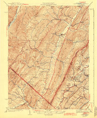
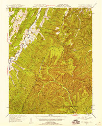
 1941 Harrisonburg1965 Print · USGSHarrisonburg and the surrounding Rockingham County countryside are shown here in the early 1940s, a landscape shaped by rail, river, and regional history. Genealogists can trace family roots through landmarks like Weyers Cave, St Michaels Ch, and the Civilian Public Service Camp No 8.
 - 1942 Map of Mt Jackson, 1959 Print
 1942 Mt Jackson1959 Print · USGSThe Shenandoah Valley during the early forties reveals a landscape defined by the towering Massanutten Mountain and the winding river forks. Researchers can trace historic industrial sites like Catherine Furnace, old schools such as Soliloquy Sch, and the grounds of Shenandoah Academy.2 unique versions available
 - 1943 Map of Orkney Springs
 1943 Orkney Springs1943 Print · USGSThe mountain valleys of the West Virginia-Virginia border come alive in the 1940s, showing a landscape defined by ridges and rural hamlets. Family researchers can trace ancestry through numerous schools and churches like Jenkins Chapel, Halterman School, and Tusing Cem.2 unique versions available
 - 1943 Map of Harrisonburg
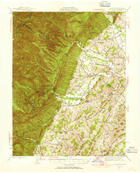
 1943 Harrisonburg1943 Print · USGSMid-century Rockingham County centers on the growing college town of Harrisonburg as the surrounding valley thrives on a mix of agriculture and rail commerce. Genealogists can trace family names through dozens of rural landmarks like Weyers Cave, Bridgewater College, and Melanchthon Chapel.
 - 1944 Map of Orkney Springs
 1944 Orkney Springs1944 Print · USGSDeep in the mountains of Hardy County during the 1940s, this area was defined by its tight-knit valley settlements and small mountain schools. Genealogists can locate family landmarks like Fravel Run Sch, Jenkins Chapel, and the community of Lost City.
 - 1944 Map of Parnassus, 1955 Print
 1944 Parnassus1955 Print · USGSThe rural landscapes of Augusta County are shown here during the mid-1940s, where farming valleys meet the high ridges of the national forest. Researchers can locate family landmarks such as Fulton Sch, the towering Natural Chimneys, and small crossroads like Parnassus and Mt Solon.2 unique versions available
 - 1946 Map of Mt Jackson
 1946 Mt Jackson1946 Print · USGSThe Shenandoah Valley during the mid-1940s reveals a landscape defined by the parallel forks of its famous river and the rising wall of Massanutten Mountain. Genealogists can trace family lines through sites like Riedlers Sch, Catherine Furnace, and Long Cem.2 unique versions available
 - 1947 Map of Parnassus
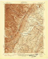 1947 Parnassus1947 Print · USGSThe rural landscape of Augusta and Rockingham counties is captured here in the mid-1940s, showing the transition from fertile valley farms to high mountain ridges. Genealogists and historians can trace family locations near Natural Chimneys, Mt Solon, and the Payne Chapel schoolhouse.2 unique versions available
 - 1947 Map of Mt Jackson
 1947 Mt Jackson1947 Print · USGSThe Shenandoah Valley during the 1940s is captured here, showing the dramatic ridges between the river forks. Genealogists and historians can trace community roots through sites like Woods Chapel, Plains Mill, and Shenandoah Academy near New Market.2 unique versions available
 - 1947 Map of Fort Seybert, 1958 Print
 1947 Fort Seybert1958 Print · USGSThe South Fork Potomac River highlands are captured here in the late 1940s, showing a landscape defined by isolated farmsteads and rural mountain schools. Researchers can trace family-named landmarks and community centers like Fort Seybert, Pleasant Grove Ch, and the Dale Hill Sch.2 unique versions available
Showing maps 1-25 of 87
Top cities of Rockingham County
- Massanetta Springs historical maps
- Bridgewater historical maps
- Broadway historical maps
- Grottoes historical maps
- Elkton historical maps
- Massanutten historical maps
See more
Frequently asked questions
- What are the different types of historical maps available for Rockingham County?
- What is the oldest map of Rockingham County?
- Where can I purchase historical maps of Rockingham County for my home or office?
- Where can I download high-res historical maps of Rockingham County?
- Are there historical topographic maps available for Rockingham County?
- Is there historical aerial imagery available for Rockingham County?
- Where are historical maps of Rockingham County sourced from?