1960s Maps of Rockingham County, Virginia
Explore 27 historic maps of Rockingham County from the 1960s. These maps offer a rare glimpse into what life looked like during the 1960s — showing old roads, neighborhoods, homes, and landmarks that have changed or disappeared over time.
Whether you're researching your family's past, planning a metal detecting trip, or studying how Rockingham County's landscape evolved across the 1960s, these high-resolution maps are a powerful tool for exploring the history of this region.
- Focus on a specific era: All maps on this page are from the 1960s, giving you a focused view of this time period.
- See what’s changed: Compare century-old streets, trails, and buildings to today's modern landscape using overlays and satellite layers.
- Research with precision: Use these maps for genealogy, historical research, land use analysis, or educational projects.
- View, download, or print: Maps are fully viewable online in high resolution, and can be downloaded or printed for your own records.
Start exploring Rockingham County's history through authentic maps from the 1960s. This is your window into the past.
Rockingham County, VA maps
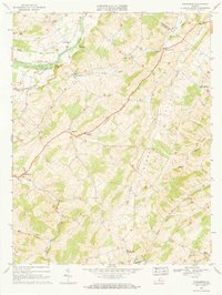
(27)- 1964 Map of Bridgewater, 1966 Print
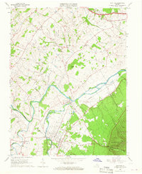
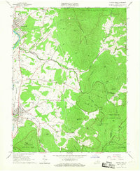
 1964 Bridgewater1966 Print · USGSThe North River valley in the mid-1960s reveals a landscape of established colleges and historic church communities. Genealogists and local historians can trace family locations near Greenwood Cem, Mt Clinton Ch, or the small settlement of Stempleytown.5 unique versions available
 - 1964 Map of Harrisonburg, 1966 Print
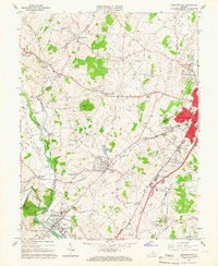
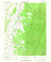
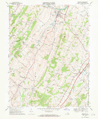
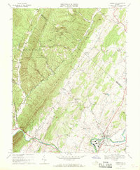
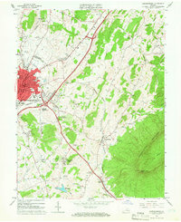 1964 Harrisonburg1966 Print · USGSThe Harrisonburg area at the height of the mid-sixties shows a growing city and college town meeting the Shenandoah Valley floor. Genealogists and researchers can trace local roots through the Lucy F Simms Sch, Hebrew Cem, and rural crossroads like Penn Laird.5 unique versions available
 - 1964 Map of Grottoes, 1966 Print
 1964 Grottoes1966 Print · USGSThe Shenandoah Valley during the mid-sixties is detailed here as the North and South Forks join near the historic settlement of Port Republic. Genealogists and historians can trace Civil War landmarks like the Cross Keys Battle Mon and local family sites including Mt Vernon Cem.4 unique versions available
 - 1964 Map of Mount Sidney, 1966 Print
 1964 Mount Sidney1966 Print · USGSThe Shenandoah Valley on the cusp of the mid-sixties reveals a landscape of river-bottom farms and emerging aviation hubs. Genealogists can locate family names at Bells Cem and Landes Cem, or trace the winding Chesapeake Western line through Weyers Cave.4 unique versions available
 - 1965 Map of Browns Cove, 1966 Print
 1965 Browns Cove1966 Print · USGSAlbemarle County in the mid-1960s shows a quiet rural landscape where the Doyles River valley meets the Blue Ridge. Genealogists and historians can locate family sites like Sandridge Cem, Mt Carmel Ch, and a Civil War Gun Emplacement near the gap.3 unique versions available
 - 1965 Map of Mc Gaheysville, 1966 Print
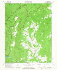
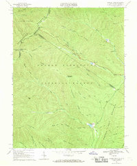
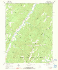
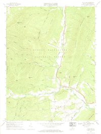
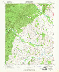
 1965 Mc Gaheysville1966 Print · USGSRockingham County at the edge of the Blue Ridge is captured here during the mid-sixties as the valley's rail lines meet the mountain wilderness. You can trace the Appalachian Trail past Pinefield Shelter or locate local landmarks like Mt Olivet Cem and the Mines near Island Ford.3 unique versions available
 - 1965 Map of Crimora, 1966 Print
 1965 Crimora1966 Print · USGSThe Blue Ridge foothills meet the Shenandoah Valley in the mid-1960s, showing a landscape shaped by mining and mountain travel. Genealogists can locate family sites like Morning Star Cem and Mt Horeb Ch alongside the Crimora Mine.3 unique versions available
 - 1965 Map of Elkton West, 1966 Print
 1965 Elkton West1966 Print · USGSThe Shenandoah Valley in the mid-sixties shows a landscape of steep mountain ridges and river-town commerce. Researchers can trace the heritage of McGaheysville and Elkton alongside the Chesapeake Western Railway and sites like East Point Cem.4 unique versions available
 - 1965 Map of Elkton East, 1967 Print
 1965 Elkton East1967 Print · USGSThe Shenandoah Valley and Blue Ridge highlands meet in the 1960s, showing a landscape of river-side towns and mountain hollows. Genealogists can trace family roots at Naylor Cem or Mt Paran Ch, and follow the rails of the Norfolk and Western.3 unique versions available
 - 1965 Map of Fletcher, 1967 Print
 1965 Fletcher1967 Print · USGSMadison and Greene Counties are shown in the mid-sixties as the mountain communities of the Blue Ridge foothills intersected with the developing Shenandoah National Park. Researchers can locate family landmarks like the Fletcher Cem, Shiloh Ch, and the presidential retreat at Rapidan Camp.4 unique versions available
 - 1965 Map of Swift Run Gap, 1983 Print
 1965 Swift Run Gap1983 Print · USGSThe eastern slopes of the Blue Ridge are captured in the mid-1960s, showing a landscape defined by Shenandoah National Park and rural mountain life. Trace family roots and local landmarks from Bacon Hollow to Mission Home, including Mt Olivet Ch and the Dyke Sch.2 unique versions available
 - 1967 Map of New Market, 1968 Print
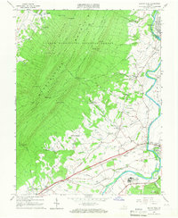
 1967 New Market1968 Print · USGSShenandoah Valley life in the mid-1960s centers on the river and rail corridors of Mt Jackson and New Market. Genealogists can trace family roots through numerous landmarks like Triplett Institute, Plains Mill, and Solomons Ch.3 unique versions available
 - 1967 Map of Parnassus, 1968 Print
 1967 Parnassus1968 Print · USGSThe rural landscape of Augusta County is captured here in the late sixties, centered on the limestone spires of Natural Chimneys. Researchers can trace the Old Railroad Grade or locate family sites at Mt Solon, Parnassus, and St Pauls Ch.2 unique versions available
 - 1967 Map of Reddish Knob, 1969 Print
 1967 Reddish Knob1969 Print · USGSHigh atop the state line in the late sixties, this survey details the peaks and watersheds of the George Washington National Forest. You can trace remote backcountry routes like the Hone Quarry Jeep Trail or locate the shoreline of Hearthstone Lake.3 unique versions available
 - 1967 Map of Bergton, 1969 Print
 1967 Bergton1969 Print · USGSThe Bergton area at the West Virginia and Virginia border comes alive in this late-sixties survey of the Shenandoah valley. Genealogists can trace family landmarks like Jenkins Chapel, Bergton School, and the Crab Run Church among the forest ridges.4 unique versions available
 - 1967 Map of Broadway, 1969 Print
 1967 Broadway1969 Print · USGSThe Shenandoah Valley landscape near Broadway shows a pattern of river-and-rail development during the late sixties. Genealogists and historians can trace family locations through numerous churches and schools, such as Cedar Run Ch and the Linville-Edom Sch.3 unique versions available
 - 1967 Map of Milam, 1969 Print
 1967 Milam1969 Print · USGSThe West Virginia-Virginia borderlands in the late sixties come into focus along the South Fork Potomac River and the ridges of the George Washington National Forest. Researchers can trace the rural communities of Milam, Peru, and Criders alongside mountain landmarks like Reynolds Knob.2 unique versions available
 - 1967 Map of Timberville, 1969 Print
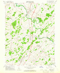
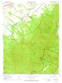
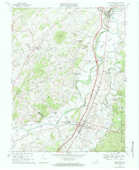
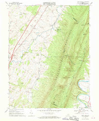
 1967 Timberville1969 Print · USGSRockingham and Shenandoah counties are captured in the late sixties as traditional valley life met mid-century industrial growth. Researchers can locate family landmarks like Moores Store, Cootes Store, and several rural houses of worship including Bethel Ch.3 unique versions available
 - 1967 Map of Cow Knob, 1969 Print
 1967 Cow Knob1969 Print · USGSThe high ridges of the Virginia-West Virginia border are captured here in the late sixties as they appeared within the George Washington National Forest. Researchers can trace the steep topography of Shenandoah Mountain to find the Lookout Tower and remote water sources like Hall Spring.3 unique versions available
 - 1967 Map of Singers Glen, 1969 Print
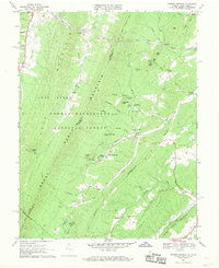
 1967 Singers Glen1969 Print · USGSRockingham County in the late sixties shows a landscape of clustered valley settlements and forested ridges. Genealogists can locate rural landmarks like Stultz Mill, Gospel Hill Ch, and the periodic waters of Tide Spring.2 unique versions available
 - 1967 Map of Fulks Run, 1969 Print
 1967 Fulks Run1969 Print · USGSThe North Fork of the Shenandoah Valley in the late 1960s was a landscape of riverside hamlets and timbered ridges. Genealogists and local historians can trace family locations near Fulks Run, Yankeetown, and several rural meeting houses like Mt Carmel Ch and Hebron Ch.
 - 1967 Map of Orkney Springs, 1969 Print
 1967 Orkney Springs1969 Print · USGSThe Shenandoah mountains during the late 1960s reveal a landscape of deep-rooted resort history and rural church communities. Researchers can locate remote settlements and mountain chapels like Orkney Springs, Mt Hermon Ch, and Bird Haven.3 unique versions available
 - 1967 Map of Rawley Springs, 1969 Print
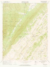
 1967 Rawley Springs1969 Print · USGSThe mountain terrain of Rockingham County is captured in the late sixties, where the watershed of the Dry River meets the George Washington National Forest. Researchers can trace old mountain routes and recreation spots like Clines Hacking, the Harrisonburg Reservoir, and Rawley Springs.4 unique versions available
 - 1967 Map of Tenth Legion, 1970 Print
 1967 Tenth Legion1970 Print · USGSThe Shenandoah Valley and the formidable slopes of Massanutten Mountain are frozen in time here during the late sixties. Genealogists and local historians can trace small communities like Arkton and Athlone or locate the Bethlehem Ch and various family cemeteries.2 unique versions available
 - 1967 Map of Briery Branch, 1970 Print
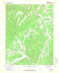
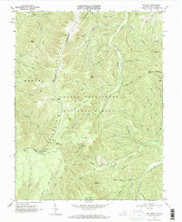
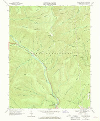
 1967 Briery Branch1970 Print · USGSRockingham County is captured in the late sixties, where the steep ridges of the national forest descend into the productive farms and villages of the valley. Genealogists and historians can locate family landmarks like Mt Olive Ch, Spring Creek Sch, and the Old Railroad Grade.3 unique versions available
Showing maps 1-25 of 27
Top cities of Rockingham County
- Massanetta Springs historical maps
- Bridgewater historical maps
- Broadway historical maps
- Grottoes historical maps
- Elkton historical maps
- Massanutten historical maps
See more
Frequently asked questions
- What are the different types of historical maps available for Rockingham County?
- What is the oldest map of Rockingham County?
- Where can I purchase historical maps of Rockingham County for my home or office?
- Where can I download high-res historical maps of Rockingham County?
- Are there historical topographic maps available for Rockingham County?
- Is there historical aerial imagery available for Rockingham County?
- Where are historical maps of Rockingham County sourced from?