Old Maps of Saltville, Virginia for Metal Detecting
Plan your next treasure hunt with 37 historic maps of Saltville. Find old homesites, ghost towns, trails, and gathering spots that may be lost to time — perfect for identifying promising metal detecting locations.
- Locate forgotten sites: Uncover places like long-lost settlements, abandoned rail lines, or gathering spots.
- Plan better hunts: Use map overlays combined with LiDAR or satellite views to narrow in on historically rich areas.
- Made for detectorists: Thousands of hobbyists use these maps to discover relics, coins, and hidden history.
Use these historic maps to boost your research and find new opportunities beneath the surface of Saltville.
Saltville, VA maps
(37)- 1891 Map of Abingdon
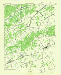
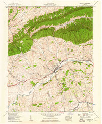
 1891 Abingdon1891 Print · USGSSouthwest Virginia in the 1890s reveals a landscape of mountain ridges and thriving valley settlements along the Norfolk and Western R. R. Lineages can be traced through sites like Emory and Henry College, Saltville, and numerous family-named landmarks like Vance's Mill.
 - 1894 Map of Abingdon, 1896 Print
 1894 Abingdon1896 Print · USGSSouthwest Virginia's valley and ridge country is captured here during the peak of the rail era, centered on the Abingdon and Marion corridors. Local historians can trace the foundations of Emory and Henry College and numerous rural mill sites like Belfast Mills or Vance's Mill.5 unique versions available
 - 1909 Map of Abingdon
 1909 Abingdon1909 Print · USGSSouthwest Virginia at the first decade's end shows a valley landscape defined by the iron rail and steep ridges. Genealogists and historians can trace the early layouts of Abingdon and Glade Spring, or locate landmarks like Dove Mills and the County Farm.2 unique versions available
 - 1911 Map of Abingdon
 1911 Abingdon1911 Print · USGSSouthwest Virginia's rugged corridors are captured here during the height of the mountain rail era. Genealogists and historians can trace old homesteads and local landmarks such as Whites Mill, Valley Church, and the County Farm near Abingdon.5 unique versions available
 - 1935 Map of Chilhowie
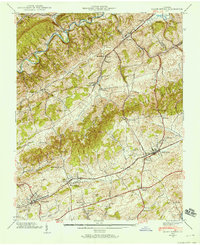
 1935 Chilhowie1935 Print · USGSSmyth County was a center of mountain industry and valley farming in the mid-1930s, defined by the Holston River forks. Researchers can trace historic family landmarks from Mathieson Alkali Works to rural centers like St Clair Bottom and Carlock Ch.
 - 1935 Map of Maccrady
 1935 Maccrady1935 Print · USGSSmyth and Tazewell Counties are shown here during the mid-1930s, as industrial activity along the river defined the local economy. Researchers can trace the path of the Mathieson Alkali Works R. R. and locate family landmarks like Carter Sch or Watsons Gap Sch.
 - 1935 Map of Saltville
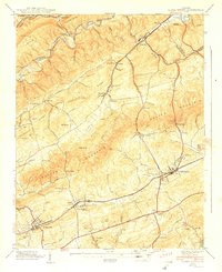
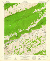
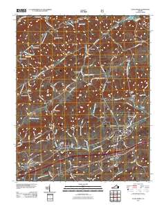
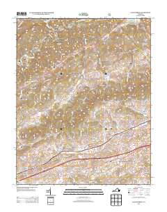
 1935 Saltville1935 Print · USGSSouthwest Virginia's industrial heart comes into focus during the mid-thirties as the salt-and-alkali economy thrives along the Holston River. Genealogists can trace the early footprint of Tumbling Creek College or locate long-standing landmarks like Belfast Mills and the Mathieson Alkali Works R R.
 - 1935 Map of Glade Spring
 1935 Glade Spring1935 Print · USGSSouthwest Virginia's ridge-and-valley landscape comes alive in the mid-1930s, showing the early path of the Appalachian Trail and the bustling campus of Emory and Henry College. Genealogists and historians can trace family-named sites like Blackwell, Moore, and Litz alongside the rail-driven economies of Saltville and Glade Spring.
 - 1938 Map of Glade Spring, 1958 Print
 1938 Glade Spring1958 Print · USGSWashington and Smyth counties in the late 1930s reveal a landscape shaped by the Norfolk and Western Railway and the valley's steep ridges. Genealogists can trace family footprints at Snodgrass Cem and the grounds of Emory and Henry College.5 unique versions available
 - 1939 Map of Glade Spring
 1939 Glade Spring1939 Print · USGSWashington and Smyth counties in the late 1930s reveal a landscape of coordinated valley settlements and mountain ridges. Researchers can trace historic family landmarks like Snoggrass Cem and Broady Cem or the campus layout of Emory and Henry College.2 unique versions available
 - 1953 Map of Winston-Salem, 1974 Print
 1953 Winston-Salem1974 Print · USGSThe North Carolina Piedmont and Virginia highlands meet in the mid-1950s, a landscape defined by the tobacco and textile hubs of the Blue Ridge foothills. Researchers can trace the rail-and-river geography connecting Winston-Salem to mountain towns like Mount Airy and Galax.2 unique versions available
 - 1955 Map of Winston-Salem
 1955 Winston-Salem1955 Print · USGSThe Central Blue Ridge and Piedmont transition are captured here in the mid-fifties, from the industrial hub of Winston-Salem to the high peaks of Southwest Virginia. Genealogists can trace family landmarks like Richmond Hill Ch, Siloam Ch, and the old rail stops along the Southern Railway.
 - 1958 Map of Saltville, 1960 Print
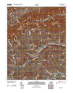
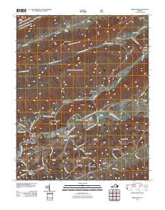
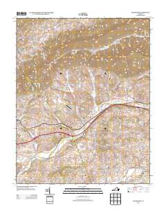
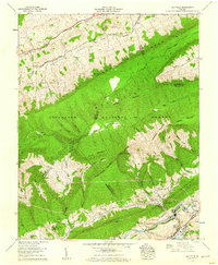 1958 Saltville1960 Print · USGSThe industrial corridor of the Holston River meets the ridges of the Jefferson National Forest in the late fifties. Genealogists can trace dozens of family burial sites like Vencill and Settle, while historians can locate the Olin Mathieson Chemical Corp RR and R B Worthy High Sch.4 unique versions available
 - 1958 Map of Broadford, 1960 Print
 1958 Broadford1960 Print · USGSRich Valley in the late fifties is captured here as a network of river settlements and ridge-top forests along the North Fork Holston River. Genealogists can locate family landmarks like the Keister Cem, Old Broad Ford, and the Buckeye Hollow Sch before the landscape modernized.5 unique versions available
 - 1958 Map of Chilhowie, 1960 Print
 1958 Chilhowie1960 Print · USGSSmyth and Washington counties are captured here in the late fifties, showing the mountain-and-valley landscape of Southwest Virginia. Genealogists can trace family footprints across dozens of sites like St Clair Bottom, Aspenvale Cem, and the Cleghorn Valley Sch.5 unique versions available
 - 1962 Map of Winston-Salem
 1962 Winston-Salem1962 Print · USGSThe North Carolina Piedmont meets the Virginia highlands in the early sixties, showing the rail corridors and mountain gaps of the southern Appalachians. Researchers can trace the Blue Ridge Parkway or locate family sites near Winston-Salem, Mount Airy, and Hanging Rock Mountain.
 - 1982 Map of Wytheville, 1983 Print
 1982 Wytheville1983 Print · USGSSouthwest Virginia's ridge-and-valley landscape is shown here in the early 1980s as the Interstate era fully connected the region. Genealogists and historians can trace family locations near Emory and Henry College, the historic Austinville Mine, and settlements like Saltville or Lansing.3 unique versions available
 - 2010 Map of Chilhowie, 2010 Print
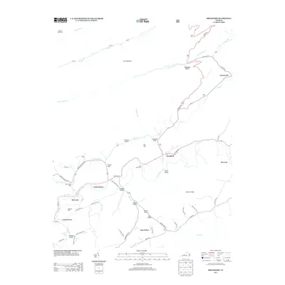
 2010 Chilhowie2010 Print · USGSCovers Saltville, including Chilhowie, Seven Mile Ford, and other nearby areas
 - 2011 Map of Saltville, 2011 Print
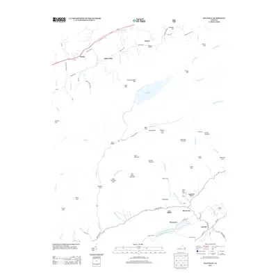
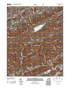 2011 Saltville2011 Print · USGSCovers Saltville, including Belfast, Belfast Mills, and other nearby areas
 - 2011 Map of Glade Spring, 2011 Print
 2011 Glade Spring2011 Print · USGSCovers Saltville, including Glade Spring, Emory, and other nearby areas
 - 2011 Map of Broadford, 2011 Print
 2011 Broadford2011 Print · USGSCovers Saltville, including Osborns Store, Tannersville, and other nearby areas
 - 2013 Map of Broadford, 2013 Print
 2013 Broadford2013 Print · USGSCovers Saltville, including Osborns Store, Tannersville, and other nearby areas
 - 2013 Map of Saltville, 2013 Print
 2013 Saltville2013 Print · USGSCovers Saltville, including Belfast, Belfast Mills, and other nearby areas
 - 2013 Map of Glade Spring, 2013 Print
 2013 Glade Spring2013 Print · USGSCovers Saltville, including Glade Spring, Emory, and other nearby areas
 - 2013 Map of Chilhowie, 2013 Print
 2013 Chilhowie2013 Print · USGSCovers Saltville, including Chilhowie, Seven Mile Ford, and other nearby areas
Showing maps 1-25 of 37
Top cities near Saltville
- Abingdon historical maps
- Marion historical maps
- Richlands historical maps
- Raven historical maps
- Chilhowie historical maps
- Glade Spring historical maps
See more
Top neighborhoods of Saltville
Frequently asked questions
- What are the different types of historical maps available for Saltville?
- What is the oldest map of Saltville?
- Where can I purchase historical maps of Saltville for my home or office?
- Where can I download high-res historical maps of Saltville?
- Are there historical topographic maps available for Saltville?
- Is there historical aerial imagery available for Saltville?
- Where are historical maps of Saltville sourced from?