Old Maps of Macanie, Virginia for Academic Research
Study the evolution of Macanie with 16 high-resolution historic maps. Whether you're teaching, researching, or modeling changes in land use, these maps provide essential visual documentation of urban, environmental, and geographic change.
- Analyze long-term change: Track patterns in development, transportation, and natural features.
- Ideal for environmental or urban studies: Support academic projects with primary historical map data.
- Use in the classroom or lab: Educators and researchers rely on these maps to bring historical context to life.
These maps are a powerful tool for teaching, research, and visualizing how Macanie has changed over the decades.
Macanie, VA maps
(16)- 1892 Map of Woodstock, 1898 Print
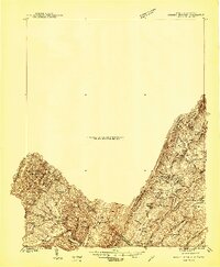
 1892 Woodstock1898 Print · USGSThe Shenandoah Valley in the 1890s is captured here as a landscape of river-driven towns and mountain iron furnaces. Researchers can trace family roots in Woodstock or Edinburg and locate historic industrial sites like Liberty Furnace and Columbia Furnace.5 unique versions available
 - 1921 Map of Orkney Springs
 1921 Orkney Springs1921 Print · USGSHardy County life in the early 1920s was centered in the valley between the high ridges of Shenandoah and South Fork mountains. Genealogists can trace family footprints through a dense network of rural schools and churches, including Jenkins Chapel, Mathias, and the Lumber RR.2 unique versions available
 - 1923 Map of Orkney Springs
 1923 Orkney Springs1923 Print · USGSHardy County, West Virginia, is shown in the early twenties as a landscape of rural schoolhouses and mountain churches tucked between high ridges. Genealogists can locate specific family-named landmarks like Halterman School, Jenkins Chapel, and the Lumber RR line.2 unique versions available
 - 1940 Map of Orkney Springs
 1940 Orkney Springs1940 Print · USGSThe West Virginia and Virginia borderlands appear in the early 1940s, showing a landscape of mountain resorts and valley farms. Genealogists can trace family landmarks like Halterman Cem and schools such as Mt Hermon Sch.2 unique versions available
 - 1943 Map of Orkney Springs
 1943 Orkney Springs1943 Print · USGSThe mountain valleys of the West Virginia-Virginia border come alive in the 1940s, showing a landscape defined by ridges and rural hamlets. Family researchers can trace ancestry through numerous schools and churches like Jenkins Chapel, Halterman School, and Tusing Cem.2 unique versions available
 - 1944 Map of Orkney Springs
 1944 Orkney Springs1944 Print · USGSDeep in the mountains of Hardy County during the 1940s, this area was defined by its tight-knit valley settlements and small mountain schools. Genealogists can locate family landmarks like Fravel Run Sch, Jenkins Chapel, and the community of Lost City.
 - 1949 Map of Charlottesville
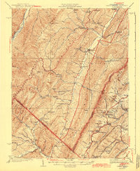
 1949 Charlottesville1949 Print · USGSThe Shenandoah Valley and Blue Ridge appear in the late 1940s as a thriving corridor of rail and river commerce. Researchers can trace the mid-century footprints of Harrisonburg, Staunton, and Culpeper alongside the historic routes of the Southern Railway.2 unique versions available
 - 1956 Map of Charlottesville, 1966 Print
 1956 Charlottesville1966 Print · USGSThe Shenandoah Valley and Blue Ridge are captured in detail during the mid-1960s as the modern interstate system began to emerge. Genealogists and historians can trace rail-connected hubs like Waynesboro or follow the river paths of the Rapidan River and Rivanna River.4 unique versions available
 - 1967 Map of Orkney Springs, 1969 Print
 1967 Orkney Springs1969 Print · USGSThe Shenandoah mountains during the late 1960s reveal a landscape of deep-rooted resort history and rural church communities. Researchers can locate remote settlements and mountain chapels like Orkney Springs, Mt Hermon Ch, and Bird Haven.3 unique versions available
 - 1986 Map of Front Royal
 1986 Front Royal1986 Print · USGSThe northern Shenandoah Valley and the Blue Ridge crest are captured here in the mid-eighties as modern highways began to bypass historic valley towns. Researchers can trace ancestral connections near Peola Mills, navigate the gaps like Manassas Gap, or study the river bends around Luray.3 unique versions available
 - 1994 Map of Orkney Springs, 1997 Print
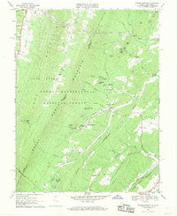
 1994 Orkney Springs1997 Print · USGSThe Shenandoah mountainside during the late twentieth century reveals a landscape of quiet resorts and deep-rooted forest camps. Genealogists and historians can trace family locations near Orkney Springs, Hepners, and the Cove Chapel burial grounds.
 - 2011 Map of Orkney Springs, 2011 Print
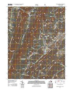 2011 Orkney Springs2011 Print · USGSCovers Macanie, including Basye, Basore, and other nearby areas
 - 2013 Map of Orkney Springs, 2013 Print
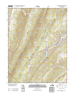 2013 Orkney Springs2013 Print · USGSCovers Macanie, including Basye, Basore, and other nearby areas
 - 2016 Map of Orkney Springs, 2016 Print
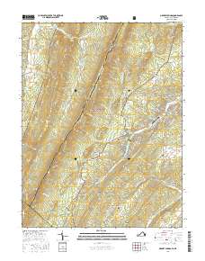 2016 Orkney Springs2016 Print · USGSCovers Macanie, including Basye, Basore, and other nearby areas
 - 2019 Map of Orkney Springs, 2019 Print
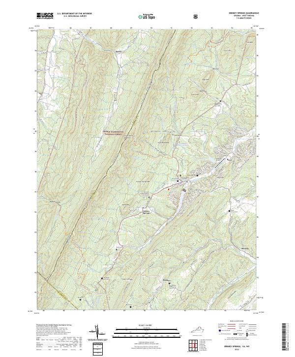
 2019 Orkney Springs2019 Print · USGSCovers Macanie, including Basye, Basore, and other nearby areas
 - 2022 Map of Orkney Springs, 2022 Print
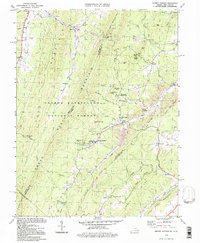
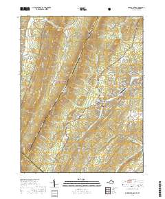
 2022 Orkney Springs2022 Print · USGSShenandoah County mountain communities and forest lands are detailed here during the early twenty-first century. Researchers can trace family sites at Woodland Mennonite Church Cem, Basye Cem, and the high ridges of Supin Lick Mtn.
End of results
Showing maps 1-16 of 16
Top cities near Macanie
- Woodstock historical maps
- Broadway historical maps
- New Market historical maps
- Mount Jackson historical maps
- Timberville historical maps
- Basye historical maps
See more
Frequently asked questions
- What are the different types of historical maps available for Macanie?
- What is the oldest map of Macanie?
- Where can I purchase historical maps of Macanie for my home or office?
- Where can I download high-res historical maps of Macanie?
- Are there historical topographic maps available for Macanie?
- Is there historical aerial imagery available for Macanie?
- Where are historical maps of Macanie sourced from?