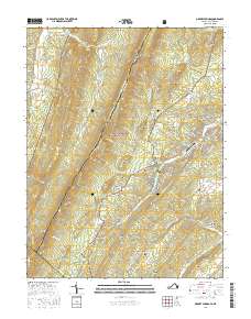
2016 Map of Orkney Springs
USGS Topo · Published 2016About this map
Orkney Springs and the George Washington National Forest anchor this survey of the Virginia-West Virginia borderlands. The landscape is defined by the high ridges of Great North Mountain and Cove Mtn, where numerous springs like Upper Cove Spring and Ervin May Spring feed the complex drainage system of Stony Cr and Capon Run. The settlement pattern follows the narrow valleys, with Basye serving as a focal point for recreation and local transport, evidenced by the presence of Sky Bryce Airport and the development around Lake Carroll.
Find a feature on this map
132 named features on this map. Tap any name to fly to it.
Don’t see what you’re looking for? This feature index may not catch every label — zoom into the map to look around manually.
Map Details
Editions of this 2016 Orkney Springs Map
This is the sole edition of this map. No revisions or reprints were ever made.
Other maps of this area

1892 · Woodstock
USGS Topo · 1:125,000

1921 · Orkney Springs
USGS Topo · 1:48,000

1923 · Orkney Springs
USGS Topo · 1:62,500

1923 · Edinburg
USGS Topo · 1:62,500

1940 · Orkney Springs
USGS Topo · 1:48,000

1942 · Mt Jackson
USGS Topo · 1:62,500

1943 · Orkney Springs
USGS Topo · 1:62,500

1944 · Orkney Springs
USGS Topo · 1:62,500

1946 · Mt Jackson
USGS Topo · 1:62,500

1947 · Mt Jackson
USGS Topo · 1:62,500