2020s Maps of Woodstock, Virginia
Explore 4 historic maps of Woodstock from the 2020s. These maps offer a rare glimpse into what life looked like during the 2020s — showing old roads, neighborhoods, homes, and landmarks that have changed or disappeared over time.
Whether you're researching your family's past, planning a metal detecting trip, or studying how Woodstock's landscape evolved across the 2020s, these high-resolution maps are a powerful tool for exploring the history of this region.
- Focus on a specific era: All maps on this page are from the 2020s, giving you a focused view of this time period.
- See what’s changed: Compare century-old streets, trails, and buildings to today's modern landscape using overlays and satellite layers.
- Research with precision: Use these maps for genealogy, historical research, land use analysis, or educational projects.
- View, download, or print: Maps are fully viewable online in high resolution, and can be downloaded or printed for your own records.
Start exploring Woodstock's history through authentic maps from the 2020s. This is your window into the past.
Woodstock, VA maps
(4)- 2022 Map of Edinburg, 2022 Print
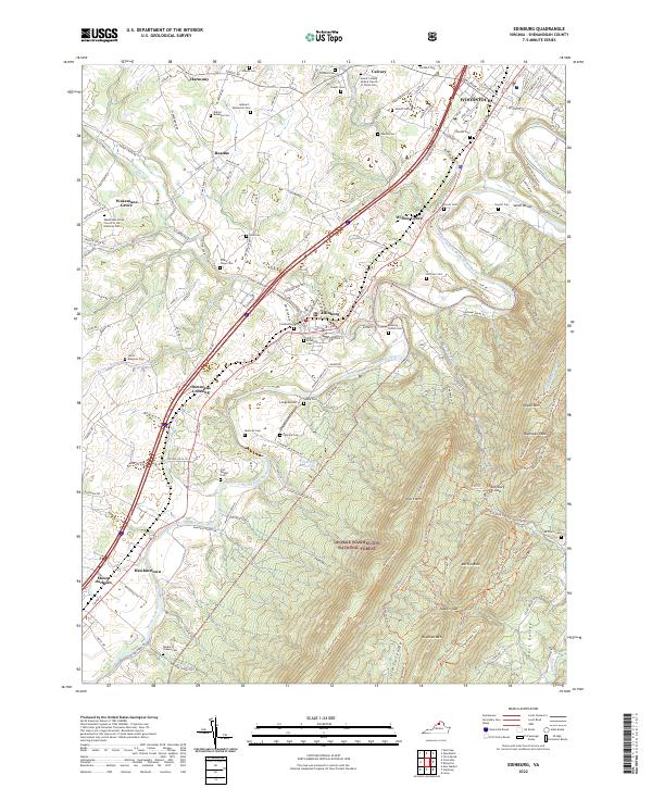 2022 Edinburg2022 Print · USGSShenandoah Valley life at the turn of the 2020s is shaped by the river's ancient path and the ridges of the National Forest. Genealogists can locate family-named sites like Cedarwood Cem and Palmyra Cem, while hikers can trace the Massanutten Trl through Edinburg Gap.
 - 2022 Map of Rileyville, 2022 Print
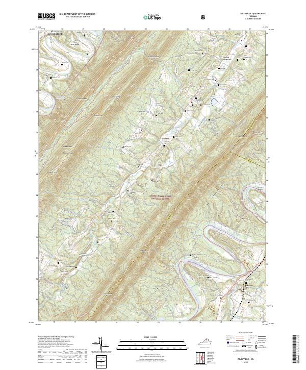 2022 Rileyville2022 Print · USGSThe Shenandoah Valley remains a landscape of traditional settlements and family farmsteads in the modern era. Genealogists can locate dozens of historic burial grounds like Clem McInturff Cem and O'Flaherty Cem, or trace the legacy of the Seven Fountains Sch.
 - 2022 Map of Woodstock, 2022 Print
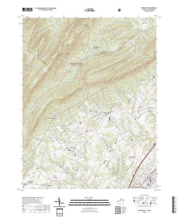 2022 Woodstock2022 Print · USGSThe Shenandoah Valley and its surrounding ridges come into focus in the early 2020s, showing a landscape shaped by forest and furnace. Researchers can trace family roots through numerous sites like Kern Springs and the Saint Luke's Lutheran Church Cem.
 - 2022 Map of Toms Brook, 2022 Print
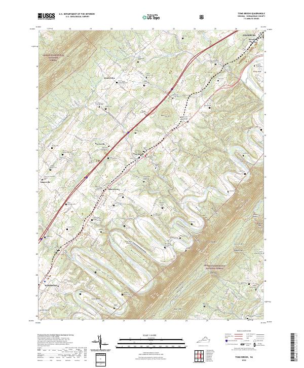 2022 Toms Brook2022 Print · USGSThe Shenandoah Valley corridor is captured here at the start of the 2020s, showing the enduring rural character of the historic Valley Pike. Researchers can trace deep family roots through numerous burial grounds like the Shenandoah County Farm Cem and Borden - Crabill Cem across Toms Brook and Maurertown.
End of results
Showing maps 1-4 of 4
Top cities near Woodstock
- Strasburg historical maps
- Luray historical maps
- New Market historical maps
- Mount Jackson historical maps
- Edinburg historical maps
- Maurertown historical maps
See more
Frequently asked questions
- What are the different types of historical maps available for Woodstock?
- What is the oldest map of Woodstock?
- Where can I purchase historical maps of Woodstock for my home or office?
- Where can I download high-res historical maps of Woodstock?
- Are there historical topographic maps available for Woodstock?
- Is there historical aerial imagery available for Woodstock?
- Where are historical maps of Woodstock sourced from?