1960s Maps of Stafford County, Virginia
Explore 15 historic maps of Stafford County from the 1960s. These maps offer a rare glimpse into what life looked like during the 1960s — showing old roads, neighborhoods, homes, and landmarks that have changed or disappeared over time.
Whether you're researching your family's past, planning a metal detecting trip, or studying how Stafford County's landscape evolved across the 1960s, these high-resolution maps are a powerful tool for exploring the history of this region.
- Focus on a specific era: All maps on this page are from the 1960s, giving you a focused view of this time period.
- See what’s changed: Compare century-old streets, trails, and buildings to today's modern landscape using overlays and satellite layers.
- Research with precision: Use these maps for genealogy, historical research, land use analysis, or educational projects.
- View, download, or print: Maps are fully viewable online in high resolution, and can be downloaded or printed for your own records.
Start exploring Stafford County's history through authentic maps from the 1960s. This is your window into the past.
Stafford County, VA maps
(15)- 1961 Map of Washington
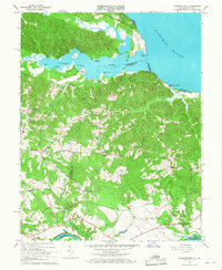
 1961 Washington1961 Print · USGSThe mid-Atlantic region in the late fifties is presented in remarkable detail, from the Blue Ridge foothills to the Chesapeake Eastern Shore. Researchers can trace historic river landings and military sites like Mount Vernon, Fort Belvoir, and Point Lookout.2 unique versions available
 - 1964 Map of Rappahannock Academy
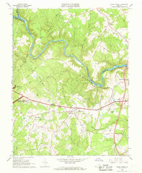
 1964 Rappahannock Academy1964 Print · USGSCaroline County and the Rappahannock River front are captured mid-century as military training grounds expanded alongside historic Virginia estates. Genealogists and historians can trace old homesteads and landmarks like Moss Neck Manor, Rappahannock Academy, and Bethesda Church.
 - 1965 Map of Stafford
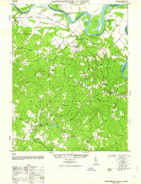
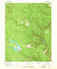
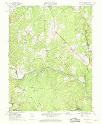
 1965 Stafford1965 Print · USGSStafford County at the end of the Second World War shows a rural landscape defined by historic crossroads and a growing military footprint. Genealogists can trace family landmarks and community centers such as Sheltons Shop, Aquia Ch, and the Stafford Training Sch.
 - 1966 Map of Stafford, 1967 Print
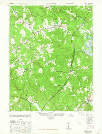
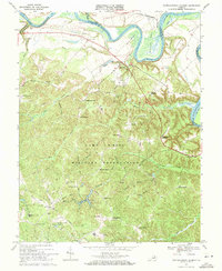
 1966 Stafford1967 Print · USGSStafford County is shown in the mid-sixties as military training grounds and early suburban developments began to reshape its rural landscape. Genealogists and historians can trace family-named sites like Sheltons Shop and Moores Corner alongside landmarks like the Crucifix Monument and St William of York Ch.4 unique versions available
 - 1966 Map of Storck, 1968 Print
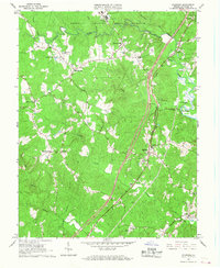
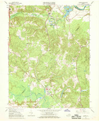
 1966 Storck1968 Print · USGSStafford County is shown in the mid-1960s as a landscape of small crossroads and rural churches. Researchers can trace family-named locations like Skidmore Corner and Roseville, or find local community centers such as Richland Ch and Hartwood.4 unique versions available
 - 1966 Map of Joplin, 1968 Print
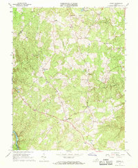
 1966 Joplin1968 Print · USGSStafford and Prince William counties are shown in the mid-1960s as the regional landscape was split between military use and conservation. Genealogists and historians can trace old community sites like Joplin and Kopp alongside features like Lunga Reservoir.4 unique versions available
 - 1966 Map of Salem Church, 1968 Print
 1966 Salem Church1968 Print · USGSSpotsylvania County is captured in the mid-1960s as suburban growth began to meet its deep Civil War history. Researchers can trace rural church locations like Zoan Ch, find the Spotswood Furnace Ruins, and map the extent of Fivemile Fork.5 unique versions available
 - 1966 Map of Widewater, 1968 Print
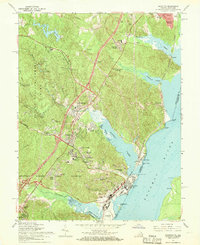
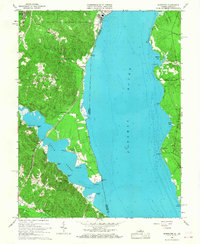 1966 Widewater1968 Print · USGSStafford County and the Potomac shoreline are captured here in the mid-sixties, before suburban growth fully transformed the corridor between Quantico and Fredericksburg. Family historians can locate rural landmarks like Mountjoy Store, the curiously named Youbedamn Landing, and Oak Grove Cem.5 unique versions available
 - 1966 Map of Guinea, 1968 Print
 1966 Guinea1968 Print · USGSSpotsylvania and Caroline counties in the mid-1960s were defined by a network of rural rail stops and Civil War memory. Genealogists and historians can locate old rural centers like Guinea and Massaponax, or trace families near Jackson Shrine and Hopewell Ch.4 unique versions available
 - 1966 Map of Passapatanzy, 1968 Print
 1966 Passapatanzy1968 Print · USGSCoastal Virginia in the mid-sixties reveals a landscape defined by the tidal necks between the Potomac and Rappahannock. Genealogists and researchers can trace family-named crossroads like Batzner Corner and old landmarks such as Fletchers Chapel and Marlboro Point.4 unique versions available
 - 1966 Map of Quantico, 1968 Print
 1966 Quantico1968 Print · USGSCoastal Prince William County is seen here during the mid-sixties, where major military installations meet growing residential villages and thick forest. Researchers can trace the layout of the Quantico Marine Corps Schools or locate local landmarks like Boswells Store and Cockpit Point.6 unique versions available
 - 1966 Map of Fredericksburg, 1968 Print
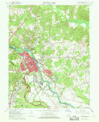 1966 Fredericksburg1968 Print · USGSFredericksburg and the Rappahannock River valley are captured here during the mid-sixties, showing the city's growth alongside its preserved Civil War sites. Genealogists and historians can trace family locations near Hulks Chapel, Monfort Academy, and the Fredericksburg Battlefield.5 unique versions available
 - 1966 Map of Somerville, 1969 Print
 1966 Somerville1969 Print · USGSNorthern Virginia's rural landscape meets military expansion in the mid-sixties, capturing a territory defined by small hamlets and training grounds. Genealogists can trace family names at Cromwell Cem and Tacketts Mill, or locate old crossroads like Sowego.4 unique versions available
 - 1968 Map of Richardsville, 1970 Print
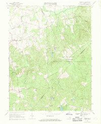
 1968 Richardsville1970 Print · USGSUpper Piedmont life in the late sixties is centered around the confluence of the Rappahannock River and Rapidan River. Genealogists and local historians can locate rural landmarks such as Goldvein, Richardsville, and Clevers Oak Ch.3 unique versions available
 - 1969 Map of Rappahannock Academy, 1971 Print
 1969 Rappahannock Academy1971 Print · USGSCaroline County during the late sixties shows a landscape of river landings and military training grounds. Genealogists can locate family-named hubs like Pullers Corner and Samuels Corner or historic sites like Rappahannock Academy.3 unique versions available
End of results
Showing maps 1-15 of 15
Top cities of Stafford County
- Stafford historical maps
- Falmouth historical maps
- Southern Gateway historical maps
- Boswell's Corner historical maps
- Camp Barrett historical maps
Frequently asked questions
- What are the different types of historical maps available for Stafford County?
- What is the oldest map of Stafford County?
- Where can I purchase historical maps of Stafford County for my home or office?
- Where can I download high-res historical maps of Stafford County?
- Are there historical topographic maps available for Stafford County?
- Is there historical aerial imagery available for Stafford County?
- Where are historical maps of Stafford County sourced from?