Old Maps of Stafford County, Virginia for Metal Detecting
Plan your next treasure hunt with 135 historic maps of Stafford County. Find old homesites, ghost towns, trails, and gathering spots that may be lost to time — perfect for identifying promising metal detecting locations.
- Locate forgotten sites: Uncover places like long-lost settlements, abandoned rail lines, or gathering spots.
- Plan better hunts: Use map overlays combined with LiDAR or satellite views to narrow in on historically rich areas.
- Made for detectorists: Thousands of hobbyists use these maps to discover relics, coins, and hidden history.
Use these historic maps to boost your research and find new opportunities beneath the surface of Stafford County.
Stafford County, VA maps
(135)- 1887 Map of Spottsylvania
 1887 Spottsylvania1887 Print · USGSCentral Virginia in the late 1880s remains a landscape of river fords and crossroads shops before modern development. Genealogists and historians can trace the locations of the Vaucluse Gold Mine, Wilderness Tavern, and the path of the Narrow Gauge Railroad.
 - 1889 Map of Fredericksburg
 1889 Fredericksburg1889 Print · USGSThe Tidewater region of Virginia and Maryland comes into focus in the late 1880s, centered on the river-and-rail hub of Fredericksburg. Genealogists can trace early landmarks like Rappahannock Academy, Bull Church, and Saunders Wharf.
 - 1890 Map of Mt. Vernon
 1890 Mt. Vernon1890 Print · USGSNorthern Virginia and the capital region appear here in the decade before the turn of the century, showing a landscape of river estates and rail-connected villages. Researchers can trace early property sites and historic river landings from Mt. Vernon to Occoquan and Falls Church.
 - 1891 Map of Mt. Vernon
 1891 Mt. Vernon1891 Print · USGSNorthern Virginia and the D.C. area appear here in the late nineteenth century, as the rail-and-river economy connected rural counties to the capital. Researchers can trace ancestral roots through dozens of local landmarks, including Arlington National Cemetery, the Fox Ferry, and historic towns like Occoquan and Vienna.
 - 1892 Map of Fredericksburg
 1892 Fredericksburg1892 Print · USGSCoastal Virginia and Maryland are captured here in the late nineteenth century, showing a landscape of river-port towns and historic crossroads. Researchers can locate vanished landmarks and family sites like Rappahannock Academy, Whites Mill, and the riverside Port Royal.
 - 1892 Map of Spottsylvania
 1892 Spottsylvania1892 Print · USGSCentral Virginia’s post-war landscape is captured here in the late nineteenth century, showing a rural economy defined by gold mining and river crossings. Genealogists can trace family footprints at Todds Tavern, the Vaucluse Gold Mine, and along the Narrow Gauge Railroad.6 unique versions available
 - 1894 Map of Warrenton
 1894 Warrenton1894 Print · USGSVirginia's northern Piedmont and mountain gaps are mapped here in the late nineteenth century as the rail-and-river economy flourished. Genealogists can trace family names and small crossroads from Warrenton and Brentsville to White Sulphur Springs.9 unique versions available
 - 1894 Map of Fredericksburg
 1894 Fredericksburg1894 Print · USGSThe Tidewater and Piedmont regions of Virginia meet in the late nineteenth century at the head of the Rappahannock River. Local historians can trace early inland commerce through rural centers like Nindes Store, the Rappahannock Academy, and Stafford.10 unique versions available
 - 1894 Map of Mt. Vernon, 1904 Print
 1894 Mt. Vernon1904 Print · USGSThe Potomac River valley south of the capital was still largely a landscape of crossroads and rail depots in the late nineteenth century. Genealogists can trace the rural reaches of Fairfax through landmarks like Arlington National Cemetery, Mt. Vernon, and Tyson Cross Roads.6 unique versions available
 - 1897 Map of Mt. Vernon
 1897 Mt. Vernon1897 Print · USGSNorthern Virginia and the Potomac River appear in the late nineteenth century as a landscape of rural crossroads and strategic fortifications. Trace the early footprints of Vienna, Herndon, and Manassas along the path of the Southern R. R.2 unique versions available
 - 1913 Map of Nanjemoy
 1913 Nanjemoy1913 Print · USGSThe Nanjemoy peninsula in the early nineteen-hundreds was a world of tidal creeks and tobacco landings. Researchers can trace the rural fabric of Charles County through family-named landmarks like Mudds Marsh and community hubs such as Durham Church and Green Leek School.3 unique versions available
 - 1926 Map of Stafford, 1956 Print
 1926 Stafford1956 Print · USGSStafford County and the Rappahannock River valley appear here in the mid-twenties, balancing colonial-era heritage with early twentieth-century growth. Genealogists can locate family landmarks like Bridges Store, Passapatanzy, and the historic Aquia Ch along the rail lines.
 - 1927 Map of Quantico
 1927 Quantico1927 Print · USGSPrince William County and the Potomac riverfront appear here in the late twenties, captured just as military and transit corridors began to reshape the rural landscape. Researchers can trace the early foundations of the Marine Corps Reservation and locate vanished local landmarks like Minnieville Store and the Sinclairs Mill.
 - 1931 Map of Stafford
 1931 Stafford1931 Print · USGSStafford County and the city of Fredericksburg are shown here in the early 1930s, documenting a landscape still deeply shaped by nineteenth-century transit and conflict. Genealogists and historians can locate family landmarks like Mountain View PO, Enon Sch, and the grounds of the Battle of Fredericksburg 1862.
 - 1940 Map of Quantico
 1940 Quantico1940 Print · USGSCoastal Virginia and Maryland are captured here during the late pre-war era, showing the growing military footprint around the Potomac. Genealogists can trace family names and landmarks like Sinclairs Mill, Bacon Race School, and the historic Dumfries settlement.2 unique versions available
 - 1942 Map of Guinea
 1942 Guinea1942 Print · USGSSpotsylvania and Caroline counties are seen here in the early 1940s as the rail-driven economy of the Rappahannock valley meets the expansion of federal military lands. Genealogists can locate family-named hubs like Flippos Corner, rural schools such as New Hope School, and the crossroads at Guinea.
 - 1942 Map of Rappahannock Academy, 1944 Print
 1942 Rappahannock Academy1944 Print · USGSThe Rappahannock River valley in the early 1940s reveals a rural landscape undergoing a massive military transformation. You can trace the early layout of the A P Hill Military Reservation and locate historic community centers like Rappahannock Academy and Travis Mill.
 - 1943 Map of Quantico
 1943 Quantico1943 Print · USGSCoastal Northern Virginia in the mid-1940s reveals a region transitioning from a rural riverfront to a strategic military hub. Researchers can trace the early layout of the Marine Corps Reservation or locate family sites like Shacklet PO and Old Chopawamsic Ch.
 - 1943 Map of Catlett, 1955 Print
 1943 Catlett1955 Print · USGSMid-century Fauquier and Prince William counties center on the Southern Railway as it links rural hubs and farming estates. Genealogists can trace family footprints across dozens of local landmarks, from Vint Hill Farm to Dunkard Church and Balls Mill.2 unique versions available
 - 1943 Map of Salem Church, 1961 Print
 1943 Salem Church1961 Print · USGSCentral Virginia during the mid-forties reveals a rural landscape of family-named runs and hilltop parishes. Genealogists and historians can trace local life through markers like Chancellor Sch, Zoan Ch, and the crossroads at Holly Corner.
 - 1943 Map of Fredericksburg, 1961 Print
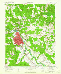 1943 Fredericksburg1961 Print · USGSVirginia's Rappahannock valley is captured here during the war years, balancing its deep Civil War history with mid-century development. Genealogists and historians can trace family-named sites and landmarks like Oak Hill Cem, Dunker Ch, and the Meade Pyramid.
 - 1944 Map of Salem Church
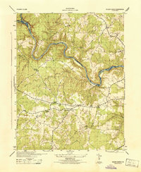 1944 Salem Church1944 Print · USGSSpotsylvania and Stafford Counties were still primarily rural landscapes of crossroads and small farms during the mid-1940s. Genealogists can trace family roots through specific landmarks like Spring Knoll Farm or local institutions such as Diggs School and Zoan Church.
 - 1944 Map of Widewater
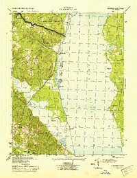 1944 Widewater1944 Print · USGSThe Potomac shoreline at the height of the Second World War shows a landscape defined by military transit and riverfront commerce. Genealogists and local historians can trace the Richmond Fredericksburg and Potomac rail stops and small hubs like Mountjoy Store and Clifton Beach.
 - 1944 Map of Somerville
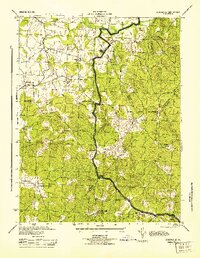 1944 Somerville1944 Print · USGSThe rural borders of Fauquier and Stafford Counties are captured here during the mid-forties. Researchers can locate family landmarks and early post offices at Somerville PO, Tacketts Mill, and Hearts Delight Ch Delight.
 - 1944 Map of Quantico
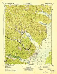 1944 Quantico1944 Print · USGSCoastal Prince William County is captured here at the height of the second World War, showing the expansion of military and transit infrastructure. Genealogists and historians can trace old landmarks like Little Union Ch, the Midway Island Housing Project, and the busy Quantico waterfront.2 unique versions available
Showing maps 1-25 of 135
Top cities of Stafford County
- Stafford historical maps
- Falmouth historical maps
- Southern Gateway historical maps
- Boswell's Corner historical maps
- Camp Barrett historical maps
Frequently asked questions
- What are the different types of historical maps available for Stafford County?
- What is the oldest map of Stafford County?
- Where can I purchase historical maps of Stafford County for my home or office?
- Where can I download high-res historical maps of Stafford County?
- Are there historical topographic maps available for Stafford County?
- Is there historical aerial imagery available for Stafford County?
- Where are historical maps of Stafford County sourced from?