1920s Maps of Sussex County, Virginia
Explore 4 historic maps of Sussex County from the 1920s. These maps offer a rare glimpse into what life looked like during the 1920s — showing old roads, neighborhoods, homes, and landmarks that have changed or disappeared over time.
Whether you're researching your family's past, planning a metal detecting trip, or studying how Sussex County's landscape evolved across the 1920s, these high-resolution maps are a powerful tool for exploring the history of this region.
- Focus on a specific era: All maps on this page are from the 1920s, giving you a focused view of this time period.
- See what’s changed: Compare century-old streets, trails, and buildings to today's modern landscape using overlays and satellite layers.
- Research with precision: Use these maps for genealogy, historical research, land use analysis, or educational projects.
- View, download, or print: Maps are fully viewable online in high resolution, and can be downloaded or printed for your own records.
Start exploring Sussex County's history through authentic maps from the 1920s. This is your window into the past.
Sussex County, VA maps
(4)- 1920 Map of Ivor
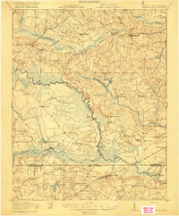
 1920 Ivor1920 Print · USGSCoastal plain life in Southampton and Isle of Wight counties is captured here just after the Great War, when rail and river travel still shaped the landscape. Genealogists can locate family landmarks like Tucker Swamp Church, Crumplers School, and Millfield Millpond.2 unique versions available
 - 1920 Map of Homeville
 1920 Homeville1920 Print · USGSCoastal plain life in Sussex and Southampton counties thrived along the rails and rivers in the early twentieth century. Researchers can trace the legacy of small communities and crossroads schools like Sebrell, Hickory Hill School, and the Union Hill Church near the Nottoway River.3 unique versions available
 - 1920 Map of Arringdale
 1920 Arringdale1920 Print · USGSCoastal plain life at the state line centered on the river and rail just after the Great War. Genealogists can locate family-named landmarks like Pearsons Millpond and several rural centers including Rising Star School, Hebron Church, and Arringdale.3 unique versions available
 - 1921 Map of Mc Kenney
 1921 Mc Kenney1921 Print · USGSSouthern Virginia at the turn of the decade reveals a landscape of tobacco-country schools, churches, and river crossings. Trace the old rail lines of the Virginian and find local landmarks like Smoky Ordinary, Barnes and Parsons Store, and Laxottes Ford.2 unique versions available
End of results
Showing maps 1-4 of 4
Top cities of Sussex County
Frequently asked questions
- What are the different types of historical maps available for Sussex County?
- What is the oldest map of Sussex County?
- Where can I purchase historical maps of Sussex County for my home or office?
- Where can I download high-res historical maps of Sussex County?
- Are there historical topographic maps available for Sussex County?
- Is there historical aerial imagery available for Sussex County?
- Where are historical maps of Sussex County sourced from?