Old Maps of Virginia Beach, Virginia
Explore 49 old maps of Virginia Beach, spanning from 1893 to today. These high-resolution historic maps reveal how streets, neighborhoods, landmarks, and natural features evolved over time — perfect for genealogy, metal detecting, research, and local history exploration.
What you can do with these maps:
- See how Virginia Beach changed over time: Compare historical maps to modern-day views to trace roads, homesites, rail lines & more.
- View detailed metadata: Each map includes creators, publishers, year, scale, and archive source.
- Overlay maps with satellite & LiDAR: Visualize the past alongside modern tools to explore terrain & human change.
- Trusted historical sources: Maps sourced from the USGS, Library of Congress, and other archives.
- Access maps your way: View online, download high-res files, or order prints for personal or research use.
Start exploring old maps of Virginia Beach to uncover forgotten places, hidden landmarks, and the deep history beneath your feet.
Virginia Beach, VA maps
(49)- 1893 Map of Virginia Beach
 1893 Virginia Beach1893 Print · USGSCovers Virginia Beach, including Carova, False Cape Landing, and other nearby areas
 - 1907 Map of Norfolk
 1907 Norfolk1907 Print · USGSCovers Virginia Beach, including Chesapeake, Norfolk, and other nearby areas
 - 1916 Map of Back Bay
 1916 Back Bay1916 Print · USGSCovers Virginia Beach, including Carova, False Cape Landing, and other nearby areas
 - 1918 Map of Cape Henry, 1961 Print
 1918 Cape Henry1961 Print · USGSCovers Virginia Beach, including Broad Creek, Alden Heights, and other nearby areas
 - 1919 Map of Cape Henry
 1919 Cape Henry1919 Print · USGSCovers Virginia Beach, including Broad Creek, Alden Heights, and other nearby areas7 unique versions available
 - 1939 Map of Moyock, 1959 Print
 1939 Moyock1959 Print · USGSCovers Virginia Beach, including Chesapeake, Moyock, and other nearby areas
 - 1943 Map of Back Bay
 1943 Back Bay1943 Print · USGSCovers Virginia Beach, including Carova, False Cape Landing, and other nearby areas
 - 1943 Map of Richmond, 1972 Print
 1943 Richmond1972 Print · USGSCovers Virginia Beach, including Richmond, Hampton, and other nearby areas
 - 1946 Map of Moyock
 1946 Moyock1946 Print · USGSCovers Virginia Beach, including Chesapeake, Moyock, and other nearby areas2 unique versions available
 - 1946 Map of Eastville, 1971 Print
 1946 Eastville1971 Print · USGSCovers Virginia Beach, including Kill Devil Hills, Chincoteague, and other nearby areas
 - 1946 Map of Currituck Sound, 1980 Print
 1946 Currituck Sound1980 Print · USGSCovers Virginia Beach, including Kill Devil Hills, Kitty Hawk, and other nearby areas
 - 1948 Map of Ocean View
 1948 Ocean View1948 Print · USGSCovers Virginia Beach, including Alden Heights, Norview, and other nearby areas
 - 1948 Map of Virginia Beach
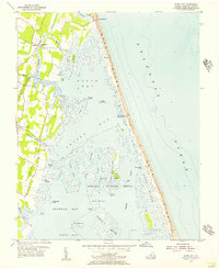
 1948 Virginia Beach1948 Print · USGSCovers Virginia Beach, including United States, Virginia, and other nearby areas
 - 1948 Map of Princess Anne
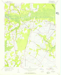
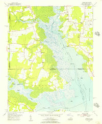
 1948 Princess Anne1948 Print · USGSCovers Virginia Beach, including Gatewood Park, Michaelwood, and other nearby areas
 - 1948 Map of Kempsville
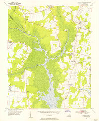
 1948 Kempsville1948 Print · USGSCovers Virginia Beach, including Broad Creek, Kempsville Colony, and other nearby areas
 - 1949 Map of Richmond, 1951 Print
 1949 Richmond1951 Print · USGSCovers Virginia Beach, including Richmond, Hampton, and other nearby areas
 - 1952 Map of Cape Henry
 1952 Cape Henry1952 Print · USGSCovers Virginia Beach, including Great Neck Estates, Great Neck Manor, and other nearby areas
 - 1953 Map of Norfolk, 1954 Print
 1953 Norfolk1954 Print · USGSCovers Virginia Beach, including Chesapeake, Norfolk, and other nearby areas4 unique versions available
 - 1953 Map of North Bay, 1956 Print
 1953 North Bay1956 Print · USGSCovers Virginia Beach, including United States, Virginia, and other nearby areas5 unique versions available
 - 1954 Map of Fentress, 1956 Print
 1954 Fentress1956 Print · USGSCovers Virginia Beach, including Chesapeake, Chesapeake, and other nearby areas4 unique versions available
 - 1954 Map of Pleasant Ridge, 1956 Print
 1954 Pleasant Ridge1956 Print · USGSCovers Virginia Beach, including Chesapeake, United States, and other nearby areas7 unique versions available
 - 1954 Map of Creeds, 1956 Print
 1954 Creeds1956 Print · USGSCovers Virginia Beach, including Greentown, Pungo Ferry, and other nearby areas4 unique versions available
 - 1954 Map of Knotts Island, 1956 Print
 1954 Knotts Island1956 Print · USGSCovers Virginia Beach, including False Cape Landing, Knotts Island, and other nearby areas3 unique versions available
 - 1954 Map of Ocean View, 1958 Print
 1954 Ocean View1958 Print · USGSCovers Virginia Beach, including Alden Heights, Norview, and other nearby areas
 - 1955 Map of Virginia Beach, 1958 Print
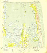
 1955 Virginia Beach1958 Print · USGSCovers Virginia Beach, including United States, Virginia, and other nearby areas
Showing maps 1-25 of 49
Top cities of Virginia Beach
Frequently asked questions
- What are the different types of historical maps available for Virginia Beach?
- What is the oldest map of Virginia Beach?
- Where can I purchase historical maps of Virginia Beach for my home or office?
- Where can I download high-res historical maps of Virginia Beach?
- Are there historical topographic maps available for Virginia Beach?
- Is there historical aerial imagery available for Virginia Beach?
- Where are historical maps of Virginia Beach sourced from?