1950s Maps of Virginia Beach, Virginia
Explore 13 historic maps of Virginia Beach from the 1950s. These maps offer a rare glimpse into what life looked like during the 1950s — showing old roads, neighborhoods, homes, and landmarks that have changed or disappeared over time.
Whether you're researching your family's past, planning a metal detecting trip, or studying how Virginia Beach's landscape evolved across the 1950s, these high-resolution maps are a powerful tool for exploring the history of this region.
- Focus on a specific era: All maps on this page are from the 1950s, giving you a focused view of this time period.
- See what’s changed: Compare century-old streets, trails, and buildings to today's modern landscape using overlays and satellite layers.
- Research with precision: Use these maps for genealogy, historical research, land use analysis, or educational projects.
- View, download, or print: Maps are fully viewable online in high resolution, and can be downloaded or printed for your own records.
Start exploring Virginia Beach's history through authentic maps from the 1950s. This is your window into the past.
Virginia Beach, VA maps
(13)- 1952 Map of Cape Henry
 1952 Cape Henry1952 Print · USGSThe Virginia coast at the mouth of the Chesapeake comes alive in this mid-century survey of the Cape Henry region. Researchers can trace the layout of Fort Story, the original boundaries of Seashore State Park, and early bayfront communities like Ocean Park.
 - 1953 Map of Norfolk, 1954 Print
 1953 Norfolk1954 Print · USGSCoastal Virginia and northeastern North Carolina appear here during the post-war industrial boom, showing the critical rail-and-sea connections of Hampton Roads. Genealogists can trace family roots through rural landmarks like Gethsemane Ch, the Caledonia State Prison Farm, and the vast interior of the Dismal Swamp.4 unique versions available
 - 1953 Map of North Bay, 1956 Print
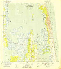
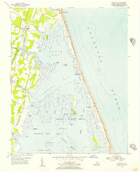 1953 North Bay1956 Print · USGSVirginia's Atlantic barrier islands and coastal marshes are captured here in the early 1950s. Genealogists and local historians can trace family-named points like Mose Island Point or locate the Little Island Coast Guard Station and Tabernacle Ch.5 unique versions available
 - 1954 Map of Fentress, 1956 Print
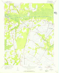 1954 Fentress1956 Print · USGSSoutheastern Virginia at the mid-century shows a landscape shaped by canal traffic and growing military infrastructure. Trace early local roads and family landmarks like Fentress, Hickory Ground, and the Great Bridge Lock.4 unique versions available
 - 1954 Map of Pleasant Ridge, 1956 Print
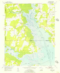
 1954 Pleasant Ridge1956 Print · USGSCoastal Virginia in the mid-fifties is captured here during a period of rural stability and maritime importance. Genealogists and local historians can trace family-named landmarks and old post offices such as Back Bay (Backbay P O), Dawley Corners, and Camels Chapel.7 unique versions available
 - 1954 Map of Creeds, 1956 Print
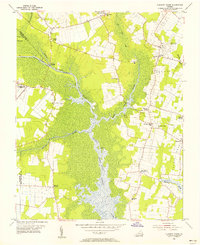
 1954 Creeds1956 Print · USGSCoastal Virginia and North Carolina are mapped here in the mid-1950s, showing the intersection of river life and rural farming. Researchers can trace family roots at Kala Ch, find the location of the Creeds Sch, or locate the Creeds Field (Abandoned).4 unique versions available
 - 1954 Map of Knotts Island, 1956 Print
 1954 Knotts Island1956 Print · USGSThe Virginia and North Carolina borderlands come alive in this mid-century coastal survey of the Back Bay. Genealogists can trace family names across Knotts Island, Deal Island, and Simpson Neck, or locate landmarks like Knotts Island Ch.3 unique versions available
 - 1954 Map of Ocean View, 1958 Print
 1954 Ocean View1958 Print · USGSCoastal Virginia in the mid-fifties shows a landscape of rapid growth where the City of Norfolk pushes into the countryside. Genealogists and historians can trace the development of neighborhoods like Camellia Shores and Brandon Place near the Norfolk Municipal Airport.
 - 1955 Map of Virginia Beach, 1958 Print
 1955 Virginia Beach1958 Print · USGSCoastal Virginia in the mid-fifties is seen here as a mix of growing beach resorts and significant Cold War-era military training grounds. Researchers can trace the early layout of Virginia Beach and find local landmarks like Mt Olive Ch, Seatack Sch, and the Coast Guard Station.
 - 1955 Map of Kempsville, 1958 Print
 1955 Kempsville1958 Print · USGSCoastal Virginia during the mid-fifties shows the evolving landscape of Princess Anne County as urban expansion meets old rural communities. Genealogists and historians can trace family-named sites like Whitehurst Landing, Barrets Corner, and Old Donation Ch.
 - 1955 Map of Cape Henry, 1958 Print
 1955 Cape Henry1958 Print · USGSCoastal Virginia at the mid-century shows the transition from military outposts to growing waterfront communities along the Chesapeake. Trace the landscape before modern expansion through landmarks like Fort Story, the Old Cape Henry Lighthouse, and Lynnhaven Inlet.
 - 1955 Map of Princess Anne, 1958 Print
 1955 Princess Anne1958 Print · USGSCoastal Virginia at the mid-century shows a landscape of tidal creeks and growing neighborhoods as the military presence expands. Trace ancestral roots at St Johns Ch, locate family landmarks like Murdens Corner, or follow the old Southern Railroad line through Oceana.
 - 1959 Map of Richmond
 1959 Richmond1959 Print · USGSMid-century Virginia is captured here at its most vital rail and river junctions, from the capital city to the Chesapeake Bay. Genealogists and historians can trace the development of colonial settlements like Williamsburg and military landmarks including Fort Monroe and Camp Lee.
End of results
Showing maps 1-13 of 13
Top cities of Virginia Beach
Frequently asked questions
- What are the different types of historical maps available for Virginia Beach?
- What is the oldest map of Virginia Beach?
- Where can I purchase historical maps of Virginia Beach for my home or office?
- Where can I download high-res historical maps of Virginia Beach?
- Are there historical topographic maps available for Virginia Beach?
- Is there historical aerial imagery available for Virginia Beach?
- Where are historical maps of Virginia Beach sourced from?