2000s (21st Century) Maps of Booker, Virginia
Explore 6 historic maps of Booker from the 2000s (21st Century). These maps offer a rare glimpse into what life looked like during the 2000s — showing old roads, neighborhoods, homes, and landmarks that have changed or disappeared over time.
Whether you're researching your family's past, planning a metal detecting trip, or studying how Booker's landscape evolved across the 2000s, these high-resolution maps are a powerful tool for exploring the history of this region.
- Focus on a specific era: All maps on this page are from the 2000s, giving you a focused view of this time period.
- See what’s changed: Compare century-old streets, trails, and buildings to today's modern landscape using overlays and satellite layers.
- Research with precision: Use these maps for genealogy, historical research, land use analysis, or educational projects.
- View, download, or print: Maps are fully viewable online in high resolution, and can be downloaded or printed for your own records.
Start exploring Booker's history through authentic maps from the 2000s. This is your window into the past.
Booker, VA maps
(6)- 2003 Map of Holston Valley, 2004 Print
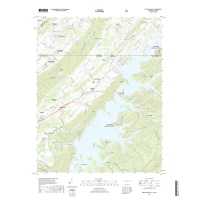
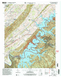 2003 Holston Valley2004 Print · USGSThe South Fork Holston River valley and the expanding suburbs of Bristol are captured here at the turn of the twenty-first century. Genealogists can locate family landmarks like Ketron Cem, Stophel Cem, and the Holston Valley Sch.
 - 2011 Map of Holston Valley, 2011 Print
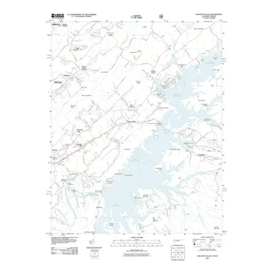 2011 Holston Valley2011 Print · USGSCovers Booker, including Bristol, Goose Pimple Junction, and other nearby areas
 - 2013 Map of Holston Valley, 2013 Print
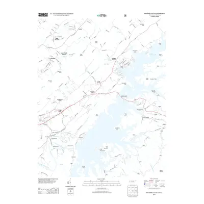 2013 Holston Valley2013 Print · USGSCovers Booker, including Bristol, Goose Pimple Junction, and other nearby areas
 - 2016 Map of Holston Valley, 2016 Print
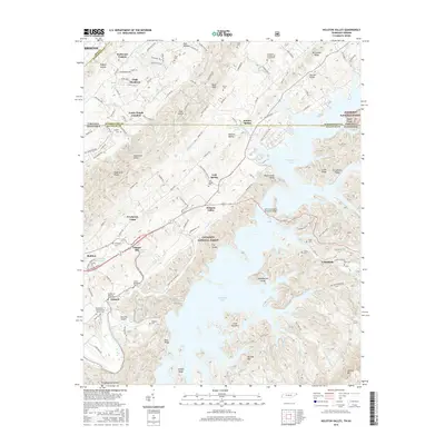 2016 Holston Valley2016 Print · USGSCovers Booker, including Bristol, Goose Pimple Junction, and other nearby areas
 - 2019 Map of Holston Valley, 2019 Print
 2019 Holston Valley2019 Print · USGSCovers Booker, including Bristol, Goose Pimple Junction, and other nearby areas
 - 2022 Map of Holston Valley, 2022 Print
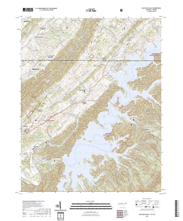 2022 Holston Valley2022 Print · USGSThe Tennessee-Virginia borderlands appear here in the early twenty-first century as a landscape of managed forests and deep reservoir waters. Genealogists can trace family names at Cleveland Presbyterian Church or burial sites like Sauls Cem and Cowan-Delaney Cem.
End of results
Showing maps 1-6 of 6
Top cities near Booker
- Johnson City historical maps
- Bristol historical maps
- Bristol historical maps
- Abingdon historical maps
- Blountville historical maps
- Walnut Hill historical maps
See more
Frequently asked questions
- What are the different types of historical maps available for Booker?
- What is the oldest map of Booker?
- Where can I purchase historical maps of Booker for my home or office?
- Where can I download high-res historical maps of Booker?
- Are there historical topographic maps available for Booker?
- Is there historical aerial imagery available for Booker?
- Where are historical maps of Booker sourced from?