1960s Maps of Wise County, Virginia
Explore 4 historic maps of Wise County from the 1960s. These maps offer a rare glimpse into what life looked like during the 1960s — showing old roads, neighborhoods, homes, and landmarks that have changed or disappeared over time.
Whether you're researching your family's past, planning a metal detecting trip, or studying how Wise County's landscape evolved across the 1960s, these high-resolution maps are a powerful tool for exploring the history of this region.
- Focus on a specific era: All maps on this page are from the 1960s, giving you a focused view of this time period.
- See what’s changed: Compare century-old streets, trails, and buildings to today's modern landscape using overlays and satellite layers.
- Research with precision: Use these maps for genealogy, historical research, land use analysis, or educational projects.
- View, download, or print: Maps are fully viewable online in high resolution, and can be downloaded or printed for your own records.
Start exploring Wise County's history through authentic maps from the 1960s. This is your window into the past.
Wise County, VA maps
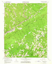
(4)- 1960 Map of Jenkins
 1960 Jenkins1960 Print · USGSEastern Kentucky and the West Virginia borderlands are captured at a mid-century peak of the coal and rail era. Trace the industrial corridors of the Chesapeake and Ohio RR through mountain hubs like Hazard and Jenkins.
 - 1960 Map of Johnson City
 1960 Johnson City1960 Print · USGSUpper East Tennessee and the surrounding tri-state area are shown in the mid-fifties during the height of the TVA reservoir era. Trace the industrial rail lines of the Southern and Louisville and Nashville between Kingsport and Johnson City.
 - 1963 Map of Johnson City
 1963 Johnson City1963 Print · USGSThe Tri-Cities and the surrounding Appalachian ridges are shown in detail during the early sixties, highlighting the era's vital rail and river networks. Genealogists and historians can trace the routes of the Clinchfield RR and locate settlements from Rogersville to Elizabethton.
 - 1963 Map of Jenkins East, 1965 Print
 1963 Jenkins East1965 Print · USGSThe coalfields of the Kentucky-Virginia border are captured here in the early sixties, showing a landscape defined by Pine Mountain and the Chesapeake and Ohio rail line. Trace family roots at Bethel Ch, Shelby Gap, and the Austin Cem.3 unique versions available
End of results
Showing maps 1-4 of 4
Top cities of Wise County
- Big Stone Gap historical maps
- Wise historical maps
- Coeburn historical maps
- Appalachia historical maps
- Pound historical maps
- Big Stone Gap East historical maps
See more
Frequently asked questions
- What are the different types of historical maps available for Wise County?
- What is the oldest map of Wise County?
- Where can I purchase historical maps of Wise County for my home or office?
- Where can I download high-res historical maps of Wise County?
- Are there historical topographic maps available for Wise County?
- Is there historical aerial imagery available for Wise County?
- Where are historical maps of Wise County sourced from?