Old Maps of Wise County, Virginia for Genealogy
Trace your family roots with 129 historic maps of Wise County. These high-res maps reveal old neighborhoods, homesites, landmarks, and streets — helping you uncover where your ancestors lived and how the area evolved over time.
- Explore historic neighborhoods: Identify where your relatives may have lived in the 1800s or 1900s.
- Compare maps over time: Trace the changes in streets, buildings, and landmarks for multi-generational research.
- Perfect for genealogy & ancestry research: Used by family historians and researchers to map out lineage and migration.
These maps are an incredible resource for exploring your personal connection to Wise County's past.
Wise County, VA maps
(129)- 1886 Map of Grundy
 1886 Grundy1886 Print · USGSThe Central Appalachian borderlands come alive in the late nineteenth century as small settlements and family outposts take hold in the hollows. Genealogists and historians can locate early communities like Clintwood and Grundy, or trace ancestral lands near Card P.O. and Sand Lick.
 - 1890 Map of Whitesburg
 1890 Whitesburg1890 Print · USGSThe Cumberland Plateau in the 1880s is a world of deep hollows and isolated mountain settlements. Genealogists can trace family roots in early communities like Whitesburgh and Pikeville or locate crossings at Pound Gap and Shelby Gap.
 - 1890 Map of Grundy
 1890 Grundy1890 Print · USGSThe Central Appalachian borderlands of Virginia and Kentucky are captured here in the late nineteenth century, showing a landscape of isolated mountain hollows. Genealogists and researchers can trace early settlements and river fords including Grundy, Clintwood, and the crossing at Fish Trap.
 - 1892 Map of Grundy
 1892 Grundy1892 Print · USGSThe Appalachian borderlands of Virginia and Kentucky appear here in the late nineteenth century, mapping the deep hollows and ridges of the coalfield region. Genealogists and historians can locate early settlement nodes like Ervinton, Sand Lick, and Grundy amidst landmarks like Pine Mountain.4 unique versions available
 - 1892 Map of Whitesburg
 1892 Whitesburg1892 Print · USGSEastern Kentucky and the Virginia borderlands appear here in the late nineteenth century as a landscape of isolated mountain hollows. Genealogists and historians can trace early family settlements along Kingdom Come Creek, Beef Hide, and the strategic passage at Pound Gap.4 unique versions available
 - 1894 Map of Estillville, 1909 Print
 1894 Estillville1909 Print · USGSThe Appalachian highlands at the turn of the century show a landscape of isolated mountain hollows and emerging rail hubs. Genealogists can trace family footprints across river crossings like Speer Ferry and vanished industry at Zion Mills or Brick Store.3 unique versions available
 - 1897 Map of Bristol
 1897 Bristol1897 Print · USGSThe Tennessee-Virginia borderlands in the late nineteenth century were a landscape of steep ridges and river-dependent commerce. Genealogists can trace family homesteads near Bickley Mill, locate river crossings like Childress Ferry, or find early rail stops along the Norfolk and Western RR.
 - 1902 Map of Bristol
 1902 Bristol1902 Print · USGSThe interstate border region around Bristol appears here at the start of the twentieth century, defined by its deep mountain ridges and river valleys. Researchers can trace the early industrial footprint of the area through numerous landmarks like Bickley Mill, Kings Mill, and the Norfolk and Western RR.6 unique versions available
 - 1912 Map of Pound
 1912 Pound1912 Print · USGSThe borderlands of Wise County and Kentucky are captured in the early twentieth century before the coal industry fully reshaped the mountain hollows. Researchers can trace ancestral locations of schools and gaps, such as Upper Millstone School, Pound Gap, and the settlement of Jenkins.2 unique versions available
 - 1913 Map of Oven Fork
 1913 Oven Fork1913 Print · USGSLetcher County's steep ridges and narrow hollows are shown here in the early twentieth century, just as the Lexington and Eastern Ry arrived. Genealogists can trace family settlements from Whitesburg to Blackey, and locate early schools and landmarks like Campbranch Chapel or Pound Gap.
 - 1913 Map of Clintwood, 1962 Print
 1913 Clintwood1962 Print · USGSVirginia's rugged coal country is captured here during the early twentieth century, showing a landscape of isolated ridge-top schools and river-valley settlements. Genealogists can trace family footprints across dozens of local sites like Hatchet Church, Smith Corners, and the Nichols Gap School.
 - 1914 Map of Pound
 1914 Pound1914 Print · USGSThe Central Appalachian coal country comes alive in this survey of the Kentucky and Virginia borderlands during a period of rapid industrial growth. Genealogists can trace family roots through dozens of rural schools like Phipps School and Donald School, or follow the early path of the Lexington and Eastern RR.4 unique versions available
 - 1915 Map of Clintwood
 1915 Clintwood1915 Print · USGSThe northern Virginia coalfields are captured here in the mid-1910s, revealing a landscape of winding river valleys and ridge-top gaps. Genealogists can trace dozens of early schools and family settlements such as Clintwood, Haysi, and Rainy Flat School.3 unique versions available
 - 1915 Map of Whitesburg
 1915 Whitesburg1915 Print · USGSLetcher County at the start of the twentieth century shows a landscape of deep hollows and growing rail towns. Genealogists can trace family roots through numerous numbered schoolhouses and settlements like Whitesburg, Blackey, and Indian Bottom.4 unique versions available
 - 1920 Map of Wise
 1920 Wise1920 Print · USGSThe coal and rail country of Southwest Virginia is captured here in the years following the Great War. Genealogists can locate family landmarks such as Fort Blackmore, Grays School, and the scattered settlements of Dunbar and Esserville.
 - 1920 Map of Coeburn
 1920 Coeburn1920 Print · USGSSouthwest Virginia during the height of its rail and timber era reveals a complex network of company towns and mountain settlements. Genealogists can trace family footprints near Dante, St Paul, and Castlewood, or locate rural institutions like the Greenwood School and Carter School.5 unique versions available
 - 1921 Map of Big Stone Gap
 1921 Big Stone Gap1921 Print · USGSIn the early 1920s, the coal and rail networks of Wise and Lee Counties were at their peak. Genealogists and historians can trace old settlements and rural hubs like Keokee, Johnsons Mill PO, and Stonega along the Southern RR and the Powell River.
 - 1921 Map of Wise
 1921 Wise1921 Print · USGSWise County in the early twentieth century was a landscape of coal-town industry and mountain schools. Search for family roots in settlements like Norton, Big Stone Gap, and Glamorgan, or locate rural landmarks such as Cox Chapel and Buffalo School.2 unique versions available
 - 1922 Map of Big Stone Gap
 1922 Big Stone Gap1922 Print · USGSSouthwest Virginia's coal and rail corridors are captured here in the early 1920s, showing the height of industrial development in the Cumberland Mountains. Trace family roots and vanished landmarks near Appalachia, Keokee, and the historic Seminary School along the Powell River.
 - 1929 Map of Big Stone Gap
 1929 Big Stone Gap1929 Print · USGSThe coal and rail networks of the Kentucky-Virginia border country are frozen in time just before the Great Depression. Genealogists and historians can trace family roots through mountain settlements like Lynch, Keokee, and Appalachia, or locate landmarks such as Robbins Chapel and Cluttis Post Office.3 unique versions available
 - 1935 Map of Pardee
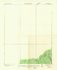 1935 Pardee1935 Print · USGSThe coal country of the Kentucky-Virginia border is captured here during the mid-1930s, documenting the industrial footprint along the state line. Genealogists and historians can locate the Pardee Mines, the Pardee Ch, and landmarks like Whitesburg No 1.
 - 1935 Map of Indian Gap
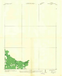 1935 Indian Gap1935 Print · USGSWise County is shown during a period of coal-driven growth in the mid-1930s. Researchers can trace the industrial landscape of Clinchfield Coal No 14 and the local community around Glamorgan, Vickers, and the Gilliam Sch.
 - 1935 Map of Wise
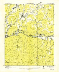 1935 Wise1935 Print · USGSWise and Norton were hubs of industry in the mid-1930s, defined by the winding Guest River and an extensive network of coal mines. Researchers can trace early mining operations like Cinchfield Coal No 15 and family-named landmarks like Stallard Ch.
 - 1935 Map of Norton
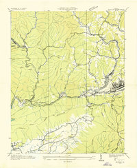 1935 Norton1935 Print · USGSIn the mid-1930s, the coal fields of Wise County were a hive of industrial activity centered around rail junctions and company towns. Researchers can trace the lineage of local families at Legion Memorial Cem and locate specific mine sites like Stonega Coal No 125 or the CCC Camp P 63.
 - 1935 Map of Appalachia
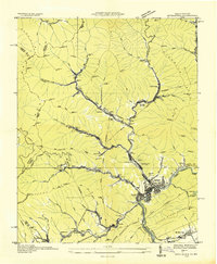 1935 Appalachia1935 Print · USGSThe Virginia-Kentucky borderlands hummed with coal and rail activity in the mid-1930s. Genealogists and industrial historians can trace family locations through numerous company towns like Roda and Arno, or locate the Interstate Shops and Yards.
Showing maps 1-25 of 129
Top cities of Wise County
- Big Stone Gap historical maps
- Wise historical maps
- Coeburn historical maps
- Appalachia historical maps
- Pound historical maps
- Big Stone Gap East historical maps
See more
Frequently asked questions
- What are the different types of historical maps available for Wise County?
- What is the oldest map of Wise County?
- Where can I purchase historical maps of Wise County for my home or office?
- Where can I download high-res historical maps of Wise County?
- Are there historical topographic maps available for Wise County?
- Is there historical aerial imagery available for Wise County?
- Where are historical maps of Wise County sourced from?