2000s (21st Century) Maps of Azwell, Washington
Explore 6 historic maps of Azwell from the 2000s (21st Century). These maps offer a rare glimpse into what life looked like during the 2000s — showing old roads, neighborhoods, homes, and landmarks that have changed or disappeared over time.
Whether you're researching your family's past, planning a metal detecting trip, or studying how Azwell's landscape evolved across the 2000s, these high-resolution maps are a powerful tool for exploring the history of this region.
- Focus on a specific era: All maps on this page are from the 2000s, giving you a focused view of this time period.
- See what’s changed: Compare century-old streets, trails, and buildings to today's modern landscape using overlays and satellite layers.
- Research with precision: Use these maps for genealogy, historical research, land use analysis, or educational projects.
- View, download, or print: Maps are fully viewable online in high resolution, and can be downloaded or printed for your own records.
Start exploring Azwell's history through authentic maps from the 2000s. This is your window into the past.
Azwell, WA maps
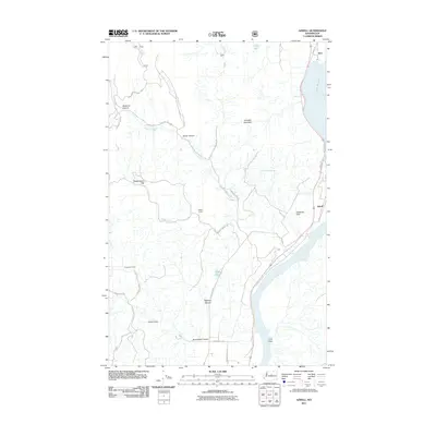
(6)- 2001 Map of Azwell, 2004 Print
 2001 Azwell2004 Print · USGSThe Columbia River corridor near the turn of the twenty-first century reveals a landscape of hydroelectric reservoirs and forest service lands. Local historians can trace early land divisions through Indian Allotment Boundaries near Azwell and the settlement of Starr.
 - 2011 Map of Azwell, 2011 Print
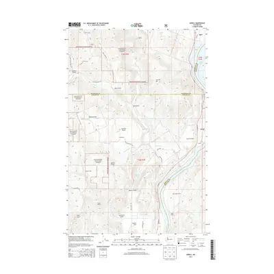
 2011 Azwell2011 Print · USGSCovers Azwell, including Starr, Chelan County, and other nearby areas
 - 2014 Map of Azwell, 2014 Print
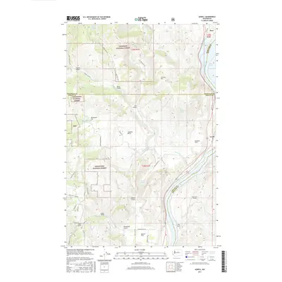
 2014 Azwell2014 Print · USGSCovers Azwell, including Starr, Chelan County, and other nearby areas
 - 2017 Map of Azwell, 2017 Print
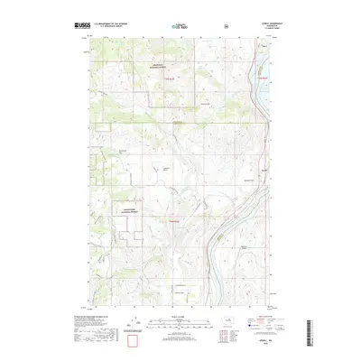
 2017 Azwell2017 Print · USGSCovers Azwell, including Starr, Chelan County, and other nearby areas
 - 2020 Map of Azwell, 2020 Print
 2020 Azwell2020 Print · USGSCovers Azwell, including Starr, Chelan County, and other nearby areas
 - 2023 Map of Azwell, 2023 Print
 2023 Azwell2023 Print · USGSThe Columbia River corridor north of Chelan comes alive in this 2023 survey, showing the relationship between the national forests and valley settlements. Genealogists and local historians can trace family-named areas like Arbuckle Mtn and Gossman Flats or locate the riverside hamlet of Azwell.
End of results
Showing maps 1-6 of 6
Top cities near Azwell
Frequently asked questions
- What are the different types of historical maps available for Azwell?
- What is the oldest map of Azwell?
- Where can I purchase historical maps of Azwell for my home or office?
- Where can I download high-res historical maps of Azwell?
- Are there historical topographic maps available for Azwell?
- Is there historical aerial imagery available for Azwell?
- Where are historical maps of Azwell sourced from?