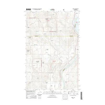
2014 Map of Azwell
USGS Topo · Published 2014About this map
The Columbia River carves a deep valley through this north-central Washington landscape, serving as the primary geographic corridor and historical boundary between Chelan, Douglas, and Okanogan counties. Along its banks, Lake Pateros is flanked by the small settlements of Starr and Azwell, while the River View Airpark signals the region's modern infrastructure. The terrain is defined by dramatic elevation shifts, moving from the river flats up into the high plateau of Highland Bench and the timbered slopes of the Okanogan National Forest and Wenatchee National Forest.
Find a feature on this map
49 named features on this map. Tap any name to fly to it.
Don’t see what you’re looking for? This feature index may not catch every label — zoom into the map to look around manually.
Map Details
Editions of this 2014 Azwell Map
This is the sole edition of this map. No revisions or reprints were ever made.
Other maps of this area

1899 · Methow
USGS Topo · 1:125,000

1901 · Chelan
USGS Topo · 1:125,000

1901 · Methow
USGS Topo · 1:125,000

1905 · Okanogan
USGS Topo · 1:125,000

1953 · Ritzville
USGS Topo · 1:250,000

1954 · Okanogan
USGS Topo · 1:250,000

1955 · Concrete
USGS Topo · 1:250,000

1957 · Brewster
USGS Topo · 1:62,500

1957 · Wenatchee
USGS Topo · 1:250,000

1958 · Concrete
USGS Topo · 1:250,000