Old Maps of Douglas County, Washington
Explore 382 old maps of Douglas County, spanning from 1901 to today. These high-resolution historic maps reveal how streets, neighborhoods, landmarks, and natural features evolved over time — perfect for genealogy, metal detecting, research, and local history exploration.
What you can do with these maps:
- See how Douglas County changed over time: Compare historical maps to modern-day views to trace roads, homesites, rail lines & more.
- View detailed metadata: Each map includes creators, publishers, year, scale, and archive source.
- Overlay maps with satellite & LiDAR: Visualize the past alongside modern tools to explore terrain & human change.
- Trusted historical sources: Maps sourced from the USGS, Library of Congress, and other archives.
- Access maps your way: View online, download high-res files, or order prints for personal or research use.
Start exploring old maps of Douglas County to uncover forgotten places, hidden landmarks, and the deep history beneath your feet.
Douglas County, WA maps
(382)- 1901 Map of Chelan
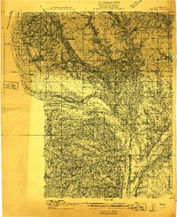
 1901 Chelan1901 Print · USGSNorth Central Washington is captured at the dawn of the twentieth century, showing the early development of the lake and river valleys. Researchers can trace the original Wapato Indian Reservation boundary and locate early townsites like Lakeside and Waterville.6 unique versions available
 - 1905 Map of Okanogan
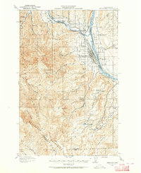
 1905 Okanogan1905 Print · USGSThe Okanogan and Columbia rivers converge in this early 1900s survey, showing the region when river ferries were the primary links between frontier settlements. Researchers can trace the original locations of Bruster, Alma, and Olema, or locate historical river crossings like Central Ferry and Andrews Ferry.3 unique versions available
 - 1912 Map of Malaga
 1912 Malaga1912 Print · USGSCentral Washington's river-driven development is on display here just before the era of major hydroelectric projects. Genealogists and historians can trace an incredible density of early schools like Lower Stemilt School and settlements like Malaga and Vulcan.2 unique versions available
 - 1913 Map of Wenatchee, 1964 Print
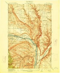
 1913 Wenatchee1964 Print · USGSThe Wenatchee River valley and Columbia River shoreline thrived in the early 1910s as a burgeoning agricultural and rail hub. Genealogists can trace early homesteads and landmarks like Martins Ranch, the Great Northern Railway, and rural sites like Pitcher School.
 - 1914 Map of Malaga
 1914 Malaga1914 Print · USGSCentral Washington ranching and rail life are captured here just before World War I, centered on the Columbia River corridor. Genealogists and local historians can locate early homesteads and landmarks like the Sheehan Ranch, Malaga, and Liberty School.3 unique versions available
 - 1915 Map of Wenatchee
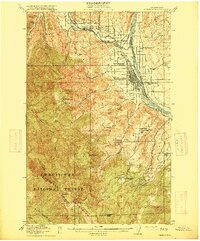 1915 Wenatchee1915 Print · USGSWenatchee and the Columbia River valley are shown in the years before major dam construction, when the region's orchard economy was firmly established. Researchers can trace early railroad history along the Great Northern or locate rural landmarks like Mortins Ranch and Ferry School.3 unique versions available
 - 1920 Map of Colockum Pass
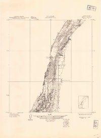
 1920 Colockum Pass1920 Print · USGSKittitas and Douglas counties are shown during a time of river ferries and mountain ranching. You can trace early schoolhouse locations like Whisky Dick School and follow the old Trinidad Ferry route across the Columbia River.
 - 1922 Map of Colockum Pass
 1922 Colockum Pass1922 Print · USGSEastern Washington ranching and river commerce are captured here just after the Great War, showing a landscape of high mountain passes and vital Columbia River crossings. Genealogists can trace family homesteads like Sheridan Ranch and local rural landmarks including Whisky Dick School and the Trinidad Ferry.2 unique versions available
 - 1930 Map of Grand Coulee Sheet 3
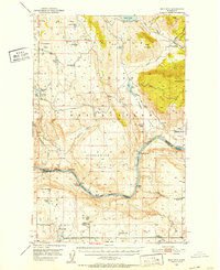
 1930 Grand Coulee Sheet 31930 Print · USGSGrant County is captured during a period of transition in the late twenties, showing the area's complex geology before major development. Researchers can trace local landmarks like the Grand View Sch and the significant geological formation of the Bacon Monocline.
 - 1948 Map of Grand Coulee Dam, 1955 Print
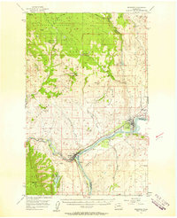
 1948 Grand Coulee Dam1955 Print · USGSThe Grand Coulee region underwent a massive transformation by the late 1940s as the dam transformed the river valley into a sprawling reservoir. Trace the growth of Coulee Dam and Grand Coulee, and locate rural landmarks like the Grand Coulee Grange and Bagdad Junction.6 unique versions available
 - 1950 Map of Grand Coulee Dam
 1950 Grand Coulee Dam1950 Print · USGSThe Grand Coulee region during the late 1940s reveals a landscape transformed by the new reservoir and the massive engineering of the dam. Researchers can trace local history through the Lafollette Cem, the community at Elmer City, and rural sites like the Grand Coulee Grange.2 unique versions available
 - 1950 Map of Nespelem, 1952 Print
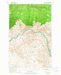
 1950 Nespelem1952 Print · USGSWithin the Colville Indian Reservation at mid-century, this area shows the transition from mountain lakes to the Columbia River shore. You can trace early settlements and agency sites like Nespelem, Koontzville, and the Colville Indian Agency during a period of significant regional change.4 unique versions available
 - 1950 Map of Boot Mtn, 1952 Print
 1950 Boot Mtn1952 Print · USGSThe Okanogan highlands meet the Columbia River in the early 1950s within the Colville Indian Reservation. Trace rural life through the Condon Ferry (Site) and several remote schoolhouses like Long Lake Sch.3 unique versions available
 - 1950 Map of Alameda Flat, 1965 Print
 1950 Alameda Flat1965 Print · USGSThe Columbia River flows through Okanogan and Douglas counties in the early 1950s, defining the rugged boundary of the Colville Indian Reservation. Genealogists and local historians can locate the Rex Grange Hall, Del Rio Cemetery, and several legacy mining sites like the Apache Mine.2 unique versions available
 - 1952 Map of Alameda Flat
 1952 Alameda Flat1952 Print · USGSOkanogan County settlement and industry are captured here in the early fifties along the Columbia River. Genealogists and historians can trace several closed schools like Rex School and remote mining sites including the Apache Mine.
 - 1953 Map of Ritzville, 1966 Print
 1953 Ritzville1966 Print · USGSEastern Washington was undergoing a massive agricultural and industrial transformation in the mid-fifties as irrigation from the Grand Coulee Dam reached the plateau. Researchers can trace the mid-century rail network of the Great Northern and locate vital local sites like Larson Air Force Base and Odessa.3 unique versions available
 - 1954 Map of Okanogan, 1964 Print
 1954 Okanogan1964 Print · USGSNorth Central Washington’s interior comes into focus during the mid-fifties, showing the rise of the Columbia River reservoir system. Genealogists and historians can trace the Great Northern rail line and locate historical mining operations at the Mountain Lion Mine or Gold Hill Mine.2 unique versions available
 - 1956 Map of Ephrata
 1956 Ephrata1956 Print · USGSThe high desert of Grant County comes into focus in the mid-fifties as irrigation canals began transforming the sagebrush landscape. Researchers can trace old rural landmarks like the Wheatland School (Aband), the Drumheller Ranch, and the Olson Spur rail siding.2 unique versions available
 - 1957 Map of Bridgeport, 1958 Print
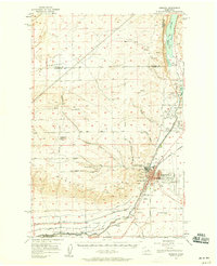
 1957 Bridgeport1958 Print · USGSThe Columbia River valley underwent significant change in the late fifties following the completion of the Chief Joseph Dam. You can trace the historic Ft Okanogan (Site), locate the Bedard Sch (Aban'd), and see the route of the Great Northern railway.2 unique versions available
 - 1957 Map of Brewster, 1959 Print
 1957 Brewster1959 Print · USGSThe confluence of the Columbia and Methow rivers comes alive in this late-fifties survey of the Okanogan valley. Local historians can trace the Northern Pacific RR through Brewster and Pateros or locate the old Gambles Mill (Site).2 unique versions available
 - 1957 Map of Wenatchee, 1973 Print
 1957 Wenatchee1973 Print · USGSThe northern Cascades and Columbia River valley appear here in the mid-fifties, showing the region's critical rail and transit corridors. Researchers can trace the routes of the Great Northern RR and Milwaukee Road through settlements like Skykomish, Baring, and Dryden.2 unique versions available
 - 1958 Map of Okanogan
 1958 Okanogan1958 Print · USGSThe Okanogan River valley and the Colville Indian Reservation are shown here in the late fifties, during a period of established river and rail commerce. Researchers can trace the Great Northern line through Oroville or locate landmarks like the Knowlton School and Orient Ranger Station.
 - 1959 Map of Ritzville
 1959 Ritzville1959 Print · USGSEastern Washington in the late fifties reveals a landscape transformed by massive irrigation projects and postwar growth. Genealogists and historians can trace rail-line communities from Ritzville to Davenport and locate landmarks like Larson Air Force Base and Telford Station.
 - 1965 Map of Ritzville
 1965 Ritzville1965 Print · USGSCentral Washington during the mid-sixties shows a landscape shaped by massive irrigation projects and the Cold War. Genealogists and historians can trace rail-town life and military presence through Ephrata Air Base, the Telford Station, and local schools.
 - 1965 Map of Jameson Lake SW, 1966 Print
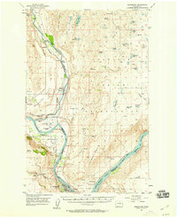
 1965 Jameson Lake SW1966 Print · USGSThe high plateau and deep canyons of Douglas County are captured here in the mid-1960s. Researchers can locate the St Hubert Church and trace the complex drainage of Moses Coulee through landmarks like Sulphur Spring and McCartney Creek.
Showing maps 1-25 of 382
Top cities of Douglas County
- East Wenatchee historical maps
- Bridgeport historical maps
- Waterville historical maps
- Rock Island historical maps
- Mansfield historical maps
Frequently asked questions
- What are the different types of historical maps available for Douglas County?
- What is the oldest map of Douglas County?
- Where can I purchase historical maps of Douglas County for my home or office?
- Where can I download high-res historical maps of Douglas County?
- Are there historical topographic maps available for Douglas County?
- Is there historical aerial imagery available for Douglas County?
- Where are historical maps of Douglas County sourced from?