1930 Map of Grand Coulee Sheet 3
USGS Topo · Published 1930About this map
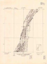
Bacon Monocline dominates this 1930 advance sheet, illustrating the dramatic geological formations of Grant County just before large-scale irrigation and infrastructure changed the region. Surveyed by A K Andrews and T. G. Gerdine, the map focuses on the complex contouring of the coulee walls and the structural significance of the monocline. Social development is marked by the presence of the Grand View Sch, a solitary educational landmark in this sparsely settled landscape. The transition between Townships 26 and 25 North provides a clear view of the area's surveying framework, highlighting the isolation of early Grant County settlements and the primary importance of the terrain's natural drainage and elevation patterns before the modern era.
Find a feature on this map
4 named features on this map. Tap any name to fly to it.
Don’t see what you’re looking for? This feature index may not catch every label — zoom into the map to look around manually.
Map Details
Editions of this 1930 Grand Coulee Sheet 3 Map
This is the sole edition of this map. No revisions or reprints were ever made.
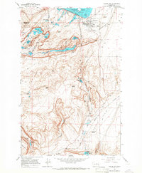
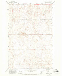
Other maps of this area

1953 · Ritzville
USGS Topo · 1:250,000

1959 · Ritzville
USGS Topo · 1:250,000

1965 · Ritzville
USGS Topo · 1:250,000

1965 · St. Andrews
USGS Topo · 1:24,000

1965 · Mold
USGS Topo · 1:24,000

1965 · Park Lake
USGS Topo · 1:24,000
1965 · Coulee City
USGS Topo · 1:24,000

1968 · Steamboat Rock SW
USGS Topo · 1:24,000

1968 · Hartline SW
USGS Topo · 1:24,000
1968 · Barnes Butte
USGS Topo · 1:24,000