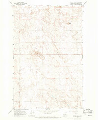
1968 Map of Barnes Butte
USGS Topo · Published 1971About this map
The high plateau of Douglas County is defined by its agricultural character and rolling topography in this late-1960s survey. Isolated structures and local landmarks like the Grange Hall and the Jean Cem highlight the rural community's footprint amidst a landscape of section lines and fence lines. The terrain is marked by significant natural elevations such as Barnes Butte in the northeast and the centrally located Pot Hills, which provide relief in an otherwise expansive open territory.
Find a feature on this map
9 named features on this map. Tap any name to fly to it.
Don’t see what you’re looking for? This feature index may not catch every label — zoom into the map to look around manually.
Map Details
Editions of this 1968 Barnes Butte Map
2 editions found
Other maps of this area

1930 · Grand Coulee Sheet 3
USGS Topo · 1:31,680

1953 · Ritzville
USGS Topo · 1:250,000

1959 · Ritzville
USGS Topo · 1:250,000

1965 · Ritzville
USGS Topo · 1:250,000

1965 · St. Andrews
USGS Topo · 1:24,000

1965 · Jameson Lake East
USGS Topo · 1:24,000

1965 · Mold
USGS Topo · 1:24,000

1968 · Coleman Hill
USGS Topo · 1:24,000

1968 · Foster Coulee
USGS Topo · 1:24,000
1968 · Leahy
USGS Topo · 1:24,000