
1965 Map of Mold
USGS Topo · Published 1967About this map
Banks Lake Upper Grand Coulee dominates the eastern landscape of this Douglas and Grant County border region, where underwater contours were mapped by the U.S. Bureau of Reclamation in 1942. The settlement of Mold and the nearby Mold Cem sit at the top of the plateau, overlooking a complex system of draws and canyons like Shrock Draw and Haynes Canyon. The map reveals the evolving infrastructure of the mid-1960s, documenting the Northern Pacific line alongside evidence of older transit routes like the Old RR Grade. From the high point at Pilot Rock to the lowlands near Dry Falls Junction, the survey details a transition from plateau farming with its Storage Bins to the vast water management systems of the Grand Coulee, including Goose Island and various Gravel Pits that supported local industry.
Find a feature on this map
32 named features on this map. Tap any name to fly to it.
Don’t see what you’re looking for? This feature index may not catch every label — zoom into the map to look around manually.
Map Details
Editions of this 1965 Mold Map
This is the sole edition of this map. No revisions or reprints were ever made.
Other maps of this area

1930 · Grand Coulee Sheet 3
USGS Topo · 1:31,680

1953 · Ritzville
USGS Topo · 1:250,000

1959 · Ritzville
USGS Topo · 1:250,000

1965 · Ritzville
USGS Topo · 1:250,000

1965 · St. Andrews
USGS Topo · 1:24,000
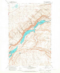
1965 · Park Lake
USGS Topo · 1:24,000

1965 · Coulee City
USGS Topo · 1:24,000

1968 · Steamboat Rock SW
USGS Topo · 1:24,000

1968 · Hartline SW
USGS Topo · 1:24,000
1968 · Barnes Butte
USGS Topo · 1:24,000