
1968 Map of Steamboat Rock SW
USGS Topo · Published 1971About this map
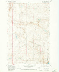
Banks Lake dominates the center of this landscape, its waters filling the Upper Grand Coulee at a normal pool elevation of 1,570 feet. The rugged basalt geography is most famously represented by Steamboat Rock in the northeast, a massive prehistoric island of stone left behind by glacial floods. Small settlements and local landmarks like Ferguson and Blain are marked along the western plateau, while the eastern shore features drainage networks such as Rusho Creek and Ladds Creek. This 1960s survey, with underwater contours provided by the U. S. Bureau of Reclamation, documents the transformed coulee after the construction of the Grand Coulee Dam, showing the modern reservoir alongside older features like the Devils Punch Bowl and the Poplars Picnic Area.
Find a feature on this map
23 named features on this map. Tap any name to fly to it.
Don’t see what you’re looking for? This feature index may not catch every label — zoom into the map to look around manually.
Map Details
Editions of this 1968 Steamboat Rock SW Map
This is the sole edition of this map. No revisions or reprints were ever made.
Other maps of this area

1930 · Grand Coulee Sheet 3
USGS Topo · 1:31,680

1953 · Ritzville
USGS Topo · 1:250,000

1959 · Ritzville
USGS Topo · 1:250,000

1965 · Ritzville
USGS Topo · 1:250,000

1965 · Mold
USGS Topo · 1:24,000

1968 · Barker Canyon
USGS Topo · 1:24,000

1968 · Hartline
USGS Topo · 1:24,000

1968 · Foster Coulee
USGS Topo · 1:24,000

1968 · Steamboat Rock SE
USGS Topo · 1:24,000
1968 · Sims Corner
USGS Topo · 1:24,000