
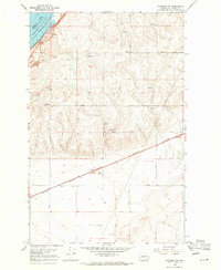
1968 Map of Steamboat Rock SE
USGS Topo · Published 1971About this map
Banks Lake dominates the northwest corner of this landscape, its waters filling the Upper Grand Coulee against the massive profile of Steamboat Rock. The 1968 survey data, including underwater contours established by the Bureau of Reclamation in the late 1940s, reveals the complex topography of the Devils Punch Bowl and the steep walls of Northrup Canyon. While the coulee floor is defined by water and dramatic basalt formations like Gibraltar Rock, the plateau to the south and east is carved by a grid of rural roads, including Road 50 NE and Road 48 NE. This upland area is marked by signs of early settlement and livestock management, with the St Johns Cem and Schrock Cem serving as vital points of reference for local family history. Small ephemeral water bodies like Coffee Lake and Henning Lakes dot the high ground, illustrating the drainage patterns that feed into Devils Creek and Rusho Creek.
Find a feature on this map
35 named features on this map. Tap any name to fly to it.
Don’t see what you’re looking for? This feature index may not catch every label — zoom into the map to look around manually.
Map Details
Editions of this 1968 Steamboat Rock SE Map
This is the sole edition of this map. No revisions or reprints were ever made.
Other maps of this area

1948 · Grand Coulee Dam
USGS Topo · 1:62,500

1950 · Grand Coulee Dam
USGS Topo · 1:62,500

1953 · Ritzville
USGS Topo · 1:250,000

1959 · Ritzville
USGS Topo · 1:250,000

1965 · Ritzville
USGS Topo · 1:250,000

1968 · Steamboat Rock SW
USGS Topo · 1:24,000

1968 · Barker Canyon
USGS Topo · 1:24,000

1968 · Hartline
USGS Topo · 1:24,000
1968 · Hartline NW
USGS Topo · 1:24,000
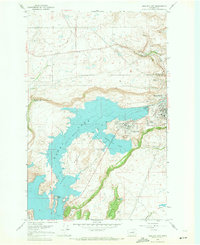
1968 · Electric City
USGS Topo · 1:24,000