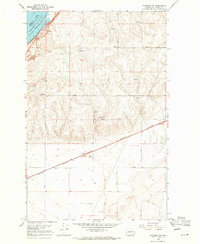
1968 Map of Hartline NW
USGS Topo · Published 1971About this map
The vast expanse of Banks Lake and the Upper Grand Coulee dominate the northwestern corner of this landscape, reflecting a geography fundamentally reshaped by modern reclamation efforts. While the high plateau above the coulee is marked by an orderly grid of section lines and gravel-surfaced routes like Road 44 NE and Road 45 NE, the presence of numerous Spring and Well sites suggests the ongoing challenge of water management in this arid region of Grant County. A diagonal strike of the Burlington Northern railroad cuts through the southern flats, providing a vital industrial link between the scattered resource sites. Local landmarks such as Chase Draw and various excavations, including a Gravel Pit and several Borrow Pits, indicate a terrain utilized for both transportation infrastructure and geological extraction during the late 1960s.
Find a feature on this map
17 named features on this map. Tap any name to fly to it.
Don’t see what you’re looking for? This feature index may not catch every label — zoom into the map to look around manually.
Map Details
Editions of this 1968 Hartline NW Map
2 editions found
Other maps of this area

1930 · Grand Coulee Sheet 3
USGS Topo · 1:31,680

1953 · Ritzville
USGS Topo · 1:250,000

1959 · Ritzville
USGS Topo · 1:250,000

1965 · Ritzville
USGS Topo · 1:250,000

1965 · Mold
USGS Topo · 1:24,000

1965 · Coulee City
USGS Topo · 1:24,000

1968 · Steamboat Rock SW
USGS Topo · 1:24,000

1968 · Hartline
USGS Topo · 1:24,000

1968 · Hartline SW
USGS Topo · 1:24,000

1968 · Steamboat Rock SE
USGS Topo · 1:24,000