
1950 Map of Alameda Flat
USGS Topo · Published 1965About this map
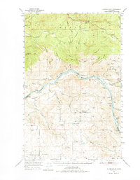
The Columbia River serves as a dominant geographic divider on this mid-century survey, separating Okanogan and Douglas counties and defining the southern border of the Colville Indian Reservation. The river's powerful character is evident in the marking of Mah-kin Rapids, Nespelem Rapids, and Equilibrium Rapids, capturing the waterway before modern engineering fully transformed its flow. Along the northern banks, the landscape of the reservation is marked by mining activity near Hobo Hill, including the Anchor Mine, Sailor Boy Mine, and Apache Mine.
Find a feature on this map
67 named features on this map. Tap any name to fly to it.
Don’t see what you’re looking for? This feature index may not catch every label — zoom into the map to look around manually.
Map Details
Editions of this 1950 Alameda Flat Map
2 editions found
Other maps of this area

1948 · Grand Coulee Dam
USGS Topo · 1:62,500

1950 · Grand Coulee Dam
USGS Topo · 1:62,500

1950 · Nespelem
USGS Topo · 1:62,500

1950 · Boot Mtn
USGS Topo · 1:62,500

1952 · Alameda Flat
USGS Topo · 1:62,500

1952 · Disautel
USGS Topo · 1:62,500

1953 · Bald Knob
USGS Topo · 1:62,500

1953 · Omak Lake
USGS Topo · 1:62,500

1953 · Ritzville
USGS Topo · 1:250,000

1954 · Okanogan
USGS Topo · 1:250,000