Old Maps of Azwell, Washington for Metal Detecting
Plan your next treasure hunt with 10 historic maps of Azwell. Find old homesites, ghost towns, trails, and gathering spots that may be lost to time — perfect for identifying promising metal detecting locations.
- Locate forgotten sites: Uncover places like long-lost settlements, abandoned rail lines, or gathering spots.
- Plan better hunts: Use map overlays combined with LiDAR or satellite views to narrow in on historically rich areas.
- Made for detectorists: Thousands of hobbyists use these maps to discover relics, coins, and hidden history.
Use these historic maps to boost your research and find new opportunities beneath the surface of Azwell.
Azwell, WA maps
(10)- 1953 Map of Ritzville, 1966 Print
 1953 Ritzville1966 Print · USGSEastern Washington was undergoing a massive agricultural and industrial transformation in the mid-fifties as irrigation from the Grand Coulee Dam reached the plateau. Researchers can trace the mid-century rail network of the Great Northern and locate vital local sites like Larson Air Force Base and Odessa.3 unique versions available
 - 1959 Map of Ritzville
 1959 Ritzville1959 Print · USGSEastern Washington in the late fifties reveals a landscape transformed by massive irrigation projects and postwar growth. Genealogists and historians can trace rail-line communities from Ritzville to Davenport and locate landmarks like Larson Air Force Base and Telford Station.
 - 1965 Map of Ritzville
 1965 Ritzville1965 Print · USGSCentral Washington during the mid-sixties shows a landscape shaped by massive irrigation projects and the Cold War. Genealogists and historians can trace rail-town life and military presence through Ephrata Air Base, the Telford Station, and local schools.
 - 1968 Map of Azwell, 1971 Print
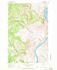 1968 Azwell1971 Print · USGSThe Columbia River corridor north of Chelan comes alive in the late sixties as a center of rail transport and forest management. Researchers can trace the Burlington Northern line through Azwell or locate remote camps like Evergreen Camp.3 unique versions available
 - 2001 Map of Azwell, 2004 Print
 2001 Azwell2004 Print · USGSThe Columbia River corridor near the turn of the twenty-first century reveals a landscape of hydroelectric reservoirs and forest service lands. Local historians can trace early land divisions through Indian Allotment Boundaries near Azwell and the settlement of Starr.
 - 2011 Map of Azwell, 2011 Print
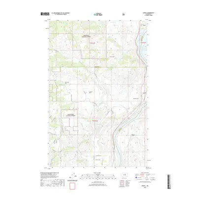
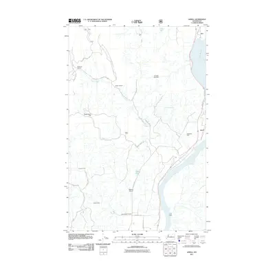 2011 Azwell2011 Print · USGSCovers Azwell, including Starr, Chelan County, and other nearby areas
 - 2014 Map of Azwell, 2014 Print
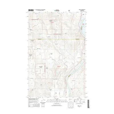 2014 Azwell2014 Print · USGSCovers Azwell, including Starr, Chelan County, and other nearby areas
 - 2017 Map of Azwell, 2017 Print
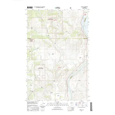 2017 Azwell2017 Print · USGSCovers Azwell, including Starr, Chelan County, and other nearby areas
 - 2020 Map of Azwell, 2020 Print
 2020 Azwell2020 Print · USGSCovers Azwell, including Starr, Chelan County, and other nearby areas
 - 2023 Map of Azwell, 2023 Print
 2023 Azwell2023 Print · USGSThe Columbia River corridor north of Chelan comes alive in this 2023 survey, showing the relationship between the national forests and valley settlements. Genealogists and local historians can trace family-named areas like Arbuckle Mtn and Gossman Flats or locate the riverside hamlet of Azwell.
End of results
Showing maps 1-10 of 10
Top cities near Azwell
Frequently asked questions
- What are the different types of historical maps available for Azwell?
- What is the oldest map of Azwell?
- Where can I purchase historical maps of Azwell for my home or office?
- Where can I download high-res historical maps of Azwell?
- Are there historical topographic maps available for Azwell?
- Is there historical aerial imagery available for Azwell?
- Where are historical maps of Azwell sourced from?