1960s Maps of Chelan, Washington
Explore 3 historic maps of Chelan from the 1960s. These maps offer a rare glimpse into what life looked like during the 1960s — showing old roads, neighborhoods, homes, and landmarks that have changed or disappeared over time.
Whether you're researching your family's past, planning a metal detecting trip, or studying how Chelan's landscape evolved across the 1960s, these high-resolution maps are a powerful tool for exploring the history of this region.
- Focus on a specific era: All maps on this page are from the 1960s, giving you a focused view of this time period.
- See what’s changed: Compare century-old streets, trails, and buildings to today's modern landscape using overlays and satellite layers.
- Research with precision: Use these maps for genealogy, historical research, land use analysis, or educational projects.
- View, download, or print: Maps are fully viewable online in high resolution, and can be downloaded or printed for your own records.
Start exploring Chelan's history through authentic maps from the 1960s. This is your window into the past.
Chelan, WA maps
(3)- 1965 Map of Ritzville
 1965 Ritzville1965 Print · USGSCentral Washington during the mid-sixties shows a landscape shaped by massive irrigation projects and the Cold War. Genealogists and historians can trace rail-town life and military presence through Ephrata Air Base, the Telford Station, and local schools.
 - 1968 Map of Chelan, 1971 Print
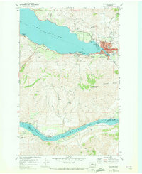 1968 Chelan1971 Print · USGSThe town of Chelan and the southeastern tip of its namesake lake are documented here in the late sixties as the area transitioned into a regional recreation center. Researchers can find lakeside settlements like Lakeside and Minneapolis Beach, trace the Burlington Northern rail line, or locate the Chelan Fraternal Cem.3 unique versions available
 - 1968 Map of Chelan Falls, 1971 Print
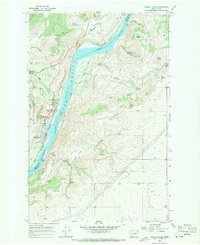 1968 Chelan Falls1971 Print · USGSThe Columbia River corridor south of Chelan shows a landscape of high plateaus and riverfront industry in the late sixties. Trace the old rail lines through Chelan Station or locate family sites at Riverview Cem and the settlement of Beebe.2 unique versions available
End of results
Showing maps 1-3 of 3
Top cities near Chelan
Top neighborhoods of Chelan
Frequently asked questions
- What are the different types of historical maps available for Chelan?
- What is the oldest map of Chelan?
- Where can I purchase historical maps of Chelan for my home or office?
- Where can I download high-res historical maps of Chelan?
- Are there historical topographic maps available for Chelan?
- Is there historical aerial imagery available for Chelan?
- Where are historical maps of Chelan sourced from?