Old Maps of Basin City, Washington for Hiking & Exploration
Hike through history with 12 historic maps of Basin City. Explore old trails, ghost towns, and forgotten backroads — perfect for outdoor adventurers and local explorers.
- Rediscover forgotten places: Map out old mining camps, roads, and footpaths that no longer exist on modern maps.
- Layer with modern tools: Combine with LiDAR or satellite views to plan hikes through historical terrain.
- Made for exploration: Popular among hikers, overlanders, and local history lovers.
Use these maps to find adventure and explore the hidden past of Basin City.
Basin City, WA maps
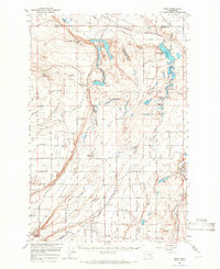
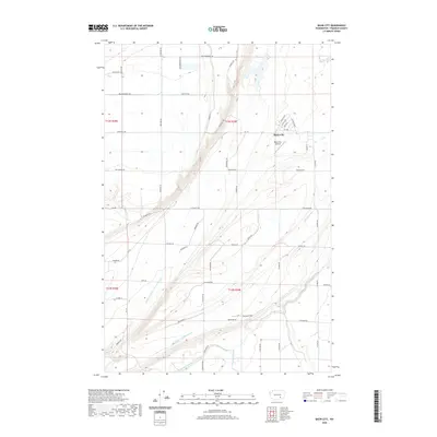
(12)- 1925 Map of Scooteney Lake
 1925 Scooteney Lake1925 Print · USGSFranklin County ranching and rail life are captured here in the mid-1920s, showing the early development of the Columbia Basin. Genealogists can locate family homesteads like Hendrix Sheep Ranch and Hezel Ranch or trace rural education at Kohler School.
 - 1951 Map of Scooteney Lake
 1951 Scooteney Lake1951 Print · USGSFranklin County ranching and rail history are preserved in this mid-century survey of the Washington high desert. Genealogists and historians can trace family landmarks like Rickards Ranch and the early layout of Mesa along the Pacific Northern line.
 - 1953 Map of Walla Walla, 1964 Print
 1953 Walla Walla1964 Print · USGSSoutheast Washington enters the atomic and hydroelectric age in the mid-twentieth century as new dams reshape the desert landscape. You can trace the development of the Hanford Works, identify remote rail stops like Novara Siding, and locate the historic Dry Creek Cem.3 unique versions available
 - 1958 Map of Walla Walla
 1958 Walla Walla1958 Print · USGSThe Tri-Cities and Walla Walla region are captured here during the mid-century expansion of atomic energy and river infrastructure. Genealogists and historians can trace the early layout of Richland (AEC), the rural Hatton and Washtucna settlements, and landmarks like Palouse Falls State Park.
 - 1965 Map of Mesa, 1966 Print
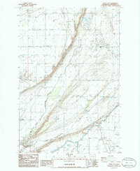
 1965 Mesa1966 Print · USGSCentral Washington's desert landscape was being reshaped by irrigation in the mid-sixties. Trace the growth of Basin City, the path of the Northern Pacific Railroad, and the operations at the Othello Air Force Sta.2 unique versions available
 - 1979 Map of Priest Rapids
 1979 Priest Rapids1979 Print · USGSThe Columbia River basin in the late seventies reveals a landscape shaped by massive federal projects and rail expansion. Trace the Hanford Works perimeter, the Priest Rapids Dam, and the early growth of Royal City and Othello.2 unique versions available
 - 1986 Map of Basin City
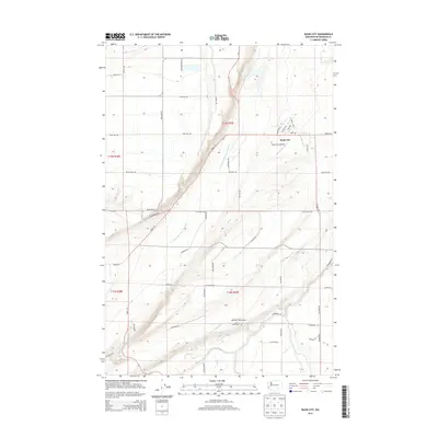
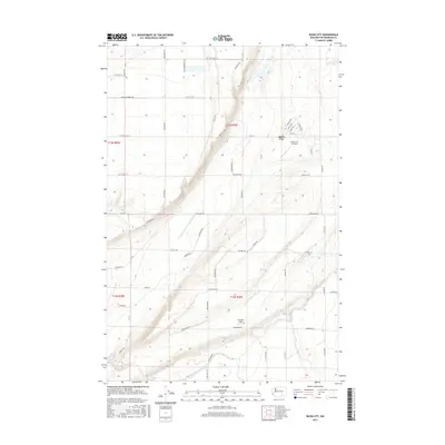
 1986 Basin City1986 Print · USGSBasin City in the mid-eighties was a center for high-desert agriculture and irrigation engineering. Researchers can trace the water infrastructure of the Aqueduct and Siphon alongside local landmarks like the Rodeo Grounds and the Grain Elevator.
 - 2011 Map of Basin City, 2011 Print
 2011 Basin City2011 Print · USGSCovers Basin City, including Franklin County, United States, and other nearby areas
 - 2013 Map of Basin City, 2013 Print
 2013 Basin City2013 Print · USGSCovers Basin City, including Franklin County, United States, and other nearby areas
 - 2017 Map of Basin City, 2017 Print
 2017 Basin City2017 Print · USGSCovers Basin City, including Franklin County, United States, and other nearby areas
 - 2020 Map of Basin City, 2020 Print
 2020 Basin City2020 Print · USGSCovers Basin City, including Franklin County, United States, and other nearby areas
 - 2023 Map of Basin City, 2023 Print
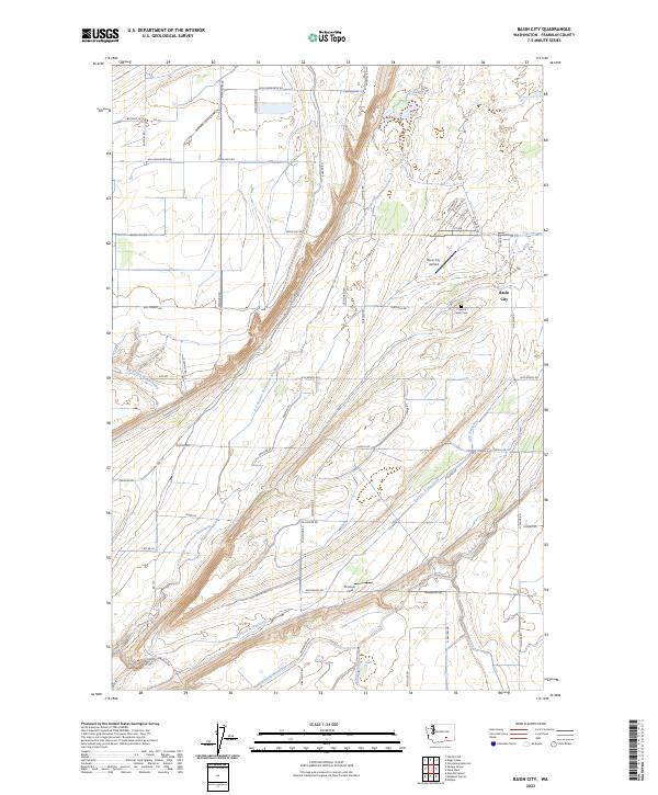 2023 Basin City2023 Print · USGSAgricultural development in Franklin County is on full display here, showing the intricate irrigation systems of the Columbia Basin. Researchers can trace the layout of Basin City and locate local landmarks like the Country View Cem and the Basin City Airfield.
End of results
Showing maps 1-12 of 12
Top cities near Basin City
Frequently asked questions
- What are the different types of historical maps available for Basin City?
- What is the oldest map of Basin City?
- Where can I purchase historical maps of Basin City for my home or office?
- Where can I download high-res historical maps of Basin City?
- Are there historical topographic maps available for Basin City?
- Is there historical aerial imagery available for Basin City?
- Where are historical maps of Basin City sourced from?