Old Maps of Mesa, Washington
Explore 21 old maps of Mesa, spanning from 1916 to today. These high-resolution historic maps reveal how streets, neighborhoods, landmarks, and natural features evolved over time — perfect for genealogy, metal detecting, research, and local history exploration.
What you can do with these maps:
- See how Mesa changed over time: Compare historical maps to modern-day views to trace roads, homesites, rail lines & more.
- View detailed metadata: Each map includes creators, publishers, year, scale, and archive source.
- Overlay maps with satellite & LiDAR: Visualize the past alongside modern tools to explore terrain & human change.
- Trusted historical sources: Maps sourced from the USGS, Library of Congress, and other archives.
- Access maps your way: View online, download high-res files, or order prints for personal or research use.
Start exploring old maps of Mesa to uncover forgotten places, hidden landmarks, and the deep history beneath your feet.
Mesa, WA maps
(21)- 1916 Map of Connell
 1916 Connell1916 Print · USGSIn the decade before the region's landscape was further transformed by modern irrigation, this area shows a dense network of early schoolhouses and railroad stops. Genealogists can trace family footprints through sites like Roxboro School, Hatton, and Kahlotus along the Washtucna Lake shoreline.
 - 1918 Map of Connell
 1918 Connell1918 Print · USGSEastern Washington at the end of the Great War era shows a landscape shaped by emerging railroads and a dense network of rural school districts. Genealogists and historians can trace family-named sites across Paradise Flats and locate early community hubs like Kahlotus, Connell, and Stephenson School.
 - 1925 Map of Scooteney Lake
 1925 Scooteney Lake1925 Print · USGSFranklin County ranching and rail life are captured here in the mid-1920s, showing the early development of the Columbia Basin. Genealogists can locate family homesteads like Hendrix Sheep Ranch and Hezel Ranch or trace rural education at Kohler School.
 - 1951 Map of Scooteney Lake
 1951 Scooteney Lake1951 Print · USGSFranklin County ranching and rail history are preserved in this mid-century survey of the Washington high desert. Genealogists and historians can trace family landmarks like Rickards Ranch and the early layout of Mesa along the Pacific Northern line.
 - 1953 Map of Walla Walla, 1964 Print
 1953 Walla Walla1964 Print · USGSSoutheast Washington enters the atomic and hydroelectric age in the mid-twentieth century as new dams reshape the desert landscape. You can trace the development of the Hanford Works, identify remote rail stops like Novara Siding, and locate the historic Dry Creek Cem.3 unique versions available
 - 1958 Map of Walla Walla
 1958 Walla Walla1958 Print · USGSThe Tri-Cities and Walla Walla region are captured here during the mid-century expansion of atomic energy and river infrastructure. Genealogists and historians can trace the early layout of Richland (AEC), the rural Hatton and Washtucna settlements, and landmarks like Palouse Falls State Park.
 - 1965 Map of Mesa, 1966 Print
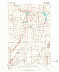 1965 Mesa1966 Print · USGSCentral Washington's desert landscape was being reshaped by irrigation in the mid-sixties. Trace the growth of Basin City, the path of the Northern Pacific Railroad, and the operations at the Othello Air Force Sta.2 unique versions available
 - 1970 Map of Mesa East, 1973 Print
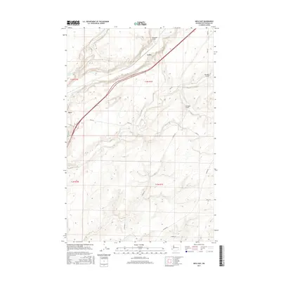
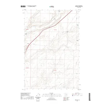
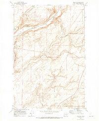 1970 Mesa East1973 Print · USGSFranklin County's dryland farming and rail corridors come into focus in the early 1970s. Trace the tracks of the Burlington Northern through Mesa and find family-named landmarks like Pepiot Road and Old Maid Coulee.
 - 1979 Map of Priest Rapids
 1979 Priest Rapids1979 Print · USGSThe Columbia River basin in the late seventies reveals a landscape shaped by massive federal projects and rail expansion. Trace the Hanford Works perimeter, the Priest Rapids Dam, and the early growth of Royal City and Othello.2 unique versions available
 - 1983 Map of Connell
 1983 Connell1983 Print · USGSEastern Washington's coulee country is captured here in the early eighties as a landscape of remote rail junctions and massive river engineering. Trace family roots in Connell or Kahlotus, and follow old transport lines like the Old Lind Road Grade and Burlington Northern tracks.
 - 1986 Map of Mesa West
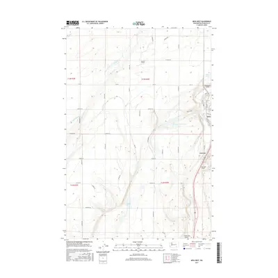
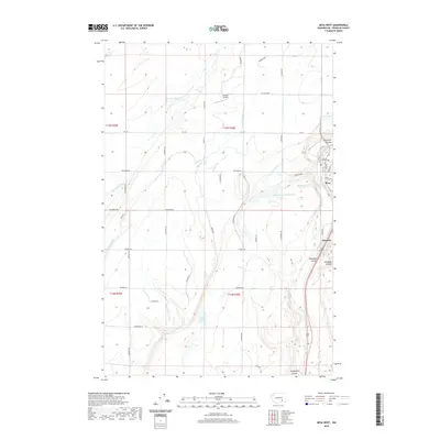
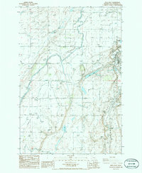 1986 Mesa West1986 Print · USGSFranklin County's agricultural heartland is captured in the mid-1980s, centered on the settlement of Mesa. Genealogists and historians can trace the paths of the Burlington Northern railroad, find the Old RR Grade, and locate landmarks like Old Maid Coulee and Worth Lake.
 - 2011 Map of Mesa East, 2011 Print
 2011 Mesa East2011 Print · USGSCovers Mesa, including Franklin County, United States, and other nearby areas
 - 2011 Map of Mesa West, 2011 Print
 2011 Mesa West2011 Print · USGSCovers Mesa, including Franklin County, United States, and other nearby areas
 - 2013 Map of Mesa East, 2013 Print
 2013 Mesa East2013 Print · USGSCovers Mesa, including Franklin County, United States, and other nearby areas
 - 2014 Map of Mesa West, 2014 Print
 2014 Mesa West2014 Print · USGSCovers Mesa, including Franklin County, United States, and other nearby areas
 - 2017 Map of Mesa West, 2017 Print
 2017 Mesa West2017 Print · USGSCovers Mesa, including Franklin County, United States, and other nearby areas
 - 2017 Map of Mesa East, 2017 Print
 2017 Mesa East2017 Print · USGSCovers Mesa, including Franklin County, United States, and other nearby areas
 - 2020 Map of Mesa East, 2020 Print
 2020 Mesa East2020 Print · USGSCovers Mesa, including Franklin County, United States, and other nearby areas
 - 2020 Map of Mesa West, 2020 Print
 2020 Mesa West2020 Print · USGSCovers Mesa, including Franklin County, United States, and other nearby areas
 - 2023 Map of Mesa West, 2023 Print
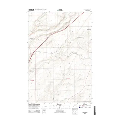
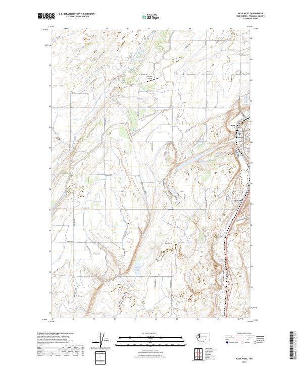 2023 Mesa West2023 Print · USGSEastern Washington agriculture and infrastructure take center stage in this 2023 survey of Franklin County. Researchers can trace irrigation networks like Potholes Canal and landmarks such as Slinkard Airfield, Mesa, and Esquatzel Coulee.
 - 2023 Map of Mesa East, 2023 Print
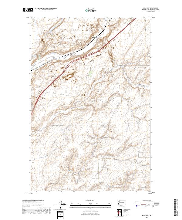 2023 Mesa East2023 Print · USGSFranklin County's dry coulees and agricultural outposts are shown here in the 2020s, highlighting the enduring geography of the region. Researchers can trace the path of Esquatzel Coulee or locate local landmarks like Mesa and Baillie Pond.
End of results
Showing maps 1-21 of 21
Top cities near Mesa
- Richland historical maps
- Othello historical maps
- Connell historical maps
- Basin City historical maps
- Hatton historical maps
Frequently asked questions
- What are the different types of historical maps available for Mesa?
- What is the oldest map of Mesa?
- Where can I purchase historical maps of Mesa for my home or office?
- Where can I download high-res historical maps of Mesa?
- Are there historical topographic maps available for Mesa?
- Is there historical aerial imagery available for Mesa?
- Where are historical maps of Mesa sourced from?