1970s Maps of Mesa, Washington
Explore 2 historic maps of Mesa from the 1970s. These maps offer a rare glimpse into what life looked like during the 1970s — showing old roads, neighborhoods, homes, and landmarks that have changed or disappeared over time.
Whether you're researching your family's past, planning a metal detecting trip, or studying how Mesa's landscape evolved across the 1970s, these high-resolution maps are a powerful tool for exploring the history of this region.
- Focus on a specific era: All maps on this page are from the 1970s, giving you a focused view of this time period.
- See what’s changed: Compare century-old streets, trails, and buildings to today's modern landscape using overlays and satellite layers.
- Research with precision: Use these maps for genealogy, historical research, land use analysis, or educational projects.
- View, download, or print: Maps are fully viewable online in high resolution, and can be downloaded or printed for your own records.
Start exploring Mesa's history through authentic maps from the 1970s. This is your window into the past.
Mesa, WA maps
(2)- 1970 Map of Mesa East, 1973 Print
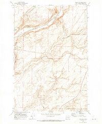 1970 Mesa East1973 Print · USGSFranklin County's dryland farming and rail corridors come into focus in the early 1970s. Trace the tracks of the Burlington Northern through Mesa and find family-named landmarks like Pepiot Road and Old Maid Coulee.
 - 1979 Map of Priest Rapids
 1979 Priest Rapids1979 Print · USGSThe Columbia River basin in the late seventies reveals a landscape shaped by massive federal projects and rail expansion. Trace the Hanford Works perimeter, the Priest Rapids Dam, and the early growth of Royal City and Othello.2 unique versions available
End of results
Showing maps 1-2 of 2
Top cities near Mesa
- Richland historical maps
- Othello historical maps
- Connell historical maps
- Basin City historical maps
- Hatton historical maps
Frequently asked questions
- What are the different types of historical maps available for Mesa?
- What is the oldest map of Mesa?
- Where can I purchase historical maps of Mesa for my home or office?
- Where can I download high-res historical maps of Mesa?
- Are there historical topographic maps available for Mesa?
- Is there historical aerial imagery available for Mesa?
- Where are historical maps of Mesa sourced from?