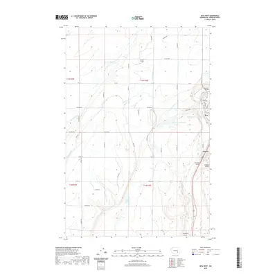
2020 Map of Mesa West
USGS Topo · Published 2020About this map
Mesa and the nearby siding at Edwards anchor this portion of the Columbia Basin, where the semi-arid landscape is defined by the heavy engineering of the Columbia Basin Project. The path of the Potholes Canal is central to the area's geography, feeding a network of irrigation that supports local agriculture across the desert terrain. Natural and man-made water features such as Worth Lake, Bailie Pond, and the Bernsens 810 Reservoir punctuate the grid of section roads, including Colonial Rd and Sheffield Rd.
Find a feature on this map
46 named features on this map. Tap any name to fly to it.
Don’t see what you’re looking for? This feature index may not catch every label — zoom into the map to look around manually.
Map Details
Editions of this 2020 Mesa West Map
This is the sole edition of this map. No revisions or reprints were ever made.
Other maps of this area

1915 · Wallulah
USGS Topo · 1:96,000

1916 · Connell
USGS Topo · 1:125,000

1917 · Pasco
USGS Topo · 1:125,000

1918 · Connell
USGS Topo · 1:125,000

1918 · Wallula
USGS Topo · 1:125,000

1925 · Scooteney Lake
USGS Topo · 1:62,500

1951 · Scooteney Lake
USGS Topo · 1:62,500

1953 · Walla Walla
USGS Topo · 1:250,000

1958 · Walla Walla
USGS Topo · 1:250,000

1963 · Rye Grass Coulee
USGS Topo · 1:24,000