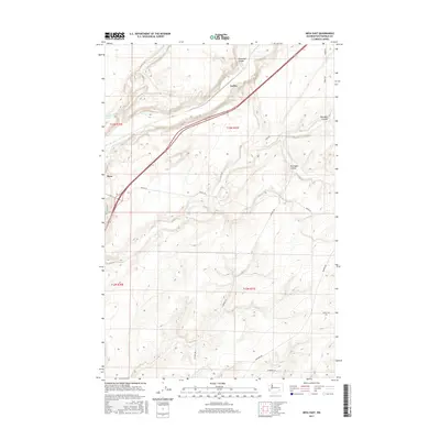
2017 Map of Mesa East
USGS Topo · Published 2017About this map
Mesa and the smaller locality of Cactus define the human footprint on this high desert landscape, which is deeply scarred by the geological remnants of glacial floods. The terrain is dominated by three major seasonal drainages: the wide Esquatzel Coulee, Old Maid Coulee, and Dunnigan Coulee, which cut across the volcanic plateau. Us-395 serves as the primary modern transit corridor, slicing diagonally through the northern half of the quadrangle and linking these isolated settlements. Beyond the highway, the map reveals a network of rural routes like Pepiot Rd and Blanton Rd that provide access to the agricultural lands between the coulees. A small hydrologic feature, Baillie Pond, sits near the western edge, providing a rare permanent water source in this arid region of Franklin County.
Find a feature on this map
21 named features on this map. Tap any name to fly to it.
Don’t see what you’re looking for? This feature index may not catch every label — zoom into the map to look around manually.
Map Details
Editions of this 2017 Mesa East Map
This is the sole edition of this map. No revisions or reprints were ever made.
Other maps of this area

1915 · Wallulah
USGS Topo · 1:96,000

1916 · Connell
USGS Topo · 1:125,000

1917 · Pasco
USGS Topo · 1:125,000

1918 · Connell
USGS Topo · 1:125,000

1918 · Wallula
USGS Topo · 1:125,000

1925 · Scooteney Lake
USGS Topo · 1:62,500

1951 · Scooteney Lake
USGS Topo · 1:62,500

1953 · Walla Walla
USGS Topo · 1:250,000

1958 · Walla Walla
USGS Topo · 1:250,000

1963 · Rye Grass Coulee
USGS Topo · 1:24,000