Old Maps of Garfield County, Washington
Explore 178 old maps of Garfield County, spanning from 1910 to today. These high-resolution historic maps reveal how streets, neighborhoods, landmarks, and natural features evolved over time — perfect for genealogy, metal detecting, research, and local history exploration.
What you can do with these maps:
- See how Garfield County changed over time: Compare historical maps to modern-day views to trace roads, homesites, rail lines & more.
- View detailed metadata: Each map includes creators, publishers, year, scale, and archive source.
- Overlay maps with satellite & LiDAR: Visualize the past alongside modern tools to explore terrain & human change.
- Trusted historical sources: Maps sourced from the USGS, Library of Congress, and other archives.
- Access maps your way: View online, download high-res files, or order prints for personal or research use.
Start exploring old maps of Garfield County to uncover forgotten places, hidden landmarks, and the deep history beneath your feet.
Garfield County, WA maps
(178)- 1910 Map of Pullman
 1910 Pullman1910 Print · USGSThe Palouse hills and Snake River breaks are shown here in the early twentieth century, during a period of rapid railway expansion and academic growth. Genealogists and historians can trace the early layouts of Pullman and Colfax, as well as rural post offices like Guy Albion PO and the campus of the State College of Washington.5 unique versions available
 - 1937 Map of Pomeroy
 1937 Pomeroy1937 Print · USGSGarfield and Columbia Counties appear in the late thirties as a patchwork of upland farms and forest outposts. Genealogists and historians can locate rural landmarks like Pataha Cem, the Tucannon Guard Sta, and various country schools including Pine Grove Sch.3 unique versions available
 - 1942 Map of Pomeroy
 1942 Pomeroy1942 Print · USGSThe foothills of the Blue Mountains are captured here in the late 1930s, showing the settled valleys of Garfield and Columbia Counties. Genealogists and local historians can locate early rural landmarks like Pataha City, Jackson Sch, and the UNION PACIFIC rail line serving Dayton.2 unique versions available
 - 1943 Map of Peola
 1943 Peola1943 Print · USGSSoutheast Washington’s plateau and canyon country are captured here in the 1940s, showing the intersection of mountain timber and ranch land. Researchers can find old district schoolhouses like Philomathian Sch and trace family holdings such as Armstrong Ranch or the Iron Springs Guard Sta.
 - 1943 Map of Saddle Butte, 1964 Print
 1943 Saddle Butte1964 Print · USGSThe Blue Mountains and the canyon of the Grande Ronde River appear here in the early 1940s. Genealogists and local historians can locate remote outposts like Hanson Ferry, Mountain View Sch, and the Wenatchee Guard Sta.
 - 1945 Map of Clarkston, 1965 Print
 1945 Clarkston1965 Print · USGSThe Snake and Clearwater rivers meet in the mid-1940s, showing the early industrial growth of the border towns. Genealogists can trace family landmarks like Huggins Ranch and Stout Ranch or locate burials at Vineland Cem and Asotin Cem.
 - 1946 Map of Saddle Butte
 1946 Saddle Butte1946 Print · USGSAsotin County and the Oregon borderlands are captured here in the mid-1940s, showing a rugged landscape of ridges and river crossings. Researchers can locate remote education sites like Mountain View Sch and historical transit points including Hanson Ferry and McNeil along the Grande Ronde River.
 - 1946 Map of Peola
 1946 Peola1946 Print · USGSGarfield County ranching and timber lands are captured here just after the war, showing a landscape of remote homesteads and mountain ridges. Genealogists can trace family landmarks like Robinson Ranch or rural school sites such as Philomathian Sch and School No 18.
 - 1948 Map of Clarkston
 1948 Clarkston1948 Print · USGSSoutheast Washington and the Idaho border come alive in this post-war survey of the Snake and Clearwater river junction. Genealogists and local historians can trace family roots through sites like Vineland Cem, Huggins Ranch, and the early township of Asotin.
 - 1950 Map of Penawawa, 1952 Print
 1950 Penawawa1952 Print · USGSIn the early 1950s, the Snake River still flowed freely past small riverside settlements and across numerous bars. Genealogists can trace family names and vanished locales such as Penawawa, Gould City, and Rice Bar along the Union Pacific line.2 unique versions available
 - 1950 Map of Hay, 1956 Print
 1950 Hay1956 Print · USGSWhitman and Garfield counties are captured here in the mid-twentieth century as the regional economy revolved around the Snake River and its rail corridors. Genealogists and local historians can locate rural landmarks like the Selbu Church, the Pataha Valley Grange, and the Central Ferry crossing.2 unique versions available
 - 1952 Map of Hay
 1952 Hay1952 Print · USGSThe Snake River corridor in the early fifties shows a landscape of isolated ferry crossings and canyon-side rail lines. Genealogists can locate family landmarks like Selbu Church, the Pataha Valley Grange, and the old Central Ferry School.
 - 1955 Map of Pullman, 1963 Print
 1955 Pullman1963 Print · USGSThe Palouse and Clearwater regions are captured here in the mid-1950s, showing the height of the rail-and-river economy. Genealogists and historians can trace rail lines like the Camas Prairie RR, find local landmarks like Whitman County Memorial Cem, and locate early academic centers at Washington State University and the University of Idaho.3 unique versions available
 - 1955 Map of Grangeville, 1964 Print
 1955 Grangeville1964 Print · USGSThe high country of the Idaho-Oregon border comes alive in the mid-1950s, showing the deep river canyons and mountain peaks. Trace the Union Pacific RR through the valleys or locate settlements like Grangeville, Joseph, and the shoreline of Wallowa Lake.4 unique versions available
 - 1958 Map of Pullman
 1958 Pullman1958 Print · USGSThe Palouse and Clearwater regions are captured here in the late fifties, showing the vital river-and-rail connection between eastern Washington and northern Idaho. Local historians can trace the paths of the Camas Prairie RR and Union Pacific RR as they serve towns like Colfax, Kamiah, and Nezperce.2 unique versions available
 - 1959 Map of Grangeville
 1959 Grangeville1959 Print · USGSThe high alpine peaks and deep river canyons of the Idaho-Oregon borderlands are captured in the late fifties. Researchers can trace the Union Pacific RR through the valleys to settlements like Enterprise, Union, and Grangeville.2 unique versions available
 - 1964 Map of Kirby, 1965 Print
 1964 Kirby1965 Print · USGSGarfield County's high farming plateaus overlook the river during the mid-1960s, showing a landscape of deep canyons and isolated rural hubs. Genealogists can locate the Kirby Cemetery, Bell Plain Sch, and the unique early Tramway systems used for grain transport.2 unique versions available
 - 1964 Map of Colton, 1965 Print
 1964 Colton1965 Print · USGSWhitman County's Palouse landscape is captured in the mid-1960s as the rail-and-road network supported a thriving agricultural community. Researchers can trace local landmarks like Colton, the Nesterbank Ranch, and several deep drainages including Yakawawa Canyon.2 unique versions available
 - 1964 Map of Bishop, 1965 Print
 1964 Bishop1965 Print · USGSThe Snake River canyon in the mid-1960s was a landscape of remote ranches and dramatic geology before major hydrological changes. Genealogists and historians can trace the rural road networks near Valentine or locate landmarks like Bishop Bar and the Kelly Ranch.2 unique versions available
 - 1964 Map of Almota, 1965 Print
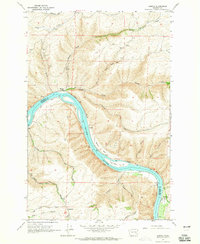 1964 Almota1965 Print · USGSThe Snake River canyon in the 1960s shows a landscape of steep grades and river-bottom landings before dam projects reshaped the shoreline. Researchers can trace historic sites like Almota, the Mays Cemetery, and the Tramway near the Garfield County line.2 unique versions available
 - 1967 Map of Rose Springs, 1971 Print
 1967 Rose Springs1971 Print · USGSIn the foothills of the Blue Mountains during the late sixties, this area shows the rugged interface between livestock grazing lands and the forest. You can trace early mountain routes like Bosley Grade and locate numerous historic water sources including Rose Springs and Sawmill Spring.3 unique versions available
 - 1967 Map of Troy, 1971 Print
 1967 Troy1971 Print · USGSThe Oregon-Washington border region comes to life in the late sixties as the Grande Ronde River carves through the high plateaus. Genealogists and hikers can trace the remote settlement of Troy, the upland community of Bartlett, and the Bartlett Cem tucked away on the flat.2 unique versions available
 - 1967 Map of Eden, 1971 Print
 1967 Eden1971 Print · USGSThe Oregon and Washington borderlands in the late 1960s reveal a landscape of deep river canyons and high timbered ridges. Genealogists and historians can locate remote landmarks like Eden Cem, Eden Community Hall, and the Hoodoo Lookout Tower.2 unique versions available
 - 1967 Map of Hopkins Ridge, 1971 Print
 1967 Hopkins Ridge1971 Print · USGSThe Blue Mountains of Columbia and Garfield counties appear in the late sixties as a landscape of deep river canyons and high timbered ridges. Researchers can trace the Tucannon River past the Fish Hatchery, Tucannon Guard Sta, and remote points like Jumpoff Joe.4 unique versions available
 - 1967 Map of Pomeroy, 1971 Print
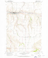 1967 Pomeroy1971 Print · USGSPomeroy and the surrounding Garfield County plateaus are captured here in the late sixties. Genealogists and local historians can trace family plots at Holy Rosary Cemetery or locate the old Holy Rosary Sch and the County Fairgrounds.
Showing maps 1-25 of 178
Top cities of Garfield County
Frequently asked questions
- What are the different types of historical maps available for Garfield County?
- What is the oldest map of Garfield County?
- Where can I purchase historical maps of Garfield County for my home or office?
- Where can I download high-res historical maps of Garfield County?
- Are there historical topographic maps available for Garfield County?
- Is there historical aerial imagery available for Garfield County?
- Where are historical maps of Garfield County sourced from?