1960s Maps of Garfield County, Washington
Explore 13 historic maps of Garfield County from the 1960s. These maps offer a rare glimpse into what life looked like during the 1960s — showing old roads, neighborhoods, homes, and landmarks that have changed or disappeared over time.
Whether you're researching your family's past, planning a metal detecting trip, or studying how Garfield County's landscape evolved across the 1960s, these high-resolution maps are a powerful tool for exploring the history of this region.
- Focus on a specific era: All maps on this page are from the 1960s, giving you a focused view of this time period.
- See what’s changed: Compare century-old streets, trails, and buildings to today's modern landscape using overlays and satellite layers.
- Research with precision: Use these maps for genealogy, historical research, land use analysis, or educational projects.
- View, download, or print: Maps are fully viewable online in high resolution, and can be downloaded or printed for your own records.
Start exploring Garfield County's history through authentic maps from the 1960s. This is your window into the past.
Garfield County, WA maps
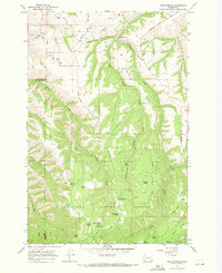
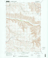
(13)- 1964 Map of Kirby, 1965 Print
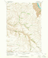 1964 Kirby1965 Print · USGSGarfield County's high farming plateaus overlook the river during the mid-1960s, showing a landscape of deep canyons and isolated rural hubs. Genealogists can locate the Kirby Cemetery, Bell Plain Sch, and the unique early Tramway systems used for grain transport.2 unique versions available
 - 1964 Map of Colton, 1965 Print
 1964 Colton1965 Print · USGSWhitman County's Palouse landscape is captured in the mid-1960s as the rail-and-road network supported a thriving agricultural community. Researchers can trace local landmarks like Colton, the Nesterbank Ranch, and several deep drainages including Yakawawa Canyon.2 unique versions available
 - 1964 Map of Bishop, 1965 Print
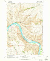
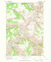
 1964 Bishop1965 Print · USGSThe Snake River canyon in the mid-1960s was a landscape of remote ranches and dramatic geology before major hydrological changes. Genealogists and historians can trace the rural road networks near Valentine or locate landmarks like Bishop Bar and the Kelly Ranch.2 unique versions available
 - 1964 Map of Almota, 1965 Print
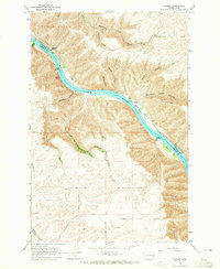
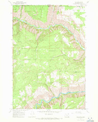
 1964 Almota1965 Print · USGSThe Snake River canyon in the 1960s shows a landscape of steep grades and river-bottom landings before dam projects reshaped the shoreline. Researchers can trace historic sites like Almota, the Mays Cemetery, and the Tramway near the Garfield County line.2 unique versions available
 - 1967 Map of Rose Springs, 1971 Print
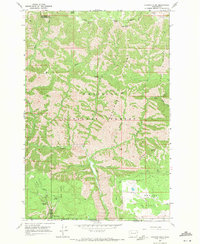
 1967 Rose Springs1971 Print · USGSIn the foothills of the Blue Mountains during the late sixties, this area shows the rugged interface between livestock grazing lands and the forest. You can trace early mountain routes like Bosley Grade and locate numerous historic water sources including Rose Springs and Sawmill Spring.3 unique versions available
 - 1967 Map of Troy, 1971 Print
 1967 Troy1971 Print · USGSThe Oregon-Washington border region comes to life in the late sixties as the Grande Ronde River carves through the high plateaus. Genealogists and hikers can trace the remote settlement of Troy, the upland community of Bartlett, and the Bartlett Cem tucked away on the flat.2 unique versions available
 - 1967 Map of Eden, 1971 Print
 1967 Eden1971 Print · USGSThe Oregon and Washington borderlands in the late 1960s reveal a landscape of deep river canyons and high timbered ridges. Genealogists and historians can locate remote landmarks like Eden Cem, Eden Community Hall, and the Hoodoo Lookout Tower.2 unique versions available
 - 1967 Map of Hopkins Ridge, 1971 Print
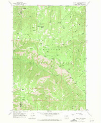
 1967 Hopkins Ridge1971 Print · USGSThe Blue Mountains of Columbia and Garfield counties appear in the late sixties as a landscape of deep river canyons and high timbered ridges. Researchers can trace the Tucannon River past the Fish Hatchery, Tucannon Guard Sta, and remote points like Jumpoff Joe.4 unique versions available
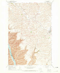
 - 1967 Map of Pomeroy, 1971 Print
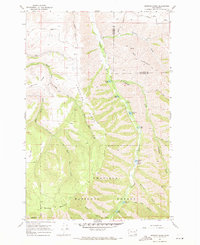
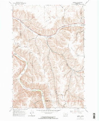
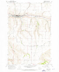 1967 Pomeroy1971 Print · USGSPomeroy and the surrounding Garfield County plateaus are captured here in the late sixties. Genealogists and local historians can trace family plots at Holy Rosary Cemetery or locate the old Holy Rosary Sch and the County Fairgrounds.
 - 1967 Map of Stentz Spring, 1971 Print
 1967 Stentz Spring1971 Print · USGSThe Umatilla National Forest in the late sixties is a landscape of high ridges and forest service outposts. Researchers can trace remote mountain geography through the Clearwater Guard Station, the Tucannon River, and the steep Hard-to-get-to Ridge.3 unique versions available
 - 1967 Map of Diamond Peak, 1971 Print
 1967 Diamond Peak1971 Print · USGSThe high timber and deep canyons of the Washington and Oregon border are captured here in the late sixties. Researchers can trace remote forest outposts like First Creek Cabin and Kelly Camp or follow the high-altitude Pack Trail across Monument Ridge.3 unique versions available
 - 1967 Map of Turner, 1971 Print
 1967 Turner1971 Print · USGSColumbia County’s high plateau and river canyons are captured here in the late sixties, showcasing the remote rail-and-river economy of southeastern Washington. Genealogists can trace family ties at Turner Cem or locate the historic Covello (Site) and the Union Pacific line.2 unique versions available
 - 1967 Map of Zumwalt, 1971 Print
 1967 Zumwalt1971 Print · USGSThe rural valleys of Garfield and Columbia Counties are captured here during the late sixties, highlighting the deep gulches and river bottoms. Family historians and researchers can trace the Union Pacific line, locate the Owsley Cem, and find local landmarks like the Grange Hall and Marengo.2 unique versions available
End of results
Showing maps 1-13 of 13
Top cities of Garfield County
Frequently asked questions
- What are the different types of historical maps available for Garfield County?
- What is the oldest map of Garfield County?
- Where can I purchase historical maps of Garfield County for my home or office?
- Where can I download high-res historical maps of Garfield County?
- Are there historical topographic maps available for Garfield County?
- Is there historical aerial imagery available for Garfield County?
- Where are historical maps of Garfield County sourced from?