1940s Maps of Innis Arden, Shoreline
Explore 3 historic maps of Innis Arden from the 1940s. These maps offer a rare glimpse into what life looked like during the 1940s — showing old roads, neighborhoods, homes, and landmarks that have changed or disappeared over time.
Whether you're researching your family's past, planning a metal detecting trip, or studying how Innis Arden's landscape evolved across the 1940s, these high-resolution maps are a powerful tool for exploring the history of this region.
- Focus on a specific era: All maps on this page are from the 1940s, giving you a focused view of this time period.
- See what’s changed: Compare century-old streets, trails, and buildings to today's modern landscape using overlays and satellite layers.
- Research with precision: Use these maps for genealogy, historical research, land use analysis, or educational projects.
- View, download, or print: Maps are fully viewable online in high resolution, and can be downloaded or printed for your own records.
Start exploring Innis Arden's history through authentic maps from the 1940s. This is your window into the past.
Innis Arden, Shoreline maps
(3)- 1942 Map of Edmonds, 1944 Print
 1942 Edmonds1944 Print · USGSCoastal Snohomish County and Whidbey Island are captured in the early 1940s during a period of maritime and rail expansion. Researchers can trace historic ferry lines, the Great Northern railroad, and local landmarks like Alderwood Manor and Firlands Sanitarium.
 - 1949 Map of Shilshole Bay, 1954 Print
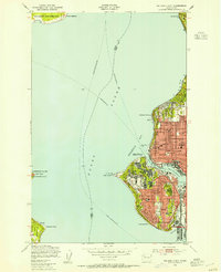 1949 Shilshole Bay1954 Print · USGSSeattle's northwestern waterfront is captured in the mid-century as neighborhoods like Ballard and Loyal Heights expand near the industrial shore. Trace the rail lines of the Great Northern and find historic sites like Fort Lawton and West Point Light.4 unique versions available
 - 1949 Map of Seattle North, 1956 Print
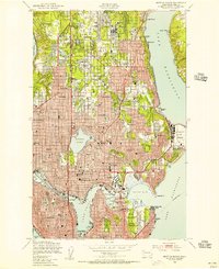 1949 Seattle North1956 Print · USGSMid-century Seattle is captured here as the city's northern neighborhoods and shorelines entered an era of rapid postwar development. Genealogists and historians can trace the early layouts of Greenwood, Lake City, and Laurelhurst, while locating landmarks like the U S Naval Air Station and St Edwards Seminary.3 unique versions available
End of results
Showing maps 1-3 of 3
Frequently asked questions
- What are the different types of historical maps available for Innis Arden?
- What is the oldest map of Innis Arden?
- Where can I purchase historical maps of Innis Arden for my home or office?
- Where can I download high-res historical maps of Innis Arden?
- Are there historical topographic maps available for Innis Arden?
- Is there historical aerial imagery available for Innis Arden?
- Where are historical maps of Innis Arden sourced from?