1990s Maps of Poulsbo, Washington
Explore 3 historic maps of Poulsbo from the 1990s. These maps offer a rare glimpse into what life looked like during the 1990s — showing old roads, neighborhoods, homes, and landmarks that have changed or disappeared over time.
Whether you're researching your family's past, planning a metal detecting trip, or studying how Poulsbo's landscape evolved across the 1990s, these high-resolution maps are a powerful tool for exploring the history of this region.
- Focus on a specific era: All maps on this page are from the 1990s, giving you a focused view of this time period.
- See what’s changed: Compare century-old streets, trails, and buildings to today's modern landscape using overlays and satellite layers.
- Research with precision: Use these maps for genealogy, historical research, land use analysis, or educational projects.
- View, download, or print: Maps are fully viewable online in high resolution, and can be downloaded or printed for your own records.
Start exploring Poulsbo's history through authentic maps from the 1990s. This is your window into the past.
Poulsbo, WA maps
(3)- 1992 Map of Seattle, 1993 Print
 1992 Seattle1993 Print · USGSThe Seattle metropolitan area and Puget Sound are shown here in the early nineties during a period of rapid suburban and technological growth. Researchers can trace the development of Mercer Island, locate the Bangor Naval Submarine Base, and study the industrial layout of Boeing Field.2 unique versions available
 - 1997 Map of Suquamish, 2003 Print
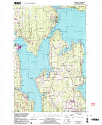 1997 Suquamish2003 Print · USGSCoastal Kitsap and Bainbridge Island are shown here in the late twentieth century as local maritime and military hubs evolved. Researchers can find many community markers, from the Bainbridge Grange and Poulsbo Cemetery to the Agate Pass Bridge.
 - 1997 Map of Port Gamble, 2003 Print
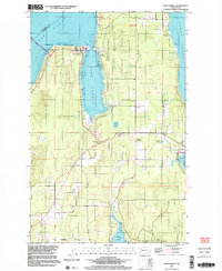 1997 Port Gamble2003 Print · USGSKitsap Peninsula's northern tip in the late nineties shows the enduring presence of the Port Gamble Indian Reservation and maritime commerce. Trace family roots and local industry near Little Boston, the sawmill at Port Gamble, and the Kingston Grange.
End of results
Showing maps 1-3 of 3
Top cities near Poulsbo
- Seattle historical maps
- Edmonds historical maps
- Bremerton historical maps
- Bainbridge Island historical maps
- Silverdale historical maps
- Port Orchard historical maps
See more
Top neighborhoods of Poulsbo
Frequently asked questions
- What are the different types of historical maps available for Poulsbo?
- What is the oldest map of Poulsbo?
- Where can I purchase historical maps of Poulsbo for my home or office?
- Where can I download high-res historical maps of Poulsbo?
- Are there historical topographic maps available for Poulsbo?
- Is there historical aerial imagery available for Poulsbo?
- Where are historical maps of Poulsbo sourced from?