1900s (20th Century) Maps of Ellensburg, Washington
Explore 11 historic maps of Ellensburg from the 1900s (20th Century). These maps offer a rare glimpse into what life looked like during the 1900s — showing old roads, neighborhoods, homes, and landmarks that have changed or disappeared over time.
Whether you're researching your family's past, planning a metal detecting trip, or studying how Ellensburg's landscape evolved across the 1900s, these high-resolution maps are a powerful tool for exploring the history of this region.
- Focus on a specific era: All maps on this page are from the 1900s, giving you a focused view of this time period.
- See what’s changed: Compare century-old streets, trails, and buildings to today's modern landscape using overlays and satellite layers.
- Research with precision: Use these maps for genealogy, historical research, land use analysis, or educational projects.
- View, download, or print: Maps are fully viewable online in high resolution, and can be downloaded or printed for your own records.
Start exploring Ellensburg's history through authentic maps from the 1900s. This is your window into the past.
Ellensburg, WA maps
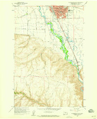
(11)- 1901 Map of Ellensburg
 1901 Ellensburg1901 Print · USGSCentral Washington at the turn of the century shows a landscape shaped by river valleys and high ridges. Trace the early Northern Pacific Railway line through Ellensburg and the remote outposts of Nile and Tampico.6 unique versions available
 - 1902 Map of Mount Stuart, 1908 Print
 1902 Mount Stuart1908 Print · USGSThe Kittitas Valley and Wenatchee Mountains are shown here during the height of the early twentieth-century rail and mining era. Researchers can trace the industrial landscape through the Roslyn Branch and mountain camps like Liberty and Blewett.5 unique versions available
 - 1950 Map of Yakima, 1951 Print
 1950 Yakima1951 Print · USGSThe Yakima Valley and the towering Cascades meet in this mid-century survey of South Central Washington. Genealogists and local historians can trace the irrigation-era growth of Yakima, the historic Fort Simcoe outpost, and the White Swan Mission on the Yakima Indian Reservation.
 - 1957 Map of Wenatchee, 1973 Print
 1957 Wenatchee1973 Print · USGSThe northern Cascades and Columbia River valley appear here in the mid-fifties, showing the region's critical rail and transit corridors. Researchers can trace the routes of the Great Northern RR and Milwaukee Road through settlements like Skykomish, Baring, and Dryden.2 unique versions available
 - 1958 Map of Ellensburg South, 1959 Print
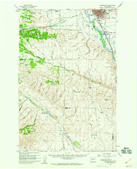
 1958 Ellensburg South1959 Print · USGSThe southern outskirts of Ellensburg and the surrounding Kittitas Valley are captured in the late fifties, just as the regional highway network was expanding. Genealogists and researchers can trace local landmarks like Dammon Sch, the Drive-in Theater, and the rail lines through Thrall.4 unique versions available
 - 1958 Map of Ellensburg, 1960 Print
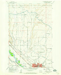
 1958 Ellensburg1960 Print · USGSThe Kittitas Valley and the Yakima River corridor are captured here during the late fifties as irrigation and rail infrastructure reshaped the landscape. Researchers can trace historic family-named sites like High Valley Ranch, the Wenas Cemetery, and the Dammon Sch.2 unique versions available
 - 1958 Map of Thorp, 1960 Print
 1958 Thorp1960 Print · USGSKittitas County at the close of the 1950s shows a landscape shaped by competing rail lines and high-country forestry. Genealogists and historians can trace family locations near Thorp Cem, rural education at Woldale Sch, or the old mining works at Old Placer Mine.2 unique versions available
 - 1958 Map of Ellensburg North, 1960 Print
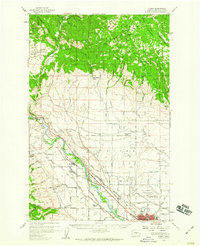
 1958 Ellensburg North1960 Print · USGSThe Kittitas Valley at the end of the fifties reveals a landscape shaped by the Yakima River and the Milwaukee Road rail line. Researchers can trace the early layout of Ellensburg near the Central Washington College of Education or locate rural sites like Woldale School and the IOOF Cem.3 unique versions available
 - 1958 Map of Yakima, 1964 Print
 1958 Yakima1964 Print · USGSThe Yakima Valley in the late fifties shows a landscape of mountain peaks and irrigated plains at the height of its rail-era development. Researchers can trace the lineage of early settlements through sites like Fort Simcoe, the Wenas Cemetery, and the Yakima Indian Agency School.3 unique versions available
 - 1961 Map of Yakima
 1961 Yakima1961 Print · USGSCentral Washington thrived in the mid-century as an agricultural powerhouse defined by the Yakima River. Trace local roots through Medicine Valley School, Fort Simcoe, and the rail lines of the Northern Pacific RR.
 - 1975 Map of Wenatchee, 1977 Print
 1975 Wenatchee1977 Print · USGSCentral Washington in the mid-seventies shows a landscape of deep mountain valleys and bustling river towns. Trace the industrial and agricultural backbone of the region along the Yakima River and Columbia River, from the mining history of Roslyn to the rail hubs at Cle Elum and Appleyard.
End of results
Showing maps 1-11 of 11
Top cities near Ellensburg
Frequently asked questions
- What are the different types of historical maps available for Ellensburg?
- What is the oldest map of Ellensburg?
- Where can I purchase historical maps of Ellensburg for my home or office?
- Where can I download high-res historical maps of Ellensburg?
- Are there historical topographic maps available for Ellensburg?
- Is there historical aerial imagery available for Ellensburg?
- Where are historical maps of Ellensburg sourced from?