1900s (20th Century) Maps of Kittitas, Washington
Explore 8 historic maps of Kittitas from the 1900s (20th Century). These maps offer a rare glimpse into what life looked like during the 1900s — showing old roads, neighborhoods, homes, and landmarks that have changed or disappeared over time.
Whether you're researching your family's past, planning a metal detecting trip, or studying how Kittitas's landscape evolved across the 1900s, these high-resolution maps are a powerful tool for exploring the history of this region.
- Focus on a specific era: All maps on this page are from the 1900s, giving you a focused view of this time period.
- See what’s changed: Compare century-old streets, trails, and buildings to today's modern landscape using overlays and satellite layers.
- Research with precision: Use these maps for genealogy, historical research, land use analysis, or educational projects.
- View, download, or print: Maps are fully viewable online in high resolution, and can be downloaded or printed for your own records.
Start exploring Kittitas's history through authentic maps from the 1900s. This is your window into the past.
Kittitas, WA maps
(8)- 1938 Map of Badger Pocket
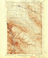
 1938 Badger Pocket1938 Print · USGSThe Kittitas Valley at the end of the 1930s reveals a landscape of expanding irrigation and rail-connected settlements. Researchers can trace the extensive Cascade Canal system and locate family-history sites like Denmark Hall, Regal, and the Silica Mine.
 - 1943 Map of Badger Pocket
 1943 Badger Pocket1943 Print · USGSSettlement and irrigation define the Kittitas Valley in the years before the Second World War. Researchers can trace the legacy of early ranching and rail at Renslow, the Silica Mine, and rural landmarks like Denmark Hall and Davis Ranch.2 unique versions available
 - 1950 Map of Yakima, 1951 Print
 1950 Yakima1951 Print · USGSThe Yakima Valley and the towering Cascades meet in this mid-century survey of South Central Washington. Genealogists and local historians can trace the irrigation-era growth of Yakima, the historic Fort Simcoe outpost, and the White Swan Mission on the Yakima Indian Reservation.
 - 1953 Map of Kittitas, 1957 Print
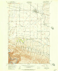 1953 Kittitas1957 Print · USGSThe Kittitas Valley at mid-century is captured here as a productive landscape defined by its irrigation canals and transcontinental rail lines. Researchers can trace the routes of the Chicago Milwaukee St Paul and Pacific through Regal or locate rural landmarks like Denmark Hall and Edgemont.4 unique versions available
 - 1953 Map of Badger Pocket, 1958 Print
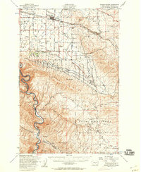 1953 Badger Pocket1958 Print · USGSThe Kittitas Valley at the dawn of the fifties was a landscape of intensive irrigation and dual rail lines. Researchers can trace the agricultural footprint of Kittitas and East Kittitas alongside the industrial activity of the Silica Mines and Cameron Airfield.2 unique versions available
 - 1958 Map of Yakima, 1964 Print
 1958 Yakima1964 Print · USGSThe Yakima Valley in the late fifties shows a landscape of mountain peaks and irrigated plains at the height of its rail-era development. Researchers can trace the lineage of early settlements through sites like Fort Simcoe, the Wenas Cemetery, and the Yakima Indian Agency School.3 unique versions available
 - 1961 Map of Yakima
 1961 Yakima1961 Print · USGSCentral Washington thrived in the mid-century as an agricultural powerhouse defined by the Yakima River. Trace local roots through Medicine Valley School, Fort Simcoe, and the rail lines of the Northern Pacific RR.
 - 1965 Map of Badger Pocket, 1966 Print
 1965 Badger Pocket1966 Print · USGSBenton County agriculture and rail infrastructure are on full display in the mid-sixties, from the Yakima River banks to the high Horse Heaven Hills. Researchers can trace old family holdings and rural landmarks like the Prior Ranch, the Horseheaven settlement, and the Cemetery on the plateau.
End of results
Showing maps 1-8 of 8
Top cities near Kittitas
Frequently asked questions
- What are the different types of historical maps available for Kittitas?
- What is the oldest map of Kittitas?
- Where can I purchase historical maps of Kittitas for my home or office?
- Where can I download high-res historical maps of Kittitas?
- Are there historical topographic maps available for Kittitas?
- Is there historical aerial imagery available for Kittitas?
- Where are historical maps of Kittitas sourced from?