
1938 Map of Badger Pocket
USGS Topo · Published 1938About this map
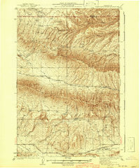
The Kittitas Valley is defined here by a sophisticated irrigation network during the late 1930s, featuring the Cascade Canal, Standard Canal, and a series of specialized ditches including the Turbine Ditch and Pump Ditch. This infrastructure supported the rural communities of Kittitas and East Kittitas, where local life centered around landmarks like Denmark Hall and the Badger Rocket Sch. The Chicago Milwaukee St Paul and Pacific railroad cuts through the valley, connecting small stops such as Regal and Renslow.
Find a feature on this map
48 named features on this map. Tap any name to fly to it.
Don’t see what you’re looking for? This feature index may not catch every label — zoom into the map to look around manually.
Map Details
Editions of this 1938 Badger Pocket Map
This is the sole edition of this map. No revisions or reprints were ever made.
Other maps of this area

1897 · Mount Stuart
USGS Topo · 1:125,000

1899 · Ellensburg
USGS Topo · 1:125,000

1901 · Ellensburg
USGS Topo · 1:125,000

1902 · Mount Stuart
USGS Topo · 1:125,000

1920 · Colockum Pass
USGS Topo · 1:125,000

1922 · Colockum Pass
USGS Topo · 1:125,000

1936 · Yakima East
USGS Topo · 1:48,000

1936 · Hog Ranch Buttes
USGS Topo · 1:48,000

1939 · Boylston
USGS Topo · 1:48,000
1941 · Black Rock Spring
USGS Topo · 1:62,500