Old Maps of Lakedale, Washington for Hiking & Exploration
Hike through history with 12 historic maps of Lakedale. Explore old trails, ghost towns, and forgotten backroads — perfect for outdoor adventurers and local explorers.
- Rediscover forgotten places: Map out old mining camps, roads, and footpaths that no longer exist on modern maps.
- Layer with modern tools: Combine with LiDAR or satellite views to plan hikes through historical terrain.
- Made for exploration: Popular among hikers, overlanders, and local history lovers.
Use these maps to find adventure and explore the hidden past of Lakedale.
Lakedale, WA maps
(12)- 1901 Map of Snoqualmie Pass, 1956 Print
 1901 Snoqualmie Pass1956 Print · USGSSnoqualmie Pass and the central Cascades are seen here during the early years of transcontinental rail expansion. Trace the original Northern Pacific route through the Stampede Tunnel and past early mountain stops like Easton, Hyak, and Ronald.2 unique versions available
 - 1903 Map of Snoqualmie
 1903 Snoqualmie1903 Print · USGSThe Cascade Range at the turn of the century was a landscape of high-altitude rail engineering and timber potential. Trace the Northern Pacific RR through the Stampede Tunnel to early mountain settlements like Easton and Lester.6 unique versions available
 - 1957 Map of Wenatchee, 1973 Print
 1957 Wenatchee1973 Print · USGSThe northern Cascades and Columbia River valley appear here in the mid-fifties, showing the region's critical rail and transit corridors. Researchers can trace the routes of the Great Northern RR and Milwaukee Road through settlements like Skykomish, Baring, and Dryden.2 unique versions available
 - 1961 Map of Kachess Lake, 1963 Print
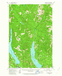 1961 Kachess Lake1963 Print · USGSThe Cascades wilderness of Kittitas County is seen here in the early sixties, centered on the major reservoirs and high forest ridges. Researchers can trace the early layout of Easton, locate the Salmon la Sac Guard Sta, and find legacy sites like the Elsnor Mine.3 unique versions available
 - 1975 Map of Snoqualmie Pass, 1977 Print
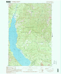
 1975 Snoqualmie Pass1977 Print · USGSThe central Cascades are shown here in the mid-seventies, just as the regional balance between industrial timber, rail transport, and recreation was shifting. Genealogists and hikers can trace old rail stops like Lester and Nagrom, or follow the Pacific Crest National Scenic Trail past Keechelus Lake.
 - 1989 Map of Cle Elum Lake
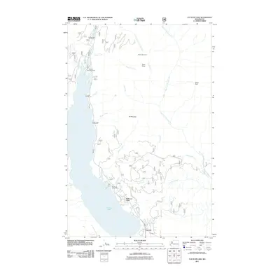
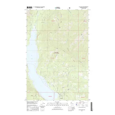
 1989 Cle Elum Lake1989 Print · USGSUpper Kittitas County in the late eighties shows a landscape of mountain recreation and resource extraction centered on Cle Elum Lake. Researchers can trace the shorefront near Lakedale and locate sites like the Strip Mine and Wish Poosh Campground.2 unique versions available
 - 2003 Map of Cle Elum Lake, 2006 Print
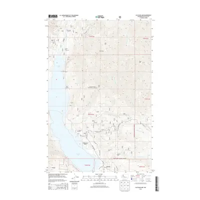
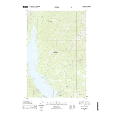
 2003 Cle Elum Lake2006 Print · USGSThe eastern slopes of the Cascades near Kittitas are shown here at the start of the millennium, highlighting the timber and water resources of the Wenatchee National Forest. Researchers can trace the shoreline developments of Lakedale or locate mining remnants like the Strip Mine and Adit near Sandstone Creek.
 - 2011 Map of Cle Elum Lake, 2011 Print
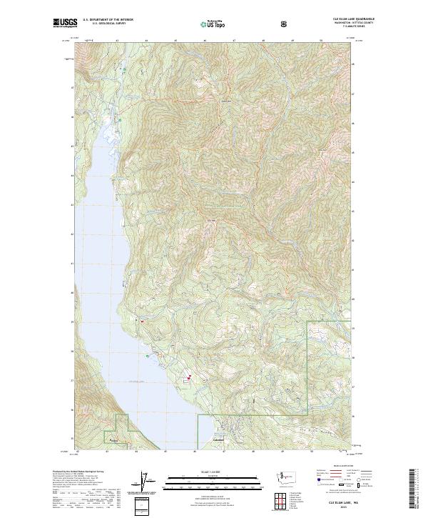
 2011 Cle Elum Lake2011 Print · USGSCovers Lakedale, including Driftwood Acres, Kittitas County, and other nearby areas
 - 2014 Map of Cle Elum Lake, 2014 Print
 2014 Cle Elum Lake2014 Print · USGSCovers Lakedale, including Driftwood Acres, Kittitas County, and other nearby areas
 - 2017 Map of Cle Elum Lake, 2017 Print
 2017 Cle Elum Lake2017 Print · USGSCovers Lakedale, including Driftwood Acres, Kittitas County, and other nearby areas
 - 2020 Map of Cle Elum Lake, 2020 Print
 2020 Cle Elum Lake2020 Print · USGSCovers Lakedale, including Driftwood Acres, Kittitas County, and other nearby areas
 - 2023 Map of Cle Elum Lake, 2023 Print
 2023 Cle Elum Lake2023 Print · USGSModern-day settlement meets the North Cascades wilderness in the early 2020s. Trace the backcountry trail system from Sasse Mtn down to the residential expansion at Lakedale and Roslyn.
End of results
Showing maps 1-12 of 12
Top cities near Lakedale
Frequently asked questions
- What are the different types of historical maps available for Lakedale?
- What is the oldest map of Lakedale?
- Where can I purchase historical maps of Lakedale for my home or office?
- Where can I download high-res historical maps of Lakedale?
- Are there historical topographic maps available for Lakedale?
- Is there historical aerial imagery available for Lakedale?
- Where are historical maps of Lakedale sourced from?