Old Maps of Firwood, Washington for Hiking & Exploration
Hike through history with 7 historic maps of Firwood. Explore old trails, ghost towns, and forgotten backroads — perfect for outdoor adventurers and local explorers.
- Rediscover forgotten places: Map out old mining camps, roads, and footpaths that no longer exist on modern maps.
- Layer with modern tools: Combine with LiDAR or satellite views to plan hikes through historical terrain.
- Made for exploration: Popular among hikers, overlanders, and local history lovers.
Use these maps to find adventure and explore the hidden past of Firwood.
Firwood, WA maps
(7)- 1953 Map of The Dalles, 1965 Print
 1953 The Dalles1965 Print · USGSThe Columbia River Gorge at mid-century shows a region being transformed by massive hydroelectric dams and a growing highway network. Researchers can trace the development of The Dalles Dam, locate the Maryhill Museum, and find old rail stops in Rufus, Wishram, and Arlington.3 unique versions available
 - 1956 Map of The Dalles
 1956 The Dalles1956 Print · USGSThe Columbia River Gorge and the high Cascades are captured in the mid-1950s, showing a vital corridor of rail and road. Researchers can trace the original path of The Old Oregon Trail or locate historical landmarks like the Maryhill Museum and Mount Hood.
 - 1957 Map of The Dalles
 1957 The Dalles1957 Print · USGSThe Columbia River Gorge and the high plateaus of the mid-1950s come alive on this detailed survey of northern Oregon and southern Washington. Researchers can trace the path of the Oregon Trail and The Old Barlow Road alongside river towns like The Dalles and Wishram.
 - 1957 Map of Goldendale, 1959 Print
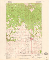 1957 Goldendale1959 Print · USGSMid-century Klickitat County comes alive in this survey of the Goldendale area during its post-war growth. Genealogists and historians can trace local landmarks like Orchard Heights School, the A J Bolon Historic Monument, and the rural settlement of Blockhouse.2 unique versions available
 - 1980 Map of Goldendale, 1981 Print
 1980 Goldendale1981 Print · USGSThe Columbia River corridor in the 1980s was a critical junction of rail, water, and highway commerce between Washington and Oregon. Genealogists and historians can trace riverside settlements like Wishram, high-country towns like Bickleton, and the grounds of the Maryhill Museum.
 - 1983 Map of White Pine Buttes
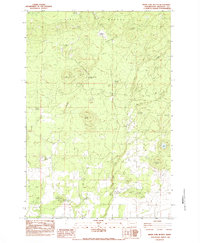 1983 White Pine Buttes1983 Print · USGSKlickitat County's high country is captured here in the early eighties, showing a landscape defined by volcanic buttes and historic territorial markers. Researchers can trace the legacy of the region through the A J Bolon Historic Mon, Brownlee Corrals, and seasonal waters like Pretty Swamp.
 - 2023 Map of White Pine Buttes, 2023 Print
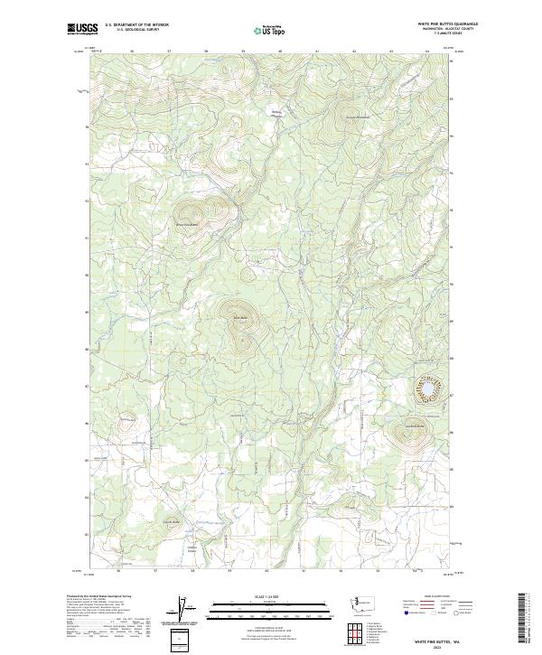 2023 White Pine Buttes2023 Print · USGSKlickitat County as it appears today remains a landscape of volcanic buttes and high-country meadows. Researchers can trace the layout of Matola and Crafton Prairie alongside landmarks like White Pine Buttes and Jackknife Butte.
End of results
Showing maps 1-7 of 7
Top cities near Firwood
Frequently asked questions
- What are the different types of historical maps available for Firwood?
- What is the oldest map of Firwood?
- Where can I purchase historical maps of Firwood for my home or office?
- Where can I download high-res historical maps of Firwood?
- Are there historical topographic maps available for Firwood?
- Is there historical aerial imagery available for Firwood?
- Where are historical maps of Firwood sourced from?