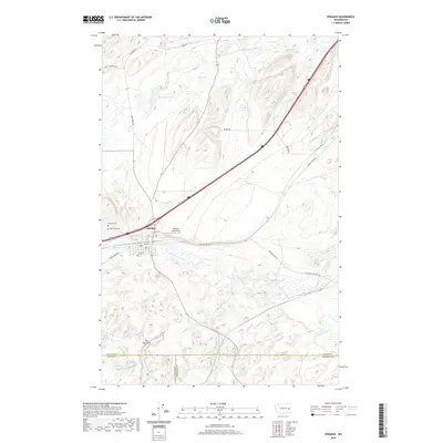
Old Maps of Sprague, Washington for Academic Research
Study the evolution of Sprague with 10 high-resolution historic maps. Whether you're teaching, researching, or modeling changes in land use, these maps provide essential visual documentation of urban, environmental, and geographic change.
- Analyze long-term change: Track patterns in development, transportation, and natural features.
- Ideal for environmental or urban studies: Support academic projects with primary historical map data.
- Use in the classroom or lab: Educators and researchers rely on these maps to bring historical context to life.
These maps are a powerful tool for teaching, research, and visualizing how Sprague has changed over the decades.
Sprague, WA maps
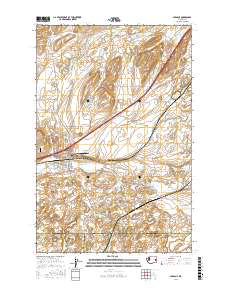
(10)- 1954 Map of Sprague, 1956 Print
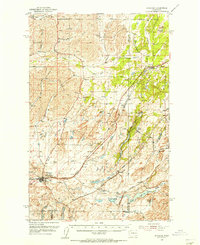 1954 Sprague1956 Print · USGSEastern Washington’s Channeled Scablands are captured in the mid-1950s, showing a complex network of four major railroads crossing the rocky terrain. Genealogists and rail historians can trace the foundations of Sprague, the community at Fishtrap, and the Aban'd Sch near Tyler.2 unique versions available
 - 1955 Map of Spokane, 1965 Print
 1955 Spokane1965 Print · USGSInland Empire life in the fifties and sixties centers on the growth of Spokane and the heavy mining industry of northern Idaho. Trace mid-century landmarks like Fairchild Air Force Base, the Bunker Hill Mine, and early campuses such as Gonzaga University.2 unique versions available
 - 1958 Map of Spokane
 1958 Spokane1958 Print · USGSThe Inland Empire is shown at a mid-century peak of industrial and military activity, from the rail hubs of Spokane to the deep silver mines of northern Idaho. Researchers can trace the sprawling rail lines of the Union Pacific RR or locate landmarks like Fairchild Air Force Base and the Bunker Hill Smelter & Mine.
 - 1981 Map of Sprague
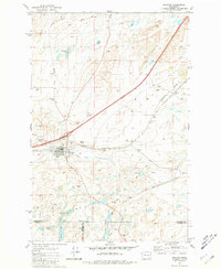 1981 Sprague1981 Print · USGSThe rail-centered town of Sprague is shown here in the early eighties at a significant junction of two major lines. Genealogists and researchers can trace local landmarks like Lake View Cem, Maccabee Cem, and the waters of Fourth of July Lake.
 - 1984 Map of Rosalia
 1984 Rosalia1984 Print · USGSThe Palouse region of Eastern Washington and the Idaho borderlands are shown here in the mid-1980s, a landscape of rolling wheat fields and vital rail corridors. Genealogists and historians can trace the early layout of Cheney, the rail junctions at Rosalia, and the distinct topography of Steptoe Butte.
 - 2011 Map of Sprague, 2011 Print
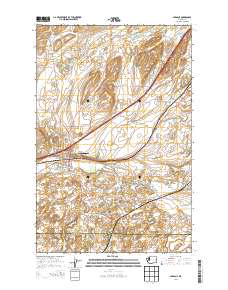
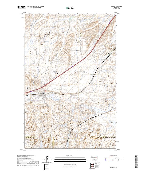
 2011 Sprague2011 Print · USGSCovers Sprague, including Whitman County, Adams County, and other nearby areas
 - 2014 Map of Sprague, 2014 Print
 2014 Sprague2014 Print · USGSCovers Sprague, including Whitman County, Adams County, and other nearby areas
 - 2017 Map of Sprague, 2017 Print
 2017 Sprague2017 Print · USGSCovers Sprague, including Whitman County, Adams County, and other nearby areas
 - 2020 Map of Sprague, 2020 Print
 2020 Sprague2020 Print · USGSCovers Sprague, including Whitman County, Adams County, and other nearby areas
 - 2023 Map of Sprague, 2023 Print
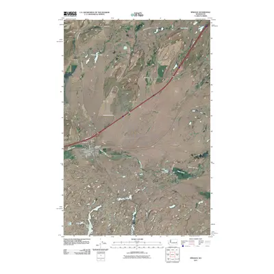
 2023 Sprague2023 Print · USGSThe town of Sprague and the surrounding cattle-and-wheat country of the Inland Northwest are shown in the early twenty-first century. Genealogists and local historians can locate Lake View Cem, Sprague Catholic Cem, and the Redfern Aerodrome.
End of results
Showing maps 1-10 of 10
Top cities near Sprague
Frequently asked questions
- What are the different types of historical maps available for Sprague?
- What is the oldest map of Sprague?
- Where can I purchase historical maps of Sprague for my home or office?
- Where can I download high-res historical maps of Sprague?
- Are there historical topographic maps available for Sprague?
- Is there historical aerial imagery available for Sprague?
- Where are historical maps of Sprague sourced from?